, to see if you have full access to this publication.
Monograph No access
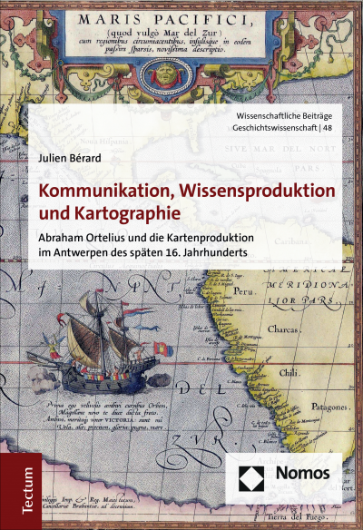
Kommunikation, Wissensproduktion und Kartographie
Abraham Ortelius und die Kartenproduktion im Antwerpen des späten 16. Jahrhunderts- Authors:
- Series:
- Wissenschaftliche Beiträge aus dem Tectum Verlag: Geschichtswissenschaft, Volume 48
- Publisher:
- 2020
Search publication
Bibliographic data
- Edition
- 1/2020
- Copyright Year
- 2020
- ISBN-Print
- 978-3-8288-4542-8
- ISBN-Online
- 978-3-8288-7591-3
- Publisher
- Nomos, Baden-Baden
- Series
- Wissenschaftliche Beiträge aus dem Tectum Verlag: Geschichtswissenschaft
- Volume
- 48
- Language
- German
- Pages
- 412
- Product Type
- Monograph
Table of contents
ChapterPages
- Titelei/Inhaltsverzeichnis No access Pages I - XII
- Einleitung No access Pages 1 - 26
- Iberische Handelsrouten No access
- Konkurrenz im Atlantik No access
- Die Mittelmeerrouten No access
- Kaufmannsfamilien und europäische Handelswege No access
- Exotische Waren, kuriose Objekte und wundersame Sammlungen No access
- Antwerpen im europäischen Handelssystem No access
- Antwerpen als Kommunikationsraum No access
- Antwerpen als Medienstadt No access
- Antwerpen und der kosmographische Druck No access
- Briefbeförderung im 16. Jahrhundert No access
- Briefzeitungen und kosmographische Informationen No access
- Der Brief als Medium der Berichterstattung No access
- Der Renaissance-Gelehrte No access
- Der Brief als Bindeglied der Gelehrtenrepublik No access
- Kleinschriften No access
- Manuskripte und nicht europäische Schriften No access
- Kosmographische Drucke No access
- Struktur und Organisation des Buchmarktes No access
- Eine Tradition des Mittelmeers No access
- Iberische Seekarten No access
- Nicht europäisches Wissen No access
- Die Dissemination von iberischen Seekarten No access
- Antwerpen als Operationsbasis No access
- In Westeuropa unterwegs No access
- Ein Handels- und Gelehrtennetzwerk No access
- Ortelius und Mercator No access
- Ortelius und die Gelehrtenrepublik No access
- Obrigkeit und Kartographie No access
- Marktanforderungen No access
- Kupferstich und Tiefdruckverfahren No access
- Finanzierung und Vertrieb No access
- Ortelius’ Methoden No access
- Die Auswahl, Bewertung und Bearbeitung der Vorlagen No access
- Das Problem der Sprachen No access
- Wissensordnungen, Ästhetik und intermediale Wissensvermittlung No access
- Die Welt in Raum und Zeit No access
- Gottesschöpfung und menschliche Ausbeutung No access
- Mirabilia, Neugier und Glaubwürdigkeit No access
- Plurale Geographie und harmonia mundi No access
- Politik und Pietät No access
- Europa und „der Andere“ No access
- Ergebnisse No access Pages 349 - 358
- Appendix I: Die Karten des Ortelius No access Pages 359 - 362
- Appendix II: Kartenvorlagen No access Pages 363 - 368
- Appendix III: Textvorlagen No access Pages 369 - 374
- Appendix IV: Quellenverzeichnis No access Pages 375 - 380
- Literaturverzeichnis No access Pages 381 - 412
Bibliography (494 entries)
No match found. Try another term.
- Literaturverzeichnis Open Google Scholar DOI: 10.5771/9783828875913
- Abulafia, David (2008): The Discovery of Mankind. Atlantic Encounters in the Age of Columbus, New Haven, CT. Open Google Scholar DOI: 10.5771/9783828875913
- Abulafia, David (2014): Das Mittelmeer. Eine Biographie, Frankfurt am Main. Open Google Scholar DOI: 10.5771/9783828875913
- Adhémar, Jean (1947): Frère André Thevet. Grand voyageur et cosmographe des rois de France au XVIe siècle, Paris. Open Google Scholar DOI: 10.5771/9783828875913
- Akerman, James R. (1995): The Structuring of Political Territory in Early Printed Atlases, in: Imago Mundi, 47. Jg., S. 138–154. Open Google Scholar DOI: 10.5771/9783828875913
- Alden, John (1980): European Americana. A Chronological Guide to Works Printed in Europe Relating to the Americas, 1493–1776, New York, NY. Open Google Scholar DOI: 10.5771/9783828875913
- Alegria, Maria Fernanda u. a. (2007): Portuguese Cartography in the Renaissance, in: Woodward, David/Harley, John B. (Hrsg.): The History of Cartography. Bd. 3. Cartography in the Renaissance, Chicago, IL, S. 975–1068. Open Google Scholar DOI: 10.5771/9783828875913
- Allaire, Bernard (1997): La France et les voyages de Martin Frobisher (1576–1578), in: Revue Historique, 121. Jg., Nr. 3, S. 3–22. Open Google Scholar DOI: 10.5771/9783828875913
- Allen, L. John (1992): From Cabot to Cartier. The Early Exploration of Eastern North America, in: Annals of the Association of American Geographers, 82. Jg., S. 500–521. Open Google Scholar DOI: 10.5771/9783828875913
- Andrea, Bernadette (2003): The Ghost of Leo Africanus from the English to the Irish Renaissance, in: Ingham, Patricia Clare/Warren, Michelle R. (Hrsg.): Postcolonial Moves. Medieval through Modern, New York, S. 195–215. Open Google Scholar DOI: 10.5771/9783828875913
- Ankenbauer, Norbert (2010): "Das ich mochte meer newer dyng erfaren". Die Versprachlichung des Neuen in den Paesi novamente retrovati (Vicenza, 1507) und in ihrer deutschen Übersetzung (Nürnberg, 1508), Berlin. Open Google Scholar DOI: 10.5771/9783828875913
- Arblaster, Paul (2001): Policy and Publishing in the Habsburg Netherlands,1585–1690, in: Dooley, Brendan Maurice (Hrsg.): The Politics of Information in Early Modern Europe, London, S. 179–198. Open Google Scholar DOI: 10.5771/9783828875913
- Arblaster, Paul (2004): 'Totius Mundi Emporium'. Antwerp as a Centre for Vernacular Bible Translation, 1253–1545, in: Gelderblom, Arie-Jan/Long, Jan L. de (Hrsg.): The Low Countries as a Crossroads of Religious Beliefs, Leiden, 9–31. Open Google Scholar DOI: 10.5771/9783828875913
- Ash, Eric H. (2007): Navigation Techniques and Practice in the Renassance, in: Woodward, David/Harley, John B. (Hrsg.): The History of Cartography. Bd. 3. Cartography in the Renaissance, Chicago, IL, S. 509–527. Open Google Scholar DOI: 10.5771/9783828875913
- Astengo, Corradino (2007): The Renaissance Chart Tradition in the Mediterranean, in: Woodward, David/Harley, John B. (Hrsg.): The History of Cartography. Bd. 3. Cartography in the Renaissance, Chicago, IL, S. 174–262. Open Google Scholar DOI: 10.5771/9783828875913
- Barbarics, Zsusza/Pieper, Renate (2007): Handwritten Newsletters as a Mean of Communication in Early Modern Europe, in: Bethencourt, Francisco/Egmond, Florike (Hrsg.): Cultural Exchange in Early Modern Europe. Correspondence andCultural Exchange in Europe, 1400–1700, Cambridge, S. 53–79. Open Google Scholar DOI: 10.5771/9783828875913
- Barbarics-Hernanik, Zsuzsa (2011): The Coexistence of Manuscript and Print. Handwritten Newsletters in the Second Century of Print, 1540–1640, in: Walsby, Malcolm/Kemp, Graeme (Hrsg.): The Book Triumphant. Print in Transition in the Sixteenth and Seventeenth Centuries, Leiden, S. 347–368. Open Google Scholar DOI: 10.5771/9783828875913
- Barrera-Orosio, Antonio (2008): Empiricism in the Spanish Atlantic World, in: Delbourgo, James/Dew, Nicholas (Hrsg.): Science and Empire in the Atlantic World, New York, NY, S. 177–202. Open Google Scholar DOI: 10.5771/9783828875913
- Barthes, Roland (2002): La mort de l'auteur [1968], in: Marty, Éric (Hrsg.): Oeuvres compètes. Bd. 3 1968–1971, Paris, S. 40–45. Open Google Scholar DOI: 10.5771/9783828875913
- Bartusch, Mark W. (2003): Understanding Dan. An Exegetical Study of a Biblical City, Tribe and Ancestor, Sheffield. Open Google Scholar DOI: 10.5771/9783828875913
- Bassin, Mark (1991): Russia Between Europe and Asia. The Ideological Construction of Geographical Space, in: Slavic Review, 50. Jg., Nr. 1, S. 1–17. Open Google Scholar DOI: 10.5771/9783828875913
- Baßler, Moritz (1995): Einleitung, in: Baßler, Moritz (Hrsg.): New Historicism. Literaturgeschichte als Poetik der Kultur, Frankfurt am Main, S. 7–28. Open Google Scholar DOI: 10.5771/9783828875913
- Bateman, Victoria N. (2012): Markets and Growth in Early Modern Europe, London. Open Google Scholar DOI: 10.5771/9783828875913
- Bauer, Oswald (2011): Zeitungen vor der Zeitung. Die Fuggerzeitungen (1568–1605) und das frühmoderne Nachrichtensystem, Berlin. Open Google Scholar DOI: 10.5771/9783828875913
- Baumgärtner, Ingrid (1998): Kartographie, Reisebericht und Humanismus. Die Erfahrung in der Weltkarte des venezianischen Kamaldulensermönchs Fra Mauro, 1459, in: Das Mittelalter, 3. Jg., Nr. 2, S. 161–197. Open Google Scholar DOI: 10.5771/9783828875913
- Baumgärtner, Ingrid (2017): Der Portulan-Atlas des Battista Agnese. Das Kasseler Prachtexemplaar von 1542, Darmstadt. Open Google Scholar DOI: 10.5771/9783828875913
- Bécares Botas, Vicente (1999): Arias Montano y Plantino. El libro flamenco de la España de Felipe II, León. Open Google Scholar DOI: 10.5771/9783828875913
- Beeck, Bart op de/Coster, Annie de (2006): Books and Bindings from the Library of Abraham Ortelius, 1527–1598, in: Coster, Annie de/Sorgeloos, Claude (Hrsg.): Bibliophilies et Reliures, Bruxelles, S. 374–409. Open Google Scholar DOI: 10.5771/9783828875913
- Behringer, Wolfgang (2003): Im Zeichen des Merkur. Reichspost und Kommunikationsrevolution in der Frühen Neuzeit, Göttingen. Open Google Scholar DOI: 10.5771/9783828875913
- Behringer, Wolfgang (2005): "Von der Gutenberg-Galaxis zur Taxis-Galaxis". Die Kommunikationsrevolution – ein Konzept zum besseren Verständnis der Frühen Neuzeit., in: Burkhardt, Johannes/Werkstetter, Christine (Hrsg.): Kommunikation und Medien in der Frühen Neuzeit, München, S. 39–54. Open Google Scholar DOI: 10.5771/9783828875913
- Behringer, Wolfgang (2006): Communications Revolutions. A Historiographical Concept, in: German History, 24. Jg., Nr. 3, S. 333–374. Open Google Scholar DOI: 10.5771/9783828875913
- Behrisch, Lars (2008): Zu viele Informationen! Die Aggregierung des Wissens in der Frühen Neuzeit, in: Brendecke, Arndt (Hrsg.): Information in der Frühen Neuzeit. Status, Bestände, Strategien, Berlin/Münster, S. 455–474. Open Google Scholar DOI: 10.5771/9783828875913
- Bérard, Julien (2014a): Abraham Ortelius and the Mapping of the Atlantic World in Late Sixteenth Century Antwerp, in: Lachenicht, Susanne (Hrsg.): Europeans Engaging the Atlantic. Knowledge and Trade, 1500–1800, Frankfurt am Main/New York, S. 23–45. Open Google Scholar DOI: 10.5771/9783828875913
- Bérard, Julien (2014b): Die Habsburger und die Kartographie der Niederlande im 16. Jahrhundert. Repräsentation, Außenpolitik und kommerzielle Interessen, in: Baumgärtner, Ingrid/Thiel, Lena (Hrsg.): Fürstliche Koordinaten. Landesvermessung und Herrschaftsvisualisierung um 1600, Leipzig, S. 299–320. Open Google Scholar DOI: 10.5771/9783828875913
- Bérard, Julien (2016): Het middeleeuws wereldbeeld en de cartographie van de renaissance. Het Theatrum Orbis Terrarum van Abraham Ortelius, in: HistoriAnt, 4. Jg., S. 137–157. Open Google Scholar DOI: 10.5771/9783828875913
- Besse, Jean-Marc (2000): Le rôle de la carte dans la consruction du concept de terre aux XVe et XVIe siècles. Réflexions épistémologiques, in: Bulletin du Comité français de cartographie, Nr. 163, S. 6–15. Open Google Scholar DOI: 10.5771/9783828875913
- Bevers, Holm (1985): Das Rathaus von Antwerpen. (1561–1565): Architektur und Figurenprogramm, Hildesheim/Marburg. Open Google Scholar DOI: 10.5771/9783828875913
- Bierdermann, Zoltán (2008): Ormuz et sa région dans les cartes protugaises du XVIe sciècle, in: Couto, Dejanirah/Loureiro, Rui (Hrsg.): Revisiting Hormuz. Portuguese Interactions in the Persian Gulf Region in the Early Modern Period, Wiesbaden, S. 121–133. Open Google Scholar DOI: 10.5771/9783828875913
- Biggs, Michael (1999): Putting the State on the Map. Cartography, Territory and European State Formation, in: Comparative Studies in Society and History, 41. Jg., Nr. 2, S. 374–405. Open Google Scholar DOI: 10.5771/9783828875913
- Bitterli, Urs (1989): Die exotische Insel, in: König, Hans-Joachim/Reinhard, Wolfgang/Wendt, Reinhard (Hrsg.): Der europäische Beobachter außereuropäischer Kulturen. Zur Problematik der Wirklichkeitswahrnehmung, Berlin, S. 65–81. Open Google Scholar DOI: 10.5771/9783828875913
- Bitterli, Urs (1991): Der Eintritt des amerikanischen Überseebewohners in die europäische Geschichte (15.–18. Jahrhundert), in: Bitterli, Urs (Hrsg.): Die Kenntnis beider "Indien" im frühneuzeitlichen Europa, München, S. 63–92. Open Google Scholar DOI: 10.5771/9783828875913
- Black, Crofton (2002): Leo Africanus "Descrittione dell‘ Africa“ and its Sixteenth-Century Translations, in: Journal of the Warburg and Courtauld Institutes, 65. Jg., S. 262–272. Open Google Scholar DOI: 10.5771/9783828875913
- Blakely, Allison (2000): Blacks in the Dutch World. The Evolution of Racial Imagery in a Modern Society, Bloomington, ID. Open Google Scholar DOI: 10.5771/9783828875913
- Blakemore, Michael J./Harley, John B./Dahl, Edward H. (1980): Concepts in the History of Cartography. A Review and Perspective, Toronto. Open Google Scholar DOI: 10.5771/9783828875913
- Blanco, Mercedes (2015): Les langues vernaculaires à l'âge d'or de l'imprimerie anversoise. L'officine espagnole de Martin Nutius, 1542–1558, in: Kammerer, Elsa/Müller, Jan-Dirk (Hrsg.): Imprimeurs et libraires de la Renaissance. Le travail de la langue, Genf, S. 145–175. Open Google Scholar DOI: 10.5771/9783828875913
- Blondé, Bruno/Gelgerblom Oscar/Stabel, Peter (2012): Foreign Merchant Communities in Bruges, Antwerpt, and Amsterdam, c. 1350–1650, in: Calabi, Donatella/Christensen, Stephen T. (Hrsg.): Cities and Cultural Exchange in Europe, 1400–1700, Cambridge, S. 154–174. Open Google Scholar DOI: 10.5771/9783828875913
- Bodenstein, Wulf (1998): Ortelius' Maps of Africa, in: Broecke, Marcel van den/Voet, Léon (Hrsg.): Abraham Ortelius and the First Atlas. Essays Commemorating the Quadricentennial of his Death, 1598–1998, Utrecht, S. 185–207. Open Google Scholar DOI: 10.5771/9783828875913
- Böhme, Max (1904): Die großen Reisesammlungen des 16. Jahrhunderts und ihre Bedeutung, Straßburg. Open Google Scholar DOI: 10.5771/9783828875913
- Bollmann, Ulrike (2001): Wandlungen neuzeitlichen Wissens. Historisch-systematische Analysen aus pädagogischer Sicht, Würzburg. Open Google Scholar DOI: 10.5771/9783828875913
- Boone, Rebecca Ard (2007): War, Domination, and the Monarchy of France. Claude de Seyssel and the Language of Politics in the Renaissance, Leiden. Open Google Scholar DOI: 10.5771/9783828875913
- Borreguero Beltrán, Christina (2010): Philip of Spain. The Spider Web of News and Informations, in: Dooley, Brendan Maurice (Hrsg.): The Dissemination of News and the Emergence of Contemporaneity in Early Modern Europe, Farnham, S. 23–49. Open Google Scholar DOI: 10.5771/9783828875913
- Bowen, Karen Lee/Imhof, Dirk (2003): Reputation and Wage. The Case of Engravers Who Worked for the Plantin-Moretus Press, in: Simiolus: Netherlands Quarterly for the History of Art, 30. Jg., 3/4, S. 161–195. Open Google Scholar DOI: 10.5771/9783828875913
- Bowen, Karen Lee/Imhof, Dirk (2008): Christopher Plantin and Engraved Book Illustrations in Sixteenth-Century Europe, New York, NY. Open Google Scholar DOI: 10.5771/9783828875913
- Boyer, Christoph (2008): Netzwerke und Geschichte. Netzwerktheorien und Geschichtswissenschaft, in: Unfried, Berthold (Hrsg.): Transnationale Netzwerke im 20. Jahrhundert, Leipzig, S. 45–58. Open Google Scholar DOI: 10.5771/9783828875913
- Branch, Jordan (2014): The Cartographic State. Maps, Territory, and the Origin of Sovereignty, Cambridge. Open Google Scholar DOI: 10.5771/9783828875913
- Brandmair, Eduard (1914): Bibliographische Untersuchungen über Entstehung und Entwicklung des Ortelianischen Kartenwerkes, München. Open Google Scholar DOI: 10.5771/9783828875913
- Brandt, Reinhard (1994): Das Sammeln der Erkenntnis, in: Grote, Andreas (Hrsg.): Macrocosmos in Microcosmo. Die Welt in der Stube, Opladen, S. 21–33. Open Google Scholar DOI: 10.5771/9783828875913
- Braudel, Fernand (1980): Civilisation matérielle, économie et capitalisme. XVe-XVIIIe siècle, Paris. Open Google Scholar DOI: 10.5771/9783828875913
- Braudel, Fernand (1990): Das Mittelmeer und die mediterrane Welt in der Epoche Philipps II, Frankfurt am Main. Open Google Scholar DOI: 10.5771/9783828875913
- Bredekamp, Horst (1993): Antikensehnsucht und Maschinenglauben. Die Geschichte der Kunstkammer und die Zukunft der Kunstgeschichte, Berlin. Open Google Scholar DOI: 10.5771/9783828875913
- Breidbach, Olaf (2012): Representationen des Wissens. Ein Vergleich der Darstellungsformen der barocken Universalwissenschaft (Athanasius Kirchner) und der Modernen, in: Herbst, Klaus-Dieter/Walter, Helmut G. (Hrsg.): Idea matheseos universae. Ordnungssysteme und Welterklarung an den deutschen Universitäten in der zweiten Hälfte des 17. Jahrhunderts, Stuttgart, S. 13–28. Open Google Scholar DOI: 10.5771/9783828875913
- Brendecke, Arndt (2009): Imperium und Empirie. Funktionen des Wissens in der spanischen Kolonialherrschaft, Köln. Open Google Scholar DOI: 10.5771/9783828875913
- Brentjes, Sonja (2010): Travellers from Europe in the Ottoman and Safavid Empires, 16th–17th centuries. Seeking, Transforming, Discarding Knowledge, Farnham. Open Google Scholar DOI: 10.5771/9783828875913
- Brincken, Anna-Dorothee von den (1992): Fines terrae. Die Enden der Erde und der vierte Kontinent auf mittelalterlichen Weltkarten, Hannover. Open Google Scholar DOI: 10.5771/9783828875913
- Brincken, Anna-Dorothee von den (2008): Mappamundi und Chronographia. Studien zur imago mundi des abendländischen Mittelalters (1968), in: Studien zur Universalkartographie des Mittelalters, Göttingen, S. 17–81. Open Google Scholar DOI: 10.5771/9783828875913
- Broecke, Marcel van den (1998): Introduction to the Life and Work of Abraham Ortelius (1527–1598), in: Broecke, Marcel van den/Voet, Léon (Hrsg.): Abraham Ortelius and the First Atlas. Essays Commemorating the Quadricentennial of his Death, 1598–1998, Utrecht, S. 29–54. Open Google Scholar DOI: 10.5771/9783828875913
- Broecke, Marcel van den (2008): The Significance of Language. The Texts on the Verso of the Maps in Abraham Ortelius, Theatrum Orbis Terrarum, in: Imago Mundi, 60. Jg., Nr. 2, S. 202–210. Open Google Scholar DOI: 10.5771/9783828875913
- Broecke, Marcel van den (2009): Ortelius' Theatrum Orbis Terrarum (1570–1641). Characteristics and Development of a Sample of "on Verso" Map Texts, Utrecht. Open Google Scholar DOI: 10.5771/9783828875913
- Broecke, Marcel van den (2011): Ortelius Atlas Maps. An Illustrated Guide, 2. Aufl., Houten. Open Google Scholar DOI: 10.5771/9783828875913
- Broecke, Marcel van den (2014): Abraham Ortelius's Library Reconstructed, in: Imago Mundi, 66. Jg., Nr. 1, S. 25–50. Open Google Scholar DOI: 10.5771/9783828875913
- Broecke, Marcel van den (2015): Abraham Ortelius, 1527–1598. Life, Work Sources and Friends, Bilthoven. Open Google Scholar DOI: 10.5771/9783828875913
- Broecke, Marcel van den/Voet, Léon (Hrsg.) (1998): Abraham Ortelius and the First Atlas. Essays Commemorating the Quadricentennial of his Death, 1598–1998, Utrecht. Open Google Scholar DOI: 10.5771/9783828875913
- Brotton, Jerry (1997): Trading Territories. Mapping the Early Modern World, London. Open Google Scholar DOI: 10.5771/9783828875913
- Brübach, Niels (1994): Die Reichsmessen von Frankfurt am Main, Leipzig und Braunschweig. (14.–18. Jahrhundert), Stuttgart. Open Google Scholar DOI: 10.5771/9783828875913
- Buisseret, David (1998): Meso-American and Spanish Cartography. An Unusual Example of Sycretic Development, in: Reinhartz, Dennis (Hrsg.): The Mapping of the Entradas into the Greater Southwest, Norman, S. 30–55. Open Google Scholar DOI: 10.5771/9783828875913
- Buisseret, David (2003): The Mapmakers' Quest. Depicting New Worlds in Renaissance Europe, Oxford. Open Google Scholar DOI: 10.5771/9783828875913
- Buisseret, David (2007): Spanish Colonial Cartography, 1540–1700, in: Woodward, David/Harley, John B. (Hrsg.): The History of Cartography. Bd. 3. Cartography in the Renaissance, Chicago, IL, S. 1143–1171. Open Google Scholar DOI: 10.5771/9783828875913
- Bujanda, J. M. de (1971): Literary Censorship in Sixteenth-Century Spain, in: Canadian Catholic Historical Association Study, 38. Jg., S. 51–63. Open Google Scholar DOI: 10.5771/9783828875913
- Buker, George E. (1992): The Search for the Seven Cities and Early American Exploration, in: The Florida Historical Quarterly, 72. Jg., Nr. 2, S. 155–168. Open Google Scholar DOI: 10.5771/9783828875913
- Burke, Peter (1995): America and the Rewriting of World History, in: Ordahl Kupperman, Karen (Hrsg.): America in European Consciousness, 1493–1750, Chapel Hill, NC, S. 33–51. Open Google Scholar DOI: 10.5771/9783828875913
- Burke, Peter (1996): Urbanisierung und Kommunikation. Die vorindustrielle Stadt als Informationszentrale, in: Freibeuter, 68. Jg., S. 1–18. Open Google Scholar DOI: 10.5771/9783828875913
- Burke, Peter (1998): Die europäische Renaissance. Zentren und Peripherien, München. Open Google Scholar DOI: 10.5771/9783828875913
- Burke, Peter (2000a): A Social History of Knowledge. From Gutenberg to Diderot, Cambridge. Open Google Scholar DOI: 10.5771/9783828875913
- Burke, Peter (2000b): Early Modern Venice as a Center of Information and Communication, in: Martin, John/Romano, Dennis (Hrsg.): Venice Reconsidered. The History and Civilization of an Italian City-State, 1297–1797, Baltimore, S. 389–419. Open Google Scholar DOI: 10.5771/9783828875913
- Burke, Peter (2004): Languages and Communities in Early Modern Europe, Cambridge. Open Google Scholar DOI: 10.5771/9783828875913
- Burschel, Peter (2013): Yuhanna al-Assad, or the Language of Exile, in: Jobs, Sebastian/Mackenthun, Gesa (Hrsg.): Agents of Transculturation. Border-crossers, Mediators, Go-betweens, Münster, S. 39–49. Open Google Scholar DOI: 10.5771/9783828875913
- Büttner, Nils (1998): Abraham Ortelius comme collectionneur, in: Karrow, Robert W. (Hrsg.): Abraham Ortelius (1527–1598). Cartographe et humaniste, Turnhout, S. 168–180. Open Google Scholar DOI: 10.5771/9783828875913
- Büttner, Nils (2000): Die Erfindung der Landschaft. Kosmographie und Landschaftskunst im Zeitalter Bruegels, Göttingen. Open Google Scholar DOI: 10.5771/9783828875913
- Cambel, Tony (2002): Portolan Charts from the Late Thirteenth Century to 1500, in: Harley, John B./Woodward, David (Hrsg.): The History of Cartography. Cartography in Prehistoric, Ancient, and Medieval Europe and the Mediterranean, Chicago, IL, S. 371–463. Open Google Scholar DOI: 10.5771/9783828875913
- Camino, Mercedes Maroto (2008): Exploring the Explorers. Spaniards in Oceania, 1519–1794, Manchester. Open Google Scholar DOI: 10.5771/9783828875913
- Cañizares-Esguerra, Jorge (2001): How to Write the History of the New World. Histories, Epistemologies, and Identities in the Eighteenth-Century Atlantix World, Stanford, CA. Open Google Scholar DOI: 10.5771/9783828875913
- Cañizares-Esguerra, Jorge (2006): Nature, Empire, and Nation. Explorations of the History of Science in the Iberian World, Stanford, CA. Open Google Scholar DOI: 10.5771/9783828875913
- Carhart, John S. (2004): How Long Did It Take to Engrave an Early Modern Map? A Consideration of Craft Parctices, in: Imago Mundi, 56. Jg., Nr. 2, S. 194–197. Open Google Scholar DOI: 10.5771/9783828875913
- Carter, Paul (1999): Dark with Excess of Bright. Mapping the Coastlines of Knoledge, in: Cosgrove, Denis E. (Hrsg.): Mappings, London, S. 125–147. Open Google Scholar DOI: 10.5771/9783828875913
- Cassidy, Donna M. (2001): Art History and Cartography. Picture Making and Art Making in the Seventeenth-Century Netherlands, in: Edney, Matthew H./Novak, Irwin D. (Hrsg.): Reading the World Map, Portland, MA, S. 26–30. Open Google Scholar DOI: 10.5771/9783828875913
- Castro, Xavier de u. a. (2007): Le voyage de Magellan (1519–1522). La relation d'Antonio Pigafetta & autres témoignages, Paris. Open Google Scholar DOI: 10.5771/9783828875913
- Cavelti, Annina (2010): Was Karten über die Vergangenheit erzählen. Herberstein und Jenkinson kartographieren Russland, in: Happel, Jörn/Werdt, Christophe von (Hrsg.): Osteuropa kartiert. Mapping Eastern Europe, Berlin, S. 133–153. Open Google Scholar DOI: 10.5771/9783828875913
- Chaunu, Pierre (1951): Le galion de Manille. Grandeur et décadence d'une route de la soie, in: Annales. Histoire, Sciences Sociales, 6. Jg., Nr. 4, S. 447–462. Open Google Scholar DOI: 10.5771/9783828875913
- Christman, Victoria (2015): Pragmatic Toleration. The Politics of Religious Heterodoxy in Early Reformation Antwerp, 1515–1555, Rochester. Open Google Scholar DOI: 10.5771/9783828875913
- Cipolla, Carlo M./Hausmann, Friederike (1999): Segel und Kanonen. Die europäische Expansion zur See, Berlin. Open Google Scholar DOI: 10.5771/9783828875913
- Claes, Frans (2000): Vocabulaires et livres de conversation pour apprendre de français aux Pays-Bas espagnols entre 1550 et 1700, in: Lioce, Nico/Clercq, Jan de/Swiggers, Pierre (Hrsg.): Grammaire et enseignement du français, 1500–1700, Leuven, S. 217–235. Open Google Scholar DOI: 10.5771/9783828875913
- Clair, Colin (1976): A History of European Printing, London. Open Google Scholar DOI: 10.5771/9783828875913
- Cline, Howard F. (1962): The Ortelius Maps of New Spain, 1579, and Related Contemporary Materials, 1560–1610, in: Imago Mundi, 16. Jg., S. 98–115. Open Google Scholar DOI: 10.5771/9783828875913
- Collet, Dominik (2007): Die Welt in der Stube. Begegnungen mit Außereuropa in Kunstkammern der Frühen Neuzeit, Göttingen. Open Google Scholar DOI: 10.5771/9783828875913
- Conley, Tom (2007): Early Modern Literature and Cartography. An Overview, in: Woodward, David/Harley, John B. (Hrsg.): The History of Cartography. Bd. 3. Cartography in the Renaissance, Chicago, IL, S. 401–441. Open Google Scholar DOI: 10.5771/9783828875913
- Cook, Bernard A. (2004): Belgium. An History, New York, NY. Open Google Scholar DOI: 10.5771/9783828875913
- Cook, Harold John (2007): Matters of Exchange. Commerce, Medicine, and Science in the Dutch Golden Age, New Haven, CT. Open Google Scholar DOI: 10.5771/9783828875913
- Cordier, Stéphane (1972): Christophe Plantin architypographe du roy, Ardenne. Open Google Scholar DOI: 10.5771/9783828875913
- Cormach, Lessley B. (2007): Maps as Educational Tools in the Renaissance, in: Woodward, David/Harley, John B. (Hrsg.): The History of Cartography. Bd. 3. Cartography in the Renaissance, Chicago, IL, S. 622–636. Open Google Scholar DOI: 10.5771/9783828875913
- Cortés, Hernán (2001): Letters from Mexico, New Haven, CT. Open Google Scholar DOI: 10.5771/9783828875913
- Cortesão, Armando/Texeira da Mota, Avelino (1960–1987): Portugaliae monumenta cartographica. Comemorações do V centenário da morte do infante D. Henrique, Lisabon. Open Google Scholar DOI: 10.5771/9783828875913
- Cosgrove, Denis E. (1992): Mapping New Worlds. Culture and Cartography in Sixteenth-Century Venice, in: Imago Mundi, 44. Jg., S. 64–89. Open Google Scholar DOI: 10.5771/9783828875913
- Cosgrove, Denis E. (Hrsg.) (1999): Mappings, London. Open Google Scholar DOI: 10.5771/9783828875913
- Cosgrove, Denis E. (2003): Globalism and Tolerance in Early Modern Geography, in: Annals of the Association of American Geographers, 93. Jg., Nr. 4, S. 852–870. Open Google Scholar DOI: 10.5771/9783828875913
- Cosgrove, Denis E. (2007a): Images of Renaissance Cosmography, 1450–1650, in: Woodward, David/Harley, John B. (Hrsg.): The History of Cartography. Bd. 3. Cartography in the Renaissance, Chicago, IL, S. 55–98. Open Google Scholar DOI: 10.5771/9783828875913
- Cosgrove, Denis E. (2007b): Mapping the World, in: Akerman, James R./Karrow, Robert W. (Hrsg.): Maps. Finding our Place in the World, Chicago, IL, S. 65–116. Open Google Scholar DOI: 10.5771/9783828875913
- Cosgrove, Denis E. (2008): Geography and Vision. Seeing, Imagining and Representing the World, London. Open Google Scholar DOI: 10.5771/9783828875913
- Costa, Palmira Fontes Da/Leitão, Henrique (2009): Portuguese Imperial Science, 1450–1800, in: Bleichmar, Daniela u. a. (Hrsg.): Science in the Spanish and Portuguese Empires, 1500–1800, Stanford, CA, S. 35–54. Open Google Scholar DOI: 10.5771/9783828875913
- Dalton, Heather (2016): Merchants and Explorers. Roger Barlow, Sebastian Cabot, and Networks of Atlantic Exchange, 1500–1560, Oxford. Open Google Scholar DOI: 10.5771/9783828875913
- Darnton, Robert (1982): What is the History of Books?, in: Daedalus, 111. Jg., Nr. 3, S. 65–83. Open Google Scholar DOI: 10.5771/9783828875913
- Daston, Lorraine (1994): Neugierde als Empfindung und Epistemologie in der frühmodernen Wissenschaft, in: Grote, Andreas (Hrsg.): Macrocosmos in Microcosmo. Die Welt in der Stube, Opladen, S. 35–59. Open Google Scholar DOI: 10.5771/9783828875913
- Daston, Lorraine/Park, Katharine (2001): Wonders and the Order of Nature, 1150–1750, New York, NY. Open Google Scholar DOI: 10.5771/9783828875913
- Degeorge, Léon (1878): La maison de Plantin à Anvers. Monographie complète de cette imprimerie célèbre aux XVIe et XVIIe siècles ouvrage orné d'un portrait de Plantin, d'après Wierix, d'un Tableau généalogique de la famille, d'un plan-coup du rez-de-chaussée, d'une gravure de la cour interieure et de la marque typographique du grand imprimeur, 2. Aufl., Brussel. Open Google Scholar DOI: 10.5771/9783828875913
- Dekesel, Christian E. (1998): Abraham Ortelius. Numismate, in: Karrow, Robert W. (Hrsg.): Abraham Ortelius (1527–1598). Cartographe et humaniste, Turnhout, S. 181–192. Open Google Scholar DOI: 10.5771/9783828875913
- Delbourgo, James/Dew, Nicholas (Hrsg.) (2008): Science and Empire in the Atlantic World, New York, NY. Open Google Scholar DOI: 10.5771/9783828875913
- Deluz, Christiane (1988): Le livre de Jehan de Mandeville. Une geographie au XVIe siècle, Louvain-La-Neuve. Open Google Scholar DOI: 10.5771/9783828875913
- Denucé, Jean (1914): Jean & Jacques Suhron. Cartographe Montois, Mons. Open Google Scholar DOI: 10.5771/9783828875913
- Denucé, Jean (1931): De beurs van Antwerpen. Oorsprong en eerste ontwikkeling 15e en 16e eeuwen, in: Antwerpsche Archievenblad, 6. Jg., S. 81–145. Open Google Scholar DOI: 10.5771/9783828875913
- Denucé, Jean (1937): L'Afrique au XVIe sciècle et le commerce anversois, Anvers. Open Google Scholar DOI: 10.5771/9783828875913
- Denucé, Jean (1964): Oud-nederlandsche Kaartmakers in betrekking met Plantijn, 2. Aufl., Amsterdam. Open Google Scholar DOI: 10.5771/9783828875913
- Denzer, Jörg (2002): Die Welser in Venezuela. Das Scheitern ihrer wirtschaftlichen Ziele, in: Häberlein, Mark/Burkhardt, Johannes/Holuba, Judith (Hrsg.): Die Welser. Neue Forschungen zur Geschichte und Kultur des oberdeutschen Handelshauses, Berlin, S. 286–319. Open Google Scholar DOI: 10.5771/9783828875913
- Depuydt, Franz/Depuydt, Josst (2009): "America Meridionalis" en los primeros planisferios realizados en los Países Bajos del sur, in: Thomas, Werner/Stols, Eddy (Hrsg.): Un mondo sobre papel. Libros y grabados flamencos en el imperio hispanoportugués, Siglos XVI–XVIII, Leuven, S. 363–382. Open Google Scholar DOI: 10.5771/9783828875913
- Depuydt, Joost (2016): New Letters for a Biography of Abraham Ortelius, in: Imago Mundi, 68. Jg., Nr. 1, S. 67–78. Open Google Scholar DOI: 10.5771/9783828875913
- Dietrich, Craig (2001): "Until Something More Certain Emerges". Van den Keere's Asia, in: Edney, Matthew H./Novak, Irwin D. (Hrsg.): Reading the World Map, Portland, MA, S. 20–25. Open Google Scholar DOI: 10.5771/9783828875913
- Dietrich, Ronald (2003): Der Gelehrte in der Literatur. Literarische Perspektiven zur Ausdifferenzierung des Wissenschaftssystems, Würzburg. Open Google Scholar DOI: 10.5771/9783828875913
- Dietz, Alexander (1972): Frankfurter Handelsgeschichte, Glasshütten im Taunus. Open Google Scholar DOI: 10.5771/9783828875913
- Dreyer-Eimbcke, Oswald (1994): Durchs Eis ins Reich der Mitte. Einfluß und Bedeutung der Kartograpfie bei der Suche nach den Nordpassagen, in: Löffler, Ruth/Tromnau, Gernot (Hrsg.): Gerhard Mercator, Europa und die Welt, Duisburg, S. 131–172. Open Google Scholar DOI: 10.5771/9783828875913
- Dreyer-Eimbcke, Oswald (1996): Auf den Spuren der Entdecker am südlichsten Ende der Welt. Meilensteine der Entdeckungs- und Kartographiegeschichte vom 16. bis 20. Jahrhundert, Gotha. Open Google Scholar DOI: 10.5771/9783828875913
- Driessen, Henk (2013): Mediterranean Divides and Connections. The Role of Dragomans as Cultural Brokers, in: Jobs, Sebastian/Mackenthun, Gesa (Hrsg.): Agents of Transculturation. Border-crossers, Mediators, Go-betweens, Münster, S. 25–38. Open Google Scholar DOI: 10.5771/9783828875913
- Ducène, Jean-Charles (2013): Le portulan arabe décrit par Al-'Umarī, in: Comité français de cartographie, 216. Jg., S. 81–90. Open Google Scholar DOI: 10.5771/9783828875913
- Duke, Alastair/Pollmann, Judith/Spicer, Andrew (2009): Dissident Identities in the Early Modern Low Countries, Farnham. Open Google Scholar DOI: 10.5771/9783828875913
- Duntze, Oliver (2002): Die Frankfurter und Leipziger Meßkataloge als buchgeschichtliche Quellen, in: Börsenblatt für den Deutschen Buchhandel, 21. Jg., Nr. 1, S. B10–B18. Open Google Scholar DOI: 10.5771/9783828875913
- Duntze, Oliver (2010): Verlagsbuchhandel und verbreitender Buchhandel von der Erfindung des Buchdrucks bis 1700, in: Rautenberg, Ursula (Hrsg.): Buchwissenschaft in Deutschland. 1. Theorie und Forschung, Berlin, S. 203–256. Open Google Scholar DOI: 10.5771/9783828875913
- Duzer, Chet A. van (2015): The World for a King. Pierre Desceliers' map of 1550, London. Open Google Scholar DOI: 10.5771/9783828875913
- Eamon, William (2006): Markets, Piazzas, and Villages, in: Park, Katharine/Daston, Lorraine (Hrsg.): The Cambridge History of Science. Bd. 3. Early Modern Science, Cambridge, S. 206–223. Open Google Scholar DOI: 10.5771/9783828875913
- Edney, Matthew H. (1996): Theory and the History of Cartography, in: Imago Mundi, 48. Jg., S. 185–191. Open Google Scholar DOI: 10.5771/9783828875913
- Edney, Matthew H. (1997): Mapping an Empire. The Geographical Construction of British India, 1765–1843, Chicago, IL. Open Google Scholar DOI: 10.5771/9783828875913
- Edney, Matthew H. (2011): Knowledge and Cartography in the Early Atlantic, in: Canny, Nicholas P./Morgan, Philip D. (Hrsg.): The Oxford Handbook of the Atlantic World, c. 1450–c. 1850, Oxford, S. 87–112. Open Google Scholar DOI: 10.5771/9783828875913
- Eibach, Johachim (2008): Das Haus. Zwischen öffentlicher Zugänglichkeit und geschützer Privatheit (16.–18. Jahrhundert), in: Rau, Susanne/Schwerhoff, Gerd (Hrsg.): Zwischen Gotteshaus und Taverne. Öffentliche Räume in Spätmittelalter und Früher Neuzeit, 2. Aufl., Köln, S. 183–205. Open Google Scholar DOI: 10.5771/9783828875913
- Eisenstein, Elizabeth L. (1979): The Printing Press as an Agent of Change. Communications and Cultural Transformations in Early-Modern Europe, Cambridge. Open Google Scholar DOI: 10.5771/9783828875913
- Elbl, Ivana (1992): Cross-Cultural Trade and Diplomacy. Portuguese Relations with West Africa, 1441–1521, in: Journal of World History, 3. Jg., Nr. 2, S. 165–204. Open Google Scholar DOI: 10.5771/9783828875913
- Elmquvist Söderlund, Inga (2014): The Early Modern Library as a Site for Collecting and Display of Scientific Instrument, in: Gáldy, Andrea/Heudecker, Sylvia (Hrsg.): Collecting Nature, Newcastle upon Tyne, S. 151–168. Open Google Scholar DOI: 10.5771/9783828875913
- Emiralioğlu, Pınar (2014): Geographical Knowledge and Imperial Culture in the Early Modern Ottoman Empire, Farnham. Open Google Scholar DOI: 10.5771/9783828875913
- Estienne, Henri (1969): The Frankfort Book Fair. Henricus Stephanus II. Francofordiense Emporium, 1574, Amsterdam. Open Google Scholar DOI: 10.5771/9783828875913
- Ewing, Dan (1990): Marketing Art in Antwerp, 1460–1560. Our Lady's Pand, in: The Art Bulletin, 72. Jg., Nr. 4, S. 558–584. Open Google Scholar DOI: 10.5771/9783828875913
- Externbrink, Sven (2010): Humanismus, Gelehrtenrepublik und Diplomatie. Überlegung zu ihren Beziehungen in der Frühen Neuzeit, in: Thiessen, Hillard von/Windler, Christian (Hrsg.): Akteure der Außenbeziehungen. Netzwerke und Interkulturalität im historischen Wandel, Köln, S. 133–149. Open Google Scholar DOI: 10.5771/9783828875913
- Faidutti, Bruno (1996): Images et connaissance de la licorne. Fin du Moyen-Age–IXeme sciècle. Université de Paris XII, Paris. Open Google Scholar DOI: 10.5771/9783828875913
- Fangerau, Heiner (2009): Der Austausch von Wissen und die rekonstruktive Visualisierung formeller und informeller Denkkollektive, in: Fangerau, Heiner/Halling, Thorsten (Hrsg.): Netzwerke. Allgemeine Theorie oder Universalmetapher in den Wissenschaften?, Bielefeld, S. 215–246. Open Google Scholar DOI: 10.5771/9783828875913
- Febvre, Lucien/Martin, Henri-Jean (1971): L'Apparition du livre, 2. Aufl., Paris. Open Google Scholar DOI: 10.5771/9783828875913
- Feest, Christian F. (1995): The Collecting of American Indian Artifacts in Europe, 1493–1750, in: Ordahl Kupperman, Karen (Hrsg.): America in European Consciousness, 1493–1750, Chapel Hill, NC. Open Google Scholar DOI: 10.5771/9783828875913
- Feist Hirsch, Elisabeth (1967): Damião de Gois. The Life and Thought of a Portuguese Humanist, 1502–1574, Dordrecht. Open Google Scholar DOI: 10.5771/9783828875913
- Feldbauer, Peter (2005): Die Portugiesen in Asien, 1498–1620, Essen. Open Google Scholar DOI: 10.5771/9783828875913
- Fernández-Armesto, Felipe (2007): Maps and Exploration in the Sixteenth and Early Seventeenth Centuries, in: Woodward, David/Harley, John B. (Hrsg.): The History of Cartography. Bd. 3. Cartography in the Renaissance, Chicago, IL, S. 738–770. Open Google Scholar DOI: 10.5771/9783828875913
- Fernández-Armesto, Felipe (2008): Amerigo. The Man who Gave his Name to America, New York, NY. Open Google Scholar DOI: 10.5771/9783828875913
- Findlay, Ronald/O'Rourke, Kevin H. (2007): Power and Plenty. Trade, War, and the World Economy in the Second Millennium, Princeton, NJ. Open Google Scholar DOI: 10.5771/9783828875913
- Findlen, Paula (2002): Commerce, Art, and Science in Early Modern Cabinet of Curiosities, in: Smith, Pamela/Findlen, Paula (Hrsg.): Merchants and Marvels. Commerce, Science, and Art in Early Modern Europe, New York, NY, S. 297–323. Open Google Scholar DOI: 10.5771/9783828875913
- Fiorani, Francesca (2005): The Marvel of Maps. Art, Cartography and Politics in Renaissance Italy, New Haven, CT. Open Google Scholar DOI: 10.5771/9783828875913
- Fisch, Jörg (1984): Die europäische Expansion und das Völkerrecht. Die Auseinandersetzungen um den Status der überseeischen Gebiete vom 15. Jahrhundert bis zur Gegenwart, Stuttgart. Open Google Scholar DOI: 10.5771/9783828875913
- Flood, John L. (2007): "Omnium totius orbis emporiorum compendium". The Frankfurt Fair in the Early Modern Period, in: Myers, Robin/Harris, Michael/Mandelbrote, Giles (Hrsg.): Fairs, Markets and the Itinerant Book Trade, New Castle DE, S. 1–42. Open Google Scholar DOI: 10.5771/9783828875913
- Foucault, Michel (1966): Les mots et les choses. Une achéologie des sciences humaines, Paris. Open Google Scholar DOI: 10.5771/9783828875913
- Francois, Etienne (1987): Geographie du livre et réseau urbain dans l'Allemagne moderne, in: Lepetit, Bernard (Hrsg.): La ville et l'innovation. Relais et réseaux de diffusion en Europe, 14e–19e siècles, Paris, S. 59–74. Open Google Scholar DOI: 10.5771/9783828875913
- French, Peter J. (2013): John Dee. The World of an Elizabethan Magus, Hoboken. Open Google Scholar DOI: 10.5771/9783828875913
- Friedrichs, Christopher R. (2005): Das städtische Rathaus als kommunikativer Raum in europäischer Perspektive, in: Burkhardt, Johannes/Werkstetter, Christine (Hrsg.): Kommunikation und Medien in der Frühen Neuzeit, München, S. 159–174. Open Google Scholar DOI: 10.5771/9783828875913
- García Oro, José (1995): Los reyes y los libros. La política libraria de la Corona en el siglo de oro, 1475–1598, Madrid. Open Google Scholar DOI: 10.5771/9783828875913
- Gautier Dalché, Patrick (2007): The Reception of Ptolemy's Geography. End of the Fourteenth to Beginning of the Sixteenth Century, in: Woodward, David/Harley, John B. (Hrsg.): The History of Cartography. Bd. 3. Cartography in the Renaissance, Chicago, IL, S. 285–364. Open Google Scholar DOI: 10.5771/9783828875913
- Gerbi, Antonello/Moyle, Jeremy (2010): Nature in the New World. From Christopher Columbus to Gonzalo Fernández de Oviedo, Pittsburgh, PA. Open Google Scholar DOI: 10.5771/9783828875913
- Giesecke, Michael (1991): Der Buchdruck in der Frühen Neuzeit. Eine historische Fallstudie über die Durchsetzung neuer Informations- und Kommunikationstechnologien, Frankfurt am Main. Open Google Scholar DOI: 10.5771/9783828875913
- Giesecke, Michael (1994): Die typographische Konstruktion der ‚Neuen Welt‘, in: Wenzel, Horst/Kittler, Friedrich A./Schneider, Manfred (Hrsg.): Gutenberg und die neue Welt, München, S. 15–31. Open Google Scholar DOI: 10.5771/9783828875913
- Gilly, Carlos (1985): Spanien und der Basler Buchdruck bis 1600. Ein Querschnitt durch die spanische Geistesgeschichte aus der Sicht einer europaischen Buchdruckerstadt, Basel/Frankfurt am Main. Open Google Scholar DOI: 10.5771/9783828875913
- Glauser, Jürg/Kiening, Christian (Hrsg.) (2007): Text – Bild – Karte. Kartographien der Vormoderne, Freiburg. Open Google Scholar DOI: 10.5771/9783828875913
- Godinho, Vitorino Magalhães (1963–1965): Os descobrimentos e a economia mundial, Lisboa. Open Google Scholar DOI: 10.5771/9783828875913
- Goes, Damião de (1994): Damian de Góis' Schrift über Glaube und Sitten der Äthiopier, Wiesbaden. Open Google Scholar DOI: 10.5771/9783828875913
- Goldenberg, L. A. (2007): Russian Cartography to ca. 1700, in: Woodward, David/Harley, John B. (Hrsg.): The History of Cartography. Bd. 3. Cartography in the Renaissance, Chicago, IL, S. 1852–1903. Open Google Scholar DOI: 10.5771/9783828875913
- Golvers, Noel (2009): La circulación de impressos procedentes de los Países Bajos Meridionales en China en los siglos XVII y XVIII, in: Thomas, Werner/Stols, Eddy (Hrsg.): Un mondo sobre papel. Libros y grabados flamencos en el imperio hispanoportugués, Siglos XVI–XVIII, Leuven, S. 283–302. Open Google Scholar DOI: 10.5771/9783828875913
- González González, Enrique (2009): Libros de Flanders en la Nueva España, in: Thomas, Werner/Stols, Eddy (Hrsg.): Un mondo sobre papel. Libros y grabados flamencos en el imperio hispanoportugués, Siglos XVI–XVIII, Leuven, S. 183–198. Open Google Scholar DOI: 10.5771/9783828875913
- Grafton, Anthon/Shelford, April (1992): New Worlds, Ancient Texts. The Power of Tradition and the Shock of Discovery, Cambridge, MA. Open Google Scholar DOI: 10.5771/9783828875913
- Grafton, Anthony (2006): Libraries and Lecture Halls, in: Park, Katharine/Daston, Lorraine (Hrsg.): The Cambridge History of Science. Bd. 3. Early Modern Science, Cambridge, S. 238–250. Open Google Scholar DOI: 10.5771/9783828875913
- Grafton, Anthony (2009): Worlds Made by Words. Scholarship and Community in the Modern West, Cambridge, MA. Open Google Scholar DOI: 10.5771/9783828875913
- Granzow, Uwe (1986): Quadrant, Kompass und Chronometer. Technische Implikationen des euro-asiatischen Seehandels von 1500 bis 1800, Stuttgart. Open Google Scholar DOI: 10.5771/9783828875913
- Greenblatt, Stephen J. (1994): Wunderbarer Besitztümer. Die Erfindung des Fremden, Darmstadt. Open Google Scholar DOI: 10.5771/9783828875913
- Grewe, Wilhelm G. (2000): The Epochs of International Law, Berlin. Open Google Scholar DOI: 10.5771/9783828875913
- Griffin, Clive (2007): Itinerant Booksellers, Printers, and Pedlars in Sixteeneh-Century Spain and Portugal, in: Myers, Robin/Harris, Michael/Mandelbrote, Giles (Hrsg.): Fairs, Markets and the Itinerant Book Trade, New Castle DE, S. 43–59. Open Google Scholar DOI: 10.5771/9783828875913
- Groesen, Michiel van (2008): The Representations of Overseas World in De Bry Collection of Voyage, 1590–1634, Leiden. Open Google Scholar DOI: 10.5771/9783828875913
- Grote, Andreas (Hrsg.) (1994): Macrocosmos in Microcosmo. Die Welt in der Stube, Opladen. Open Google Scholar DOI: 10.5771/9783828875913
- Haase, Wolfgang/Mayer, Reinhold (Hrsg.) (1994): The Classical Tradition and the Americas. European Images of the Americas and the Classical Tradition, Berlin, Open Google Scholar DOI: 10.5771/9783828875913
- Haberland, Detlef (2005): Die Kosmographie. Typologie und Medienstrategien, in: Enenkel, Karl A. E./Neuber, Wolfgang (Hrsg.): Cognition and the Book. Typologies of Formal Organisation of Knowledge in the Printed Book of the Early Modern Period, Leiden, S. 125–159. Open Google Scholar DOI: 10.5771/9783828875913
- Häberlein, Mark (2016): Aufbruch ins globale Zeitalter. Die Handelswelt der Fugger und Welser, Darmstadt. Open Google Scholar DOI: 10.5771/9783828875913
- Hale, John (2007): Warefare and Cartography, ca. 1450 to ca. 1640, in: Woodward, David/Harley, John B. (Hrsg.): The History of Cartography. Bd. 3. Cartography in the Renaissance, Chicago, IL, S. 719–737. Open Google Scholar DOI: 10.5771/9783828875913
- Hamilton, Alastair (1981): The Family of Love, Cambridge. Open Google Scholar DOI: 10.5771/9783828875913
- Harley, John B. (1988): Silences and Secrecy. The Hidden Agenda of Cartography in Early Modern Europe, in: Imago Mundi, 40. Jg., S. 57–76. Open Google Scholar DOI: 10.5771/9783828875913
- Harley, John B. (1989): Deconstructing the Map, in: Cartographica, 26. Jg., Nr. 2, S. 1–20. Open Google Scholar DOI: 10.5771/9783828875913
- Harreld, Donald J. (2003): Trading Places. The Public and Private Spaces of Merchants in Sixteenth-Century Antwerp, in: Journal of Urban History, 29. Jg., S. 657–669. Open Google Scholar DOI: 10.5771/9783828875913
- Harreld, Donald J. (2004): High Germans in the Low Countries. German Merchants and Commerce in Golden Age Antwerp, Boston. Open Google Scholar DOI: 10.5771/9783828875913
- Harreld, Donald J. (2006): Merchants and International Trade Networks in the Sixteenth Century, URL: http://www.helsinki.fi/iehc2006/papers3/Harreld.pdf, Stand: 3. April 2014. Open Google Scholar DOI: 10.5771/9783828875913
- Harris, Jason (2004): The Religious Position of Abraham Ortelius, in: Gelderblom, Arie-Jan/Long, Jan L. de (Hrsg.): The Low Countries as a Crossroads of Religious Beliefs, Leiden, S. 89–139. Open Google Scholar DOI: 10.5771/9783828875913
- Harris, Steven J. (2006): Network of Travel, Correspondence, and Exchange, in: Park, Katharine/Daston, Lorraine (Hrsg.): The Cambridge History of Science. Bd. 3. Early Modern Science, Cambridge, S. 341–362. Open Google Scholar DOI: 10.5771/9783828875913
- Harrison, Charles (2007): The Printed Picture in the Renaissance, in: Woods, Kim W. (Hrsg.): Making Renaissance Art, New Heaven, CT, S. 211–250. Open Google Scholar DOI: 10.5771/9783828875913
- Hausberger, Bernd (2002): Lateinamerika – der eroberte Kontinent., in: Edelmayer, Friedrich/Feldbauer, Peter/Wakounig, Marija (Hrsg.): Globalgeschichte, 1450–1620. Anfänge und Perspektiven, Wien, S. 53–74. Open Google Scholar DOI: 10.5771/9783828875913
- Hausberger, Bernd (2015): Die Verknüpfung der Welt. Geschichte der frühen Globalisierung vom 16. bis zum 18. Jahrhundert, Wien. Open Google Scholar DOI: 10.5771/9783828875913
- Hébert, John R./Pflederer, Richard (2000): Like No Other. The 1562 Gutiérrez Map of America, in: Mercator's world, 5. Jg., Nr. 6, S. 46–51. Open Google Scholar DOI: 10.5771/9783828875913
- Heijden, Henk van der (1998): Ortelius and the Netherlands, in: Broecke, Marcel van den/Voet, Léon (Hrsg.): Abraham Ortelius and the First Atlas. Essays Commemorating the Quadricentennial of his Death, 1598–1998, Utrecht, S. 271–290. Open Google Scholar DOI: 10.5771/9783828875913
- Heinz, Markus/Reiter, Cornelia (1998): Asiae Descriptio and the Judgment Day Painting, in: Broecke, Marcel van den/Voet, Léon (Hrsg.): Abraham Ortelius and the First Atlas. Essays Commemorating the Quadricentennial of his Death, 1598–1998, Utrecht, S. 125–131. Open Google Scholar DOI: 10.5771/9783828875913
- Hellmann, G. (1909): Magnetische Kartographie in historisch-kritischer Darstellung, Berlin, Heidelberg. Open Google Scholar DOI: 10.5771/9783828875913
- Herzig, Edmund (1992): The Volume of Iranian Raw Silk Exports in the Safavid Period, in: Iranian Studies, 25. Jg., 1/2, S. 61–79. Open Google Scholar DOI: 10.5771/9783828875913
- Herzig, Edmund (1996): The Rise of the Julfa Merchants in the Late Sixteenth Century, in: Melville, Charles (Hrsg.): Safavid Persia. The History and Politics of an Islamic Society, London, S. 305–322. Open Google Scholar DOI: 10.5771/9783828875913
- Hiatt, Alfred (2008): Terra Incognita. Mapping the Antipodes before 1600, Chicago, IL. Open Google Scholar DOI: 10.5771/9783828875913
- Hirsch, Rudolf (1974): Printing, Selling and Reading, 1540–1550, Wiesbaden. Open Google Scholar DOI: 10.5771/9783828875913
- Hirsch, Rudolf (1976): Printed Reports on the Early Discoveries and their Reception, in: Chiappelli, Fredi (Hrsg.): First Images of America. The Impact of the New World on the Old, Berkeley, CA, S. 537–558. Open Google Scholar DOI: 10.5771/9783828875913
- Hodgett, Gerald Augustus John (2006): A Social and Economic History of Medieval Europe, London. Open Google Scholar DOI: 10.5771/9783828875913
- Hofmann, Catherine (2007): Publishing and the Map Trade in France, 1470–1670, in: Woodward, David/Harley, John B. (Hrsg.): The History of Cartography. Bd. 3. Cartography in the Renaissance, Chicago, IL, S. 1569–1588. Open Google Scholar DOI: 10.5771/9783828875913
- Hogenberg, Frans/Hogenberg, Abraham (1983): Geschichtsblätter, Nördlingen. Open Google Scholar DOI: 10.5771/9783828875913
- Holthuis, Susanne (1993): Intertextualität. Aspekte einer rezeptionsorientierten Konzeption, Tübingen. Open Google Scholar DOI: 10.5771/9783828875913
- Holtus, Günter (2000): Gérard du Vivier. Grammaire Françoise (1566), in: Lioce, Nico/Clercq, Jan de/Swiggers, Pierre (Hrsg.): Grammaire et enseignement du français, 1500–1700, Leuven, S. 401–424. Open Google Scholar DOI: 10.5771/9783828875913
- Hoonaard, Will C. van den (2013): Map Worlds. A History of Women in Cartography, Waterloo, Ontario. Open Google Scholar DOI: 10.5771/9783828875913
- Hoppe, Brigitte (1994): Kunstkammer der Spätrenaissance zwischen Kuriosität und Wissenschaft, in: Grote, Andreas (Hrsg.): Macrocosmos in Microcosmo. Die Welt in der Stube, Opladen, S. 243–263. Open Google Scholar DOI: 10.5771/9783828875913
- Horodowich, Elizabeth (2018): The Venetian Discovery of America. Geographic Imagination and Print Culture in the Age of Encounters, Cambridge. Open Google Scholar DOI: 10.5771/9783828875913
- Horodowich, Liz (2005): Armchair Travelers and the Venetian Discovery of the New World, in: Sixteenth Century Journal, 36. Jg., Nr. 4, S. 1039–1062. Open Google Scholar DOI: 10.5771/9783828875913
- Huizinga, Johan (1975): Herbst des Mittelalters. Studien über Lebens- und Geistesformen des 14. und 15. Jahrhunderts in Frankreich und in den Niederlanden, 11. Aufl., Stuttgart. Open Google Scholar DOI: 10.5771/9783828875913
- Hüllen, Werner (1994): Die Darstellung der Welt in Kirchen, Wunderkammern und naturkundlichen Museen, in: Wenzel, Horst/Kittler, Friedrich A./Schneider, Manfred (Hrsg.): Gutenberg und die neue Welt, München, S. 121–134. Open Google Scholar DOI: 10.5771/9783828875913
- Imhof, Dirk (1998a): Abraham Ortelius et Jean Moretus. La production et la vente des oeuvres d'Ortelius par l'Officine Plantinienne de 1589 à 1610, in: Karrow, Robert W. (Hrsg.): Abraham Ortelius (1527–1598). Cartographe et humaniste, Turnhout, S. 193–206. Open Google Scholar DOI: 10.5771/9783828875913
- Imhof, Dirk (1998b): The Production of Ortelius Atlases by Christopher Plantin, in: Broecke, Marcel van den/Voet, Léon (Hrsg.): Abraham Ortelius and the First Atlas. Essays Commemorating the Quadricentennial of his Death, 1598–1998, Utrecht, S. 79–92. Open Google Scholar DOI: 10.5771/9783828875913
- Imhof, Dirk (2014): Jan Moretus and the Continuation of the Plantin Press. A Bibliography of the Works Published and Printed by Jan Moretus I in Antwerp, 1589–1610, Leiden. Open Google Scholar DOI: 10.5771/9783828875913
- Israel, Jonathan I. (2002): Diasporas within a Diaspora. Jews, Crypto-Jews, and the World of Maritime Empires, 1540–1740, Boston, MA. Open Google Scholar DOI: 10.5771/9783828875913
- Israel, Jonathan I. (2009): Jews and Crypto-Jews int he Atlantic World Systems, 1500–1800, in: Kagan, Richard L./Morgan, Philip D. (Hrsg.): Atlantic Diasporas. Jews, Conversos, and Crypto-Jews in the Age of Mercantilism, Baltimore, S. 3–17. Open Google Scholar DOI: 10.5771/9783828875913
- Jacob, Christian (1996): Toward a Cultural History of Cartography, in: Imago Mundi, 48. Jg., S. 191–198. Open Google Scholar DOI: 10.5771/9783828875913
- Jacob, Christian (1999): Mapping the Mind. The Earth from Acient Alexandria, in: Cosgrove, Denis E. (Hrsg.): Mappings, London, S. 24–49. Open Google Scholar DOI: 10.5771/9783828875913
- Jacob, Christian (2006): The Sovereign Map. Theoretical Approaches in Cartography throughout History, Chicago, IL. Open Google Scholar DOI: 10.5771/9783828875913
- Jäger, Eckhard (1980): Löhne für Zeichner und Stecher von Landkarten. Beispiele aus der europäischen Landkartenrpoduktion des 15. bis 19. Jahrhunderts, in: Schmidtchen, Volder/Jäger, Eckhard/Timm, Albrecht (Hrsg.): Wirtschaft, Technik und Geschichte. Beiträge zur Erforschung der Kulturbeziehungen in Deutschland und Osteuropa, Berlin, S. 109–128. Open Google Scholar DOI: 10.5771/9783828875913
- Jäger, Georg (2005): Keine Kulturtheorie ohne Geldtheorie. Grundlegung einer Theorie des Buchverlags, in: Wittmann, Reinhard u. a. (Hrsg.): Buchkulturen. Beiträge zur Geschichte der Literaturvermittlung, Wiesbaden, S. 59–78. Open Google Scholar DOI: 10.5771/9783828875913
- Jahn, Bernhard (1993): Raumkonzepte in der frühen Neuzeit. Zur Konstruktion von Wirklichkeit in Pilgerberichten, Amerikareisebeschreibungen und Prosaerzählungen, Frankfurt am Main u.a. Open Google Scholar DOI: 10.5771/9783828875913
- Jancke, Gabriele (2013): Gastfreundschaft in der frühneuzeitlichen Gesellschaft. Praktiken, Normen und Perspektiven von Gelehrten, Göttingen. Open Google Scholar DOI: 10.5771/9783828875913
- Jandesek, Reinhold (1992): Reiseberichte nach China als Quelle für Martin Behaim, in: Pülhorn, Wolfgang (Hrsg.): Focus, Behaim-Globus. Aufsätze, Nürnberg, S. 223–238. Open Google Scholar DOI: 10.5771/9783828875913
- Johnson, Donald S. (1999): Fata Morgana der Meere. Die verschwundenen Inseln des Atlantiks, München. Open Google Scholar DOI: 10.5771/9783828875913
- Kagan, Richard L./Schmidt, Benjamin (2007): Maps and the Early Modern State. Official Cartography, in: Woodward, David/Harley, John B. (Hrsg.): The History of Cartography. Bd. 3. Cartography in the Renaissance, Chicago, IL, S. 661–679. Open Google Scholar DOI: 10.5771/9783828875913
- Kantor, Iris (2009): Impressos flamengos nas academias coloniais. Os leitores brasileiros de Ortelius e Justus Lipsius, in: Thomas, Werner/Stols, Eddy (Hrsg.): Un mondo sobre papel. Libros y grabados flamencos en el imperio hispanoportugués, Siglos XVI–XVIII, Leuven, S. 253–259. Open Google Scholar DOI: 10.5771/9783828875913
- Karrow, Robert W. (1993): Mapmakers of the Sixteenth Century and Their Maps. Bio-bibliographies of the Cartographers of Abraham Ortelius, 1570, Chicago, IL. Open Google Scholar DOI: 10.5771/9783828875913
- Karrow, Robert W. (Hrsg.) (1998): Abraham Ortelius (1527–1598). Cartographe et humaniste, Turnhout. Open Google Scholar DOI: 10.5771/9783828875913
- Kellenbenz, Hermann (1973): The Economic Significance of the Archangel Route (From the Late 16th to the Late 18th Century), in: Journal of European Economic History, 2. Jg., Nr. 3, S. 541–581. Open Google Scholar DOI: 10.5771/9783828875913
- Kellenbenz, Hermann (1990): Die Fugger in Spanien und Portugal bis 1560. Ein Großunternehmen des 16. Jahrhunderts, München. Open Google Scholar DOI: 10.5771/9783828875913
- Kellenbenz, Hermann/Angermann, Norbert (Hrsg.) (1986): Europäische Wirtschafts- und Sozialgeschichte vom ausgehenden Mittelalter bis zur Mitte des 17. Jahrhunderts, Stuttgart. Open Google Scholar DOI: 10.5771/9783828875913
- Kellenbenz, Hermann/Walter, Rolf (Hrsg.) (2001): Oberdeutsche Kaufleute in Sevilla und Cadiz (1525–1560). Eine Edition von Notariatsakten aus den dortigen Archiven, Stuttgart. Open Google Scholar DOI: 10.5771/9783828875913
- Keller, Katrin/Molino, Paola (2015): Die Fuggerzeitungen im Kontext. Zeitungssammlungen im Alten Reich und in Italien, Vienna. Open Google Scholar DOI: 10.5771/9783828875913
- Kempe, Michael (2010): Fluch der Weltmeere. Piraterie, Völkerrecht und internationale Beziehungen, 1500–1900, Frankfurt am Main. Open Google Scholar DOI: 10.5771/9783828875913
- Kiening, Christian (2007): >Erfahrung< und >Vermessung< der Welt in der frühen Neuzeit, in: Glauser, Jürg/Kiening, Christian (Hrsg.): Text – Bild – Karte. Kartographien der Vormoderne, Freiburg, S. 221–251. Open Google Scholar DOI: 10.5771/9783828875913
- Kirsch, Charles (2013): Die Carrera de Indias. Cádiz und der spanische Atlantik, Hamburg, Germany. Open Google Scholar DOI: 10.5771/9783828875913
- Klooster, Wim (2011): The Northern European Atlantic World, in: Canny, Nicholas P./Morgan, Philip D. (Hrsg.): The Oxford Handbook of the Atlantic World, c. 1450–c. 1850, Oxford, S. 165–180. Open Google Scholar DOI: 10.5771/9783828875913
- Koeman, Cornelis u. a. (2007): Commercial Cartography and Map Production in the Low Countries, 1500- ca. 1672, in: Woodward, David/Harley, John B. (Hrsg.): The History of Cartography. Bd. 3. Cartography in the Renaissance, Chicago, IL, S. 1296–1375. Open Google Scholar DOI: 10.5771/9783828875913
- Kohlndorfer-Fries, Ruth (2009): Diplomatie und Gelehrtenrepublik. Die Kontakte des französischen Gesandten Jacques Bongars (1554–1612), Tübingen. Open Google Scholar DOI: 10.5771/9783828875913
- Koller, Ariane (2014): Weltbilder und die Ästhetik der Geographie. Die Offizin Blaeu und die niederländische Kartographie der Frühen Neuzeit, Affalterbach. Open Google Scholar DOI: 10.5771/9783828875913
- Konetzke, Richard (1935–1936): Die ersten Berichte über die Eroberung Perus, in: Ibero-amerikanisches Archiv, 9. Jg., Nr. 2, S. 101–108. Open Google Scholar DOI: 10.5771/9783828875913
- Krogt, Peter van der (1998): The Elevated Stone of Poitier, in: Broecke, Marcel van den/Voet, Léon (Hrsg.): Abraham Ortelius and the First Atlas. Essays Commemorating the Quadricentennial of his Death, 1598–1998, Utrecht, S. 53–54. Open Google Scholar DOI: 10.5771/9783828875913
- Künast, Hans-Jörg (1997): "Getruckt zu Augspurg". Buchdruck und Buchhandel in Augsburg zwischen 1468 und 1555, Tübingen. Open Google Scholar DOI: 10.5771/9783828875913
- La Fontaine Verwey, Herman de (1976): Uit de wereld van het boek. Bd. 1. Humanisten, dwepers en rebellen in de zestiende eeuw, 2. Aufl., Amsterdam. Open Google Scholar DOI: 10.5771/9783828875913
- La Roncière, Monique de/Mollat du Jourdin,, Michel (1984): Les portulans. Cartes marines du XIIIe au XVIIe siècle, Fribourg. Open Google Scholar DOI: 10.5771/9783828875913
- Lach, Donald F. (1965): Asia in the Making of Europe. Bd. 1. The Century of Discovery. Buch 2, Chicago, IL. Open Google Scholar DOI: 10.5771/9783828875913
- Lach, Donald F. (1970): Asia in the Making of Europe. Bd. 2. A Century of Wonder. Buch 1. The Visual Arts, Chicago, IL. Open Google Scholar DOI: 10.5771/9783828875913
- Lach, Donald F. (1977): Asia in the Making of Europe. Bd. 2. A Century of Wonder. Buch 2. The Literary Arts, Chicago, IL. Open Google Scholar DOI: 10.5771/9783828875913
- Lachenicht, Susanne (2019): How the Americas Came to Be Known as "the Americas". A Historical Approach to the Western Hemisphere, in: Depkat, Volker/Paul, Heike/Waldschmidt-Nelson, Britta (Hrsg.): Cultural Mobility and Knowledge Formation in the Americas, Heidelberg, S. 13–30. Open Google Scholar DOI: 10.5771/9783828875913
- Landwehr, Achim (2007): Wissensgeschichte, in: Schützeichel, Rainer (Hrsg.): Handbuch Wissenssoziologie und Wissensforschung, Konstanz, S. 801–813. Open Google Scholar DOI: 10.5771/9783828875913
- Latour, Bruno (1999): Pandora's Hope. Essays on the Reality of Science Studies, Cambridge, MA. Open Google Scholar DOI: 10.5771/9783828875913
- Latour, Bruno (2007): Reassembling the Social. An Introduction to Actor-Network-Theory, Oxford. Open Google Scholar DOI: 10.5771/9783828875913
- Lazure, Guy (2011): Building Bridges Between Antwerp and Seville. Friends and Followers of Benito Arias Montano, 1579–1598, in: De Gulden Passer, 89. Jg., Nr. 1, S. 31–43. Open Google Scholar DOI: 10.5771/9783828875913
- Lederle, Julia (2009): Mission und Ökonomie der Jesuiten in Indien. Intermediäres Handeln am Beispiel der Malabar-Provinz im 18. Jahrhundert, Wiesbaden. Open Google Scholar DOI: 10.5771/9783828875913
- Leitsch, Walter (1982): Westeuropäische Reiseberichte über den Moskauer Staat, in: Maczak, Antoni/Teuteberg, Hans Jürgen (Hrsg.): Reiseberichte als Quellen europäischer Kulturgeschichte. Aufgaben und Möglichkeiten der historischen Reiseforschung, Wolfenbüttel, S. 153–176. Open Google Scholar DOI: 10.5771/9783828875913
- Lesger, Clé (2016): The Rise of the Amsterdam Market and Information Exchange. Merchants, Commercial Expansion and Change in the Spatial Economy of the Low Countries, c. 1550–1630, London. Open Google Scholar DOI: 10.5771/9783828875913
- Lestringant, Frank (1991a): André Thevet. Cosmographe des derniers Valois, Paris. Open Google Scholar DOI: 10.5771/9783828875913
- Lestringant, Frank (1991b): Le déclin d'un savoir. La crise de la cosmographie à la fin de la Renaissance, in: Annales, Économies, Sociétés, Civilisation, 46. Jg., Nr. 2, S. 239–260. Open Google Scholar DOI: 10.5771/9783828875913
- Lestringant, Frank (1994): Mapping the Renaissance World. The Geographical Imagination in the Age of Discovery, Berkeley, CA. Open Google Scholar DOI: 10.5771/9783828875913
- Lestringant, Frank (2002): Le livre des îles. Atlas et récits insulaires de la genèse à Jules Verne, Genève. Open Google Scholar DOI: 10.5771/9783828875913
- Lestringant, Frank (2003): Sous la leçon des vents. Le monde d'André Thevet, cosmographe de la Renaissance, Paris. Open Google Scholar DOI: 10.5771/9783828875913
- Lestringant, Frank (2011): Die Erfindung des Raums. Kartographie, Fiktion und Alterität in der Literatur der Renaissance, Bielefeld. Open Google Scholar DOI: 10.5771/9783828875913
- Lewis, G. Malcom (1998): Maps, Mapmaking, and Map Use by Native North Americans, in: Woodward, David/Lewis, G. Malcon (Hrsg.): The History of Cartography. Bd. 2.3. Cartography in the Traditional African, American, Arctic, Australian, and Pacific Societies, Chicago, IL, S. 51–182. Open Google Scholar DOI: 10.5771/9783828875913
- Limberger, Michael (2001): 'No Town in the World Provides More Advantages'. Economies of Agglomeration and the Golden Age of Antwerp, in: O'Brien, Patrick/Keene, Derek (Hrsg.): Urban Achievement in Early Modern Europe. Golden Ages in Antwerp, Amsterdam and London, Cambridge, S. 39–62. Open Google Scholar DOI: 10.5771/9783828875913
- Lombaerde, Piet (2001): Antwerp in its Golden Age. 'One of the Largest Cities in the Low Countries' and ' One of the Best Fortified in Europe', in: O'Brien, Patrick/Keene, Derek (Hrsg.): Urban Achievement in Early Modern Europe. Golden Ages in Antwerp, Amsterdam and London, Cambridge, S. 99–127. Open Google Scholar DOI: 10.5771/9783828875913
- Lowood, Henry (1995): The New World and the Europeean Catalog of Nature, in: Ordahl Kupperman, Karen (Hrsg.): America in European Consciousness, 1493–1750, Chapel Hill, NC, S. 295–323. Open Google Scholar DOI: 10.5771/9783828875913
- Lupher, David A. (2006): Romans in a New World. Classical Models in Sixteenth-Century Spanish America, Ann Arbor, MI. Open Google Scholar DOI: 10.5771/9783828875913
- MacGregor, Arthur (1994): Die besonderen Eigenschaften der "Kunstkammer", in: Grote, Andreas (Hrsg.): Macrocosmos in Microcosmo. Die Welt in der Stube, Opladen, S. 61–106. Open Google Scholar DOI: 10.5771/9783828875913
- Maclean, Ian (2007): Murder, Debt and Retribution in the Italico-Franco-Spanish Book Trade. The Beraud-Michel-Ruiz Affair, 1586–1591, in: Myers, Robin/Harris, Michael/Mandelbrote, Giles (Hrsg.): Fairs, Markets and the Itinerant Book Trade, New Castle DE, S. 61–106. Open Google Scholar DOI: 10.5771/9783828875913
- Maclean, Ian (2009a): Learning and the Market Place. Essays in the History of the Early Modern Book, Leiden. Open Google Scholar DOI: 10.5771/9783828875913
- Maclean, Ian (2009b): The Market for Scholarly Books and Conceptions of Genre in Northern Europe, 1570–1630, in: Learning and the Market Place. Essays in the History of the Early Modern Book, Leiden, S. 9–24. Open Google Scholar DOI: 10.5771/9783828875913
- Maclean, Ian (2012): Scholarship, Commerce, Religion. The Learned Book in the Age of Confessions, 1560–1630, Cambridge, MA. Open Google Scholar DOI: 10.5771/9783828875913
- Magini, Giovanni Antonio (1886): Carteggio inedito di Ticone Brahe, Giovanni Keplero e di altri celebri astronomi e matematici dei secoli XVI e XVII con Giovanni Antonio Magini, Bologna. Open Google Scholar DOI: 10.5771/9783828875913
- Mangani, Giorgio (1998a): Abraham Ortelius and the Hermetic Meaning of the Cordiform Projection, in: Imago Mundi, 50. Jg., Nr. 1, S. 59–83. Open Google Scholar DOI: 10.5771/9783828875913
- Mangani, Giorgio (1998b): Il "mondo" di Abramo Ortelio. Misticismo, geografia e collezionismo nel Rinascimento dei Paesi Bassi, Modena. Open Google Scholar DOI: 10.5771/9783828875913
- Mangani, Giorgio (1998c): La signification providentielle du Theatrum Orbis Terrarum, in: Karrow, Robert W. (Hrsg.): Abraham Ortelius (1527–1598). Cartographe et humaniste, Turnhout, S. 93–104. Open Google Scholar DOI: 10.5771/9783828875913
- Mathew, Kuzhippalli Skaria (1986): Portuguese and the Sultanate of Guajarat 1500–1573, Dehli. Open Google Scholar DOI: 10.5771/9783828875913
- Mathew, Kuzhippalli Skaria (1988): History of the Portuguese Navigation in India, 1497–1600, Delhi. Open Google Scholar DOI: 10.5771/9783828875913
- Matthee, Rudolph P. (2006): The Politics of Trade in Safavid Iran. Silk for Silver, 1600–1730, Cambridge. Open Google Scholar DOI: 10.5771/9783828875913
- Matthee, Rudolph P. (2012): The Safavid Economy as Part of the World Economy, in: Floor, Willem M./Herzig, Edmund (Hrsg.): Iran and the World in the Safavid Age, London, S. 31–47. Open Google Scholar DOI: 10.5771/9783828875913
- Mauelshagen, Franz (2003): Networks of Trust. Scholarly Correspondence and Scientific Exchange in Early Modern Europe, in: The Medieval History Journal, 6. Jg., Nr. 1, S. 1–32. Open Google Scholar DOI: 10.5771/9783828875913
- Mauelshagen, Franz (2005): Netzwerke des Nachrichtenaustauschs. Für einen Paradigmenwechsel in der Erforschung der "neuen Zeitung", in: Burkhardt, Johannes/Werkstetter, Christine (Hrsg.): Kommunikation und Medien in der Frühen Neuzeit, München, S. 409–425. Open Google Scholar DOI: 10.5771/9783828875913
- McCoy, Roger M. (2012): On the Edge. Mapping North America's Coasts, Oxford. Open Google Scholar DOI: 10.5771/9783828875913
- McLean, Matthew (2007): The Cosmographia of Sebastian Münster. Describing the World in the Reformation, Aldershot. Open Google Scholar DOI: 10.5771/9783828875913
- Meadow, Mark A. (2002): Merchants and Marvels. Hans Jacob Fugger and the Origins of the Wunderkammer, in: Smith, Pamela/Findlen, Paula (Hrsg.): Merchants and Marvels. Commerce, Science, and Art in Early Modern Europe, New York, NY, S. 182–200. Open Google Scholar DOI: 10.5771/9783828875913
- Meganck, Tine Luk (2017): Erudite Eyes. Friendship, Art and Erudition in the Network of Abraham Ortelius (1527–1598), Leiden. Open Google Scholar DOI: 10.5771/9783828875913
- Messerli, Alfred (2010): Leser, Leserschichten und -gruppen, Lesestoffe in der Neuzeit (1450–1850). Konsum, Rezeptionsgeschichte, Materialität, in: Rautenberg, Ursula (Hrsg.): Buchwissenschaft in Deutschland. 1. Theorie und Forschung, Berlin, S. 443–502. Open Google Scholar DOI: 10.5771/9783828875913
- Meurer, Peter H. (1991): Fontes Cartographici Orteliani. Das "Theatrum orbis terrarum" von Abraham Ortelius und seine Kartenquellen, Weinheim. Open Google Scholar DOI: 10.5771/9783828875913
- Meurer, Peter H. (1994): De verboden eerste uitgave van de Henegouwenkaart door Jacques de Surhon uit het jaar 1572, in: Caert-Thresoor, 13. Jg., S. 81–86. Open Google Scholar DOI: 10.5771/9783828875913
- Meurer, Peter H. (1998a): Abraham Ortelius comme cartographe, in: Karrow, Robert W. (Hrsg.): Abraham Ortelius (1527–1598). Cartographe et humaniste, Turnhout, S. 43–60. Open Google Scholar DOI: 10.5771/9783828875913
- Meurer, Peter H. (1998b): Ortelius as the Father of Historical Cartography, in: Broecke, Marcel van den/Voet, Léon (Hrsg.): Abraham Ortelius and the First Atlas. Essays Commemorating the Quadricentennial of his Death, 1598–1998, Utrecht, S. 133–159. Open Google Scholar DOI: 10.5771/9783828875913
- Meurer, Peter H. (2007): Cartography in the German Lands, 1450–1650, in: Woodward, David/Harley, John B. (Hrsg.): The History of Cartography. Bd. 3. Cartography in the Renaissance, Chicago, IL, S. 1172–1245. Open Google Scholar DOI: 10.5771/9783828875913
- Mielants, Eric (2017): Early Modern Antwerp. The First "World City"?, in: Journal of Historical Sociology, 30. Jg., Nr. 2, S. 262–283. Open Google Scholar DOI: 10.5771/9783828875913
- Milanesi, Marica (1982): Giovanni Battista Ramusios Sammlung von Reiseberichten des Endeckungszeitalters. Delle Navigazioni e Viaggi (1550–1559) neu betrachtet, in: Maczak, Antoni/Teuteberg, Hans Jürgen (Hrsg.): Reiseberichte als Quellen europäischer Kulturgeschichte. Aufgaben und Möglichkeiten der historischen Reiseforschung, Wolfenbüttel, S. 33–44. Open Google Scholar DOI: 10.5771/9783828875913
- Milanesi, Marica (1993): Arsarot oder Anian? Identität und Unterscheidung zwischen Asien und der Neuen Welt in der Kartographie der 16. Jahrhunderts (1500–1570), in: Prosperi, Adriano/Reinhard, Wolfgang (Hrsg.): Die Neue Welt im Bewustsein der Italiener und Deutschen des 16. Jahrhunderts, Berlin, S. 15–68. Open Google Scholar DOI: 10.5771/9783828875913
- Milano, Ernesto (1991): La carta del Cantino e la rappresentazione della terra nei codici e nei libri a stampa della Biblioteca estense e universitaria, Modena. Open Google Scholar DOI: 10.5771/9783828875913
- Moffitt Watts, Pauline (2007): The European Religious Worldview and its Influence on Mapping, in: Woodward, David/Harley, John B. (Hrsg.): The History of Cartography. Bd. 3. Cartography in the Renaissance, Chicago, IL, S. 382–400. Open Google Scholar DOI: 10.5771/9783828875913
- Moring, Beatrice/Wall, Richard (2017): Widows in European Economy and Society, 1600–1920, Suffolk. Open Google Scholar DOI: 10.5771/9783828875913
- Moss, Ann (2005): Locating Knowledge, in: Enenkel, Karl A. E./Neuber, Wolfgang (Hrsg.): Cognition and the Book. Typologies of Formal Organisation of Knowledge in the Printed Book of the Early Modern Period, Leiden, S. 35–49. Open Google Scholar DOI: 10.5771/9783828875913
- Moureau, François (1999): Répertoire des nouvelles à la main. Dictionnaire de la presse manuscrite clandestine, XVIe -XVIIIe siècle, Oxford. Open Google Scholar DOI: 10.5771/9783828875913
- Müller, Karl Otto (1962): Welthandelsbräuche, 1480–1540, 1934. Aufl., Wiesbaden. Open Google Scholar DOI: 10.5771/9783828875913
- Mundy, Barbara E. (1996): The Mapping of New Spain. Indigenous Cartography and the Maps of the Relaciones Geográficas, Chicago, IL. Open Google Scholar DOI: 10.5771/9783828875913
- Mundy, Barbara E. (1998): Mapping the Aztec Capital. 1524 Nuremberg Map of Tenochtitlan, Its Sources and Meanings, in: Imago Mundi, 50. Jg., S. 11–33. Open Google Scholar DOI: 10.5771/9783828875913
- Nave, Francine de (2009): Amberes como centro tipográfico del mundo ibérico, siglos XVI–XVIII, in: Thomas, Werner/Stols, Eddy (Hrsg.): Un mondo sobre papel. Libros y grabados flamencos en el imperio hispanoportugués, Siglos XVI–XVIII, Leuven, S. 39–62. Open Google Scholar DOI: 10.5771/9783828875913
- Noguez, Xavier (2007): Códices Mendoza, in: Arqueología Mexicana, Sonderheft, Nr. 31, S. 64–67. Open Google Scholar DOI: 10.5771/9783828875913
- Nordenskiöld, Adolf Erik von (1899): The Influence of the "Travels of Marco Polo" on Jacobo Gastaldi's Maps of Asia, in: The Geographical Journal, 13. Jg., Nr. 4, S. 396–406. Open Google Scholar DOI: 10.5771/9783828875913
- Nordenskiöld, Adolf Erik von (1973): Facsimile-Atlas to the Early History of Cartography, 2. Aufl., New York, NY. Open Google Scholar DOI: 10.5771/9783828875913
- North, Michael (2011): Geschichte der Ostsee. Handel und Kulturen, München. Open Google Scholar DOI: 10.5771/9783828875913
- Northrup, David (2002): Africa's Discovery of Europe, 1450–1850, Oxford. Open Google Scholar DOI: 10.5771/9783828875913
- Northrup, David (2011): Africans, Early European Contacts and the Emergent Diaspora, in: Canny, Nicholas P./Morgan, Philip D. (Hrsg.): The Oxford Handbook of the Atlantic World, c. 1450–c. 1850, Oxford, S. 38–54. Open Google Scholar DOI: 10.5771/9783828875913
- Nuovo, Angela (2013): The Book Trade in the Italian Renaissance, Leiden. Open Google Scholar DOI: 10.5771/9783828875913
- Offer, Avner (1997): Between the Gift and the Market. The Economy of Regard, in: The Economic History Review, New Series, 50. Jg., Nr. 3, S. 450–476. Open Google Scholar DOI: 10.5771/9783828875913
- O'Gorman, Edmundo (1958): La invención de América. El universalismo de la cultura de occidente, México/Buenos Aires. Open Google Scholar DOI: 10.5771/9783828875913
- O'Gorman, Edmundo (1989): Cuatro historiadores de indias, siglo XVI. Pedro Mártir de Anglería, Gonzalo Fernández de Oviedo y Valdés, Fray Bartolomé de las Casas, Joseph de Acosta, 2. Aufl., México. Open Google Scholar DOI: 10.5771/9783828875913
- Olmi, Giuseppe (1994): Die Sammlung. Nutzbarmachung und Funktion, in: Grote, Andreas (Hrsg.): Macrocosmos in Microcosmo. Die Welt in der Stube, Opladen, S. 169–189. Open Google Scholar DOI: 10.5771/9783828875913
- Ordahl Kupperman, Karen (ed.) (1995): America in European Consciousness, 1493–1750, Chapel Hill, NC. Open Google Scholar DOI: 10.5771/9783828875913
- Osterhammel, Jürgen (2010): Die Entzauberung Asiens. Europa und die asiatischen Reiche im 18. Jahrhundert, München. Open Google Scholar DOI: 10.5771/9783828875913
- Otroy, Fernand van (1963): L'oeuvre cartographique de Gérard et de Corneille de Jode, 2. Aufl., Amsterdam. Open Google Scholar DOI: 10.5771/9783828875913
- Padrón, Ricardo (2004): The Spacious Word. Cartography Literature and Empire in Early Modern Spain, Chicago, IL. Open Google Scholar DOI: 10.5771/9783828875913
- Pagden, Anthony Robin (1993): European Encounters with the New World. From Renaissance to Romanticism, New Haven, CT. Open Google Scholar DOI: 10.5771/9783828875913
- Pagden, Anthony Robin (Hrsg.) (2000): Facing Each Other. The World's Perception of Europe and Europe's Perception of the World, Aldershot. Open Google Scholar DOI: 10.5771/9783828875913
- Parker, Geoffrey (1992): Maps and Ministers. The Spanish Habsburgs, in: Buisseret, David (Hrsg.): Monarchs, Ministers and Maps. The Emergence of Cartography as a Tool of Goverment in Early Modern Europe, Chicago, IL, S. 124–152. Open Google Scholar DOI: 10.5771/9783828875913
- Parker, Geoffrey (2002): Success is Never Final. Empire, War, and Faith in Early Modern Europe, New York, NY. Open Google Scholar DOI: 10.5771/9783828875913
- Parker, Geoffrey (2004): The Army of Flanders and the Spanish Road, 1567–1659. The Logistics of Spanish Victory and Defeat in the Low Countries' Wars, 2. Aufl., Cambridge. Open Google Scholar DOI: 10.5771/9783828875913
- Parks, George B. (1955): Ramusio's Literary History, in: Studies in Philology, 52. Jg., Nr. 2, S. 127–148. Open Google Scholar DOI: 10.5771/9783828875913
- Parry, John Horace (1966): The Spanish Seaborne Empire, New York, NY. Open Google Scholar DOI: 10.5771/9783828875913
- Peeters-Fontainas, Jean (1956): L'officine espagnole de Martin Nutius à Anvers, Anvers. Open Google Scholar DOI: 10.5771/9783828875913
- Peeters-Fontainas, Jean (1965): Bibliographie des impressions espagnoles des Pays-Bas méridionaux, Nieuwkoop. Open Google Scholar DOI: 10.5771/9783828875913
- Pettegree, Andrew (2008): Centre and Periphery in the European Book World, in: Transactions of the Royal Historical Society, 18. Jg., S. 101–128. Open Google Scholar DOI: 10.5771/9783828875913
- Pettegree, Andrew (2011): Printing in the Low Countries in the Early Sixteenth Century, in: Walsby, Malcolm/Kemp, Graeme (Hrsg.): The Book Triumphant. Print in Transition in the Sixteenth and Seventeenth Centuries, Leiden, S. 3–28. Open Google Scholar DOI: 10.5771/9783828875913
- Pettegree, Andrew (2014): The Invention of News. How the World Came to Know about Itself, New Haven, CT. Open Google Scholar DOI: 10.5771/9783828875913
- Pettegree, Andrew (2017): Broadsheets. Single-Sheet Publishing in the First Age of Print, in: Pettegree, Andrew (Hrsg.): Broadsheets. Single-Sheet Publishing in the First Age of Print, Leiden, S. 3–32. Open Google Scholar DOI: 10.5771/9783828875913
- Pfeiffer, Rudolf (1982): Die klassische Philologie von Petrarca bis Mommsen, München. Open Google Scholar DOI: 10.5771/9783828875913
- Philip, Ian Gilbert (1985): The Bodleian Library in the Seventeenth and Eighteenth Centuries, Oxford. Open Google Scholar DOI: 10.5771/9783828875913
- Pieper, Renate (1993): Die Berichtersattung aus der Neuen Welt im ausgehenden 16. Jahrhundert am Beispiel der Fuggerzeitung, in: Prosperi, Adriano/Reinhard, Wolfgang (Hrsg.): Die Neue Welt im Bewustsein der Italiener und Deutschen des 16. Jahrhunderts, Berlin, S. 157–173. Open Google Scholar DOI: 10.5771/9783828875913
- Pieper, Renate (2000): Die Vermittlung einer neuen Welt. Amerika im Nachrichtennetz des Habsburgischen Imperiums, 1493–1598, Mainz. Open Google Scholar DOI: 10.5771/9783828875913
- Pieper, Renate (2001): Infomationszentren im Vergleich. Die Stellung Venedigs und Antwerpens im 16. Jahrhunderts, in: North, Michael (Hrsg.): Kommunikationsrevolutionen. Die neuen Medien des 16. und 19. Jahrhunderts, 2. Aufl., Köln, S. 45–60. Open Google Scholar DOI: 10.5771/9783828875913
- Pieper, Renate (2009): El nuevo mundo en los impressos flamencos del siglo XVI, in: Thomas, Werner/Stols, Eddy (Hrsg.): Un mondo sobre papel. Libros y grabados flamencos en el imperio hispanoportugués, Siglos XVI–XVIII, Leuven, S. 305–315. Open Google Scholar DOI: 10.5771/9783828875913
- Pieper, Renate (2016): News from the New World. Spain's Monopoly in the European Network of Handwritten Newsletters during the Sixteenth Century, in: Raymond, Joad/Moxham, Noah (Hrsg.): News Networks in Early Modern Europe, Leiden, S. 495–511. Open Google Scholar DOI: 10.5771/9783828875913
- Pohl, Frederick Julius (1967): Amerigo Vespucci Pilot Major, London. Open Google Scholar DOI: 10.5771/9783828875913
- Pollard, Graham/Ehrman, Albert (1965): The Distribution of Books by Catalogue. From the Inverntion of Printing to A.D. 1800, Cambridge. Open Google Scholar DOI: 10.5771/9783828875913
- Pope, Peter Edward (2004): Fish into Wine. The Newfoundland Plantation in the Seventeenth Century, Chapel Hill, NC. Open Google Scholar DOI: 10.5771/9783828875913
- Portuondo, María M. (2009a): Cosmography at the Casa, Consejo, and Corte During the Century of Discovery, in: Bleichmar, Daniela u. a. (Hrsg.): Science in the Spanish and Portuguese Empires, 1500–1800, Stanford, CA, S. 57–77. Open Google Scholar DOI: 10.5771/9783828875913
- Portuondo, María M. (2009b): Secret Science. Spanish Cosmography and the New World, Chicago, IL. Open Google Scholar DOI: 10.5771/9783828875913
- Puttevils, Jeroen (2016): Merchants and Trading in the Sixteenth Century. The Golden Age of Antwerp, London. Open Google Scholar DOI: 10.5771/9783828875913
- Raemdonk, J. van (1891): Relations commerciales entre Gerard Mercator et Christophe Plantin à Anvers, in: Acta cartographica, 27. Jg., S. 327–366. Open Google Scholar DOI: 10.5771/9783828875913
- Randles, William G. L. (1988): From the Mediterranean Portulan Chart to the Marine World Chart of the Great Discoveries. The Crisis in Cartography in the Sixteenth Century, in: Imago Mundi, 40. Jg., S. 115–118. Open Google Scholar DOI: 10.5771/9783828875913
- Rau, Susanne (2013): Räume. Konzepte, Wahrnehmungen, Nutzungen, Frankfurt am Main. Open Google Scholar DOI: 10.5771/9783828875913
- Rau, Susanne/Schwerhoff, Gerd (2008): Öffentliche Räume in der Frühen Neuzeit. Überlegungen zu Leitbegriffen und Themen eines Forschungsfeldes, in: Rau, Susanne/Schwerhoff, Gerd (Hrsg.): Zwischen Gotteshaus und Taverne. Öffentliche Räume in Spätmittelalter und Früher Neuzeit, 2. Aufl., Köln, S. 11–52. Open Google Scholar DOI: 10.5771/9783828875913
- Rautenberg, Ursula (1999): Buchhändlerische Organisationsformen in der Inkunabel- und Frühdruckzeit, in: Tiemann, Barbara (Hrsg.): Die Buchkultur im 15. und 16. Jahrhundert, Hamburg, S. 339–376. Open Google Scholar DOI: 10.5771/9783828875913
- Raven, James (1993): Selling Books across Europe c. 1450–1800. An Overview, in: Publishing History, 34. Jg., S. 5–19. Open Google Scholar DOI: 10.5771/9783828875913
- Reichert, Folker (2014): Asien und Europa im Mittelalter. Studien zur Geschichte des Reisens, Göttingen. Open Google Scholar DOI: 10.5771/9783828875913
- Reinhard, Wolfgang (1983): Geschichte der europäischen Expansion. Bd 1. Die Alte Welt, Stuttgart. Open Google Scholar DOI: 10.5771/9783828875913
- Reinhard, Wolfgang (1985): Geschichte der europäischen Expansion. Bd 2. Die Neue Welt, Stuttgart. Open Google Scholar DOI: 10.5771/9783828875913
- Reinhartz, Dennis (1998): The Americas Revealed in the Theatrum, in: Broecke, Marcel van den/Voet, Léon (Hrsg.): Abraham Ortelius and the First Atlas. Essays Commemorating the Quadricentennial of his Death, 1598–1998, Utrecht, S. 209–220. Open Google Scholar DOI: 10.5771/9783828875913
- Rocart, E. (1929): Un cartographe du XVIe siècle. Jacques de Surhon, in: Revue belge de philologie et d'histoire, 8. Jg., Nr. 2, S. 513–522. Open Google Scholar DOI: 10.5771/9783828875913
- Rodger, N. A. M. (2011): Atlantic Seafaring, in: Canny, Nicholas P./Morgan, Philip D. (Hrsg.): The Oxford Handbook of the Atlantic World, c. 1450–c. 1850, Oxford, S. 71–86. Open Google Scholar DOI: 10.5771/9783828875913
- Roeck, Bernd (2013): Gelehrte Künstler. Maler, Bildhauer und Architekten der Renaissance über Kunst, Berlin. Open Google Scholar DOI: 10.5771/9783828875913
- Romm, James (1994): New World and "Novos Orbes". Seneca in the Renaissance Debate over Ancient Knowledge of the America, in: Haase, Wolfgang/Mayer, Reinhold (Hrsg.): The Classical Tradition and the Americas. European Images of the Americas and the Classical Tradition, Berlin,, S. 77–116. Open Google Scholar DOI: 10.5771/9783828875913
- Roos, Anton G. (1914): De geschienis van de bibliotheek der Reijsuniversiteit te Groningen, Groningen. Open Google Scholar DOI: 10.5771/9783828875913
- Roover, R. de (1956): The Business Organisation of the Plantin Press in the Setting of Sixteenth Century Antwerp, in: De Gulden Passer, 34. Jg., S. 104–120. Open Google Scholar DOI: 10.5771/9783828875913
- Rossen, Stijn van (2013): The Verdussens and the International Trade in Catholic Books. Antwerp, Seventeenth Century, in: Álvarez, Natalia Maillard (Hrsg.): Books in the Catholic World during the Early Modern Period, Leiden, S. 1–50. Open Google Scholar DOI: 10.5771/9783828875913
- Rouzet, Anne/Colin-Boon, Micheline (1975): Dictionnaire des imprimeurs. Libraires et éditeurs des XVe et XVIe siècles dans les limites géographiques de la Belgique actuelle, Nieuwkoop. Open Google Scholar DOI: 10.5771/9783828875913
- Rubiés, Joan-Pau (2000): New Worlds and Renaissance Ethnology, in: Pagden, Anthony Robin (Hrsg.): Facing Each Other. The World's Perception of Europe and Europe's Perception of the World, Aldershot, S. 81–121. Open Google Scholar DOI: 10.5771/9783828875913
- Rubiés, Joan-Pau (2008): Imagen mental e imagen artística en la representación de los pueblos no europeos, in: Palos, Joan Lluís/Carrió-Invernizzi, Diana (Hrsg.): La historia imaginada. Construcciones visuales del pasado en la Edad Moderna, Madrid, S. 327–357. Open Google Scholar DOI: 10.5771/9783828875913
- Rubiés, Joan-Pau (2011): The Worlds of Europeans, Africans and Americans, c. 1490, in: Canny, Nicholas P./Morgan, Philip D. (Hrsg.): The Oxford Handbook of the Atlantic World, c. 1450–c. 1850, Oxford, S. 22–37. Open Google Scholar DOI: 10.5771/9783828875913
- Safier, Neil (2008): Measuring the New World. Enlightenment Science and South America, Chicago, IL. Open Google Scholar DOI: 10.5771/9783828875913
- Said, Edward W. (1978): Orientalism, New York, NY. Open Google Scholar DOI: 10.5771/9783828875913
- Salazar-Soler, Carmen (2009): El libro de los Países Bajos Meridionales en el Perú, in: Thomas, Werner/Stols, Eddy (Hrsg.): Un mondo sobre papel. Libros y grabados flamencos en el imperio hispanoportugués, Siglos XVI–XVIII, Leuven, S. 219–233. Open Google Scholar DOI: 10.5771/9783828875913
- Sánchez, Jean-Pierre (1994): Myths and Legends in the Old Worlds and European Expansionism on the American Continent, in: Haase, Wolfgang/Mayer, Reinhold (Hrsg.): The Classical Tradition and the Americas. European Images of the Americas and the Classical Tradition, Berlin,, S. 189–240. Open Google Scholar DOI: 10.5771/9783828875913
- Sánchez Martínez, Antonio/Pardo Thomás, José (2014): Between Imperial Design and Colonial Appropriation. The Relaciones Geográficas de Indias and their Pinturas as Cartographic Practices in New Spain, in: Bulletin for Spanish and Portugese Historical Studies, 39. Jg., Nr. 1, S. 1–20. Open Google Scholar DOI: 10.5771/9783828875913
- Sandman, Alison (2007): Spanish Nautical Cartography in the Renaissance, in: Woodward, David/Harley, John B. (Hrsg.): The History of Cartography. Bd. 3. Cartography in the Renaissance, Chicago, IL, S. 1095–1142. Open Google Scholar DOI: 10.5771/9783828875913
- Sandman, Alison (2008): Controlling Knowledge. Navigation, Cartography, and Secrecy in the Early Modern Spanish Atlantic, in: Delbourgo, James/Dew, Nicholas (Hrsg.): Science and Empire in the Atlantic World, New York, NY, S. 31–51. Open Google Scholar DOI: 10.5771/9783828875913
- Sarasin, Philipp (2011): Was ist Wissensgeschichte?, in: Internationales Archiv für Sozialgeschichte der deutschen Literatur, 36. Jg., Nr. 1, S. 159–172. Open Google Scholar DOI: 10.5771/9783828875913
- Scheiding, Oliver (2009): Mapping America and the Colonial Imagination, in: Engler, Bernd/Scheiding, Oliver (Hrsg.): A Companion to American Cultural History. From the Colonial Period to the End of the 19th Century, Trier, S. 1–26. Open Google Scholar DOI: 10.5771/9783828875913
- Schenk, Frithjof Benjamin (2002): Mental Maps. Die Konstruktion von geographischen Räumen in Europa seit der Aufklärung, in: Geschichte und Gesellschaft, 28. Jg., Nr. 3, S. 493–514. Open Google Scholar DOI: 10.5771/9783828875913
- Schilder, Günter (1981): The Cartographical Relationships between Italy and the Low Countries in the Sixteenth Century, in: The Map Collector, 17. Jg., S. 2–8. Open Google Scholar DOI: 10.5771/9783828875913
- Schilder, Günter (1998): The Wall Maps by Abraham Ortelius, in: Broecke, Marcel van den/Voet, Léon (Hrsg.): Abraham Ortelius and the First Atlas. Essays Commemorating the Quadricentennial of his Death, 1598–1998, Utrecht, S. 93–123. Open Google Scholar DOI: 10.5771/9783828875913
- Schilling, Michael (1990): Bildpublizistik der frühen Neuzeit. Aufgaben und Leistungen des illustrierten Flugblatts in Deutschland bis um 1700, Tübingen. Open Google Scholar DOI: 10.5771/9783828875913
- Schmauks, Dagmar (1998): Landkarte als synoptisches Medium, in: Schmauks, Dagmar/Nöht, Winfried (Hrsg.): Landkarten als synoptisches Medium, S. 7–24. Open Google Scholar DOI: 10.5771/9783828875913
- Schmitt, Eberhard (1992): Atlantische Epansion und maritime Indienfahrt im 16. Jahrhundert, in: Füssel, Stephan (Hrsg.): Die Folgen der Entdeckungsreisen für Europa, Nürnberg, S. 127–144. Open Google Scholar DOI: 10.5771/9783828875913
- Schmitz, Wolfgang (1999): Reformation und Gegenreformation in der Entwicklung von Buchdruck und Buchhandel, in: Tiemann, Barbara (Hrsg.): Die Buchkultur im 15. und 16. Jahrhundert, Hamburg, S. 253–338. Open Google Scholar DOI: 10.5771/9783828875913
- Schneider, Ute (2004): Die Macht der Karten. Eine Geschichte der Kartographie vom Mitealalter bis heute, Darmstadt. Open Google Scholar DOI: 10.5771/9783828875913
- Schneider, Ute (2005): Das Buch als Wissensvermittler in der Frühen Neuzeit, in: Burkhardt, Johannes/Werkstetter, Christine (Hrsg.): Kommunikation und Medien in der Frühen Neuzeit, München, S. 63–78. Open Google Scholar DOI: 10.5771/9783828875913
- Schneider, Ute (2015): Der Verlag Mercator. Strategien des Vertriebs, in: Schneider, Ute/Brakensiek, Stefan (Hrsg.): Gerhard Mercator. Wissenschaft und Wissenstransfer, Darmstadt, S. 41–53. Open Google Scholar DOI: 10.5771/9783828875913
- Schneider, Ute/Bennemann, Niels (2015): Gerhard Mercator. Lebensform und Habitus, in: Schneider, Ute/Brakensiek, Stefan (Hrsg.): Gerhard Mercator. Wissenschaft und Wissenstransfer, Darmstadt, S. 54–66. Open Google Scholar DOI: 10.5771/9783828875913
- Schnurmann, Claudia (1991): Kommerz und Klüngel. Der Englandhandel Kölner Kaufleute im 16. Jahrhundert, Göttingen. Open Google Scholar DOI: 10.5771/9783828875913
- Schobesberger, Nikolaus (2013): Räume und Einzugsgebiet der Wiener Fuggerzeitungen. Die Geographie eines frühneuzeitlichen Nachrichtenmediums, in: Frühe Neuzeit Info, 24. Jg., S. 68–80. Open Google Scholar DOI: 10.5771/9783828875913
- Schobesberger, Nikolaus u. a. (2016): European Postal Networks, in: Raymond, Joad/Moxham, Noah (Hrsg.): News Networks in Early Modern Europe, Leiden, S. 19–63. Open Google Scholar DOI: 10.5771/9783828875913
- Schreiber, Wilhelm L. (1932): Die Briefmaler und ihre Mitarbeiter, in: Gutenberg-Jahrbuch, 7. Jg., S. 53–54. Open Google Scholar DOI: 10.5771/9783828875913
- Schreiner, Klaus (2007): „Abwuerdigung der Feyertage“. Neuordnung der Zeit im Widerstreit zwischen religiöser Heilssorge und wirtschaftlichem Fortschritt, in: Brendecke, Arndt/Fuchs, Ralf-Peter/Koller, Edith (Hrsg.): Die Autorität der Zeit in der Frühen Neuzeit, Berlin, S. 257–304. Open Google Scholar DOI: 10.5771/9783828875913
- Schüler, C. J. (2010): Die Geschichte der Kartographie, Paris. Open Google Scholar DOI: 10.5771/9783828875913
- Schwartz, Stuart B. (2011): The Iberian Atlantic to 1650, in: Canny, Nicholas P./Morgan, Philip D. (Hrsg.): The Oxford Handbook of the Atlantic World, c. 1450–c. 1850, Oxford, S. 147–164. Open Google Scholar DOI: 10.5771/9783828875913
- Scott, Hamish (2015): Travel and Communications, in: Scott, Hamish (Hrsg.): The Oxford Handbook of Early Modern European History, 1350–1750, Oxford, S. 165–191. Open Google Scholar DOI: 10.5771/9783828875913
- Seaver, Kisten A. (1998): Norumbega and "Harmonia Mundi" in Sixteenth-Century Cartography, in: Imago Mundi, 50. Jg., S. 34–58. Open Google Scholar DOI: 10.5771/9783828875913
- Shafer, Boyd C./Diffie, Bailey/Winius, George (1977): Europe and the World in the Age of Expansion. Bd. 1. Foundations of the Portuguese Empire 1415–1580, Minneapolis. Open Google Scholar DOI: 10.5771/9783828875913
- Shalev, Zur (2003): Sacred Geography, Antiquarianism and Visual Erudition. Benito Arias Montano and the Maps in the Antwerp Polyglot Bible, in: Imago Mundi, 55. Jg., S. 56–80. Open Google Scholar DOI: 10.5771/9783828875913
- Shapin, Steven (2006): The Man of Science, in: Park, Katharine/Daston, Lorraine (Hrsg.): The Cambridge History of Science. Bd. 3. Early Modern Science, Cambridge, S. 179–191. Open Google Scholar DOI: 10.5771/9783828875913
- Shirley, Rodney W. (1983): The Mapping of the World. Early Printed World Maps, 1472–1700, London. Open Google Scholar DOI: 10.5771/9783828875913
- Siegert, Bernhard (1994): Die Verortung Amerikas im Nachrichtendispositiv um 1500 oder: Die Neue Welt der Casa de Contratación, in: Wenzel, Horst/Kittler, Friedrich A./Schneider, Manfred (Hrsg.): Gutenberg und die neue Welt, München, S. 307–325. Open Google Scholar DOI: 10.5771/9783828875913
- Simpson, Julianne (2009): Selling the Biblia Regia. The Marketing and Distribution Methods for Christopher Plantin's Polyglot Bible, in: Myers, Robin/Harris, Michael/Mandelbrote, Giles (Hrsg.): Books for Sale. The Advertising and Promotion of Print since the Fifteenth Century, New Castle, DE, S. 27–55. Open Google Scholar DOI: 10.5771/9783828875913
- Soucek, Svat (1998): Islamic Charting in the Mediterranean, in: Woodward, David/Lewis, G. Malcon (Hrsg.): The History of Cartography. Bd. 2.1. Cartography in the Traditional Islamic and South Asian Societies, Chicago, IL, S. 263–292. Open Google Scholar DOI: 10.5771/9783828875913
- Spenlé, Virginie (2014): Wenzel Jamnitzer's Mortar. Life Casting and Court Experimentation in the 16th Century, in: Gáldy, Andrea/Heudecker, Sylvia (Hrsg.): Collecting Nature, Newcastle upon Tyne, S. 37–56. Open Google Scholar DOI: 10.5771/9783828875913
- Spies, Marijke (1998): Humanist Conceptions of the Far North in the Works of Mercator and Ortelius, in: Broecke, Marcel van den/Voet, Léon (Hrsg.): Abraham Ortelius and the First Atlas. Essays Commemorating the Quadricentennial of his Death, 1598–1998, Utrecht, S. 303–317. Open Google Scholar DOI: 10.5771/9783828875913
- Stagl, Justin (1992): Ars Apodemica. Bildungsreise und Reisenmethodik von 1560 bis 1600, in: Ertzdorff, Xenja von (Hrsg.): Reisen und Reiseliteratur im Mittelalter und in der Frühen Neuzeit, Amsterdam, S. 141–189. Open Google Scholar DOI: 10.5771/9783828875913
- Stalljohann-Schemme, Marina (2017): Stadt und Stadtbild in der Frühen Neuzeit. Frankfurt am Main als kulturelles Zentrum im publizistischen Diskurs, Berlin. Open Google Scholar DOI: 10.5771/9783828875913
- Stock, Jan van der/Jackson, Beverly (1998): Printing Images in Antwerp. The Introduction of Printmaking in a City, Rotterdam. Open Google Scholar DOI: 10.5771/9783828875913
- Stols, Eddy (2009): Livros, gravuras e mapas Flamengos nas rotas portugueses da primereira mundialização, in: Thomas, Werner/Stols, Eddy (Hrsg.): Un mondo sobre papel. Libros y grabados flamencos en el imperio hispanoportugués, Siglos XVI–XVIII, Leuven, S. 101–145. Open Google Scholar DOI: 10.5771/9783828875913
- Straub, Eberhard (1976): Das Bellum iustum des Hernán Cortés in Mexico, Köln. Open Google Scholar DOI: 10.5771/9783828875913
- Studnicki-Gizbert, Daviken (2007): A Nation upon the Ocean Sea. Portugal's Atlantic Diaspora and the Crisis of the Spanish Empire, 1492–1640, Oxford. Open Google Scholar DOI: 10.5771/9783828875913
- Tanzella-Nitti, Giuseppe (2005): The Two Books prior to the Scientific Revolution, in: Perspectives on Science and Christian Faith, 57. Jg., Nr. 3. Open Google Scholar DOI: 10.5771/9783828875913
- Thomas, Werner (2009): Los impressores de los Países Bajos Meridionales en España e Hispanoamérica, in: Thomas, Werner/Stols, Eddy (Hrsg.): Un mondo sobre papel. Libros y grabados flamencos en el imperio hispanoportugués, Siglos XVI–XVIII, Leuven, S. 147–166. Open Google Scholar DOI: 10.5771/9783828875913
- Thornton, John (1992): Africa and the Africans in the Making of the Atlantic World, 1400–1680, New York, NY. Open Google Scholar DOI: 10.5771/9783828875913
- Tibbetts, Gerald R. (1998): The Role of Charts in Islamic Navigation in the Indian Ocean, in: Woodward, David/Lewis, G. Malcon (Hrsg.): The History of Cartography. Bd. 2.1. Cartography in the Traditional Islamic and South Asian Societies, Chicago, IL, S. 256–262. Open Google Scholar DOI: 10.5771/9783828875913
- Toulouse, Sarah (2007): Marine Cartography and Navigation in Renaissance France, in: Woodward, David/Harley, John B. (Hrsg.): The History of Cartography. Bd. 3. Cartography in the Renaissance, Chicago, IL, S. 1550–1568. Open Google Scholar DOI: 10.5771/9783828875913
- Trentmann, Frank (2017): Herrschaft der Dinge. Die Geschichte des Konsums vom 15. Jahrhundert bis heute, München. Open Google Scholar DOI: 10.5771/9783828875913
- Tromnau, Gernot (1994): Götzen, Mythen, Kannibalen. "Ethnographische" Darstellung im Kartenwerk Gerhard Mercators, in: Löffler, Ruth/Tromnau, Gernot (Hrsg.): Gerhard Mercator, Europa und die Welt, Duisburg, S. 173–182. Open Google Scholar DOI: 10.5771/9783828875913
- Turnbull, David (1966): Cartography and Science in Early Modern Europe. Mapping the Construction of Knowledge Spaces, in: Imago Mundi, 48. Jg., S. 5–24. Open Google Scholar DOI: 10.5771/9783828875913
- Tyacke, Sarah (2007): Chartmaking in England and Its Context, 1500–1660, in: Woodward, David/Harley, John B. (Hrsg.): The History of Cartography. Bd. 3. Cartography in the Renaissance, Chicago, IL, S. 1722–1753. Open Google Scholar DOI: 10.5771/9783828875913
- Unverfehrt, Gerd (2007): Da sah ich viel köstliche Dinge. Albrecht Dürers Reise in die Niederlande, Göttingen. Open Google Scholar DOI: 10.5771/9783828875913
- Vaganay, Hugues (1918): Bibliographie hispanique extra-péninsulaire. Seizième et dix-septième siècle, in: Revue Hispanique, 42. Jg., S. 1–304. Open Google Scholar DOI: 10.5771/9783828875913
- Valkema Blouw, Paul (2013): Plantin Clandestine Activities, 1555 to 1583, in: van Croiset Uchelen, Anthony R. A. (Hrsg.): Dutch Typography in the Sixteenth Century. The Collected Works of Paul Valema Blouw, Leiden, S. 729–752. Open Google Scholar DOI: 10.5771/9783828875913
- Varry, Dominique (2002): Lyon's Printers and Booksellers from the Fifteenth to the Nineteenth Centuy, in: Gee, Malcolm/Kirk, Tim (Hrsg.): Printed Matters. Printing, Publishing and Urban Culture in Europe in the Early Modern Period, Aldershot, S. 30–47. Open Google Scholar DOI: 10.5771/9783828875913
- Vigneras, L. A. (1962): The Cartographer Diogo Ribeiro, in: Imago Mundi, 16. Jg., Nr. 1, S. 76–83. Open Google Scholar DOI: 10.5771/9783828875913
- Vivanti, Corrado (1993): Die Humanisten und die geographischen Entdeckungen, in: Prosperi, Adriano/Reinhard, Wolfgang (Hrsg.): Die Neue Welt im Bewustsein der Italiener und Deutschen des 16. Jahrhunderts, Berlin, S. 273–290. Open Google Scholar DOI: 10.5771/9783828875913
- Voet, Léon (1969–1972): The Golden Compasses. The History of the House of Plantin-Moretus, 2. Aufl., Amsterdam. Open Google Scholar DOI: 10.5771/9783828875913
- Voet, Léon (1998): Abraham Otelius and His World, in: Broecke, Marcel van den/Voet, Léon (Hrsg.): Abraham Ortelius and the First Atlas. Essays Commemorating the Quadricentennial of his Death, 1598–1998, Utrecht, S. 11–28. Open Google Scholar DOI: 10.5771/9783828875913
- Vogel, Jakob (2004): Von der Wissenschafts- zur Wissensgeschichte. Für eine Historisierung der "Wissensgesellschaft", in: Geschichte und Gesellschaft, 30. Jg., Nr. 4, S. 639–660. Open Google Scholar DOI: 10.5771/9783828875913
- Vogel, Klaus A. (1992): Amerigo Vespucci und die Humanisten in Wien. Die Rezeption der geographischen Entdeckungen und der Streit zwischen Johachim Vadian und Johannes Camers über die Irrtümer der Klassiker, in: Füssel, Stephan (Hrsg.): Die Folgen der Entdeckungsreisen für Europa, Nürnberg, S. 53–104. Open Google Scholar DOI: 10.5771/9783828875913
- Vogel, Klaus A. (2006): Cosmography, in: Park, Katharine/Daston, Lorraine (Hrsg.): The Cambridge History of Science. Bd. 3. Early Modern Science, Cambridge, S. 469–496. Open Google Scholar DOI: 10.5771/9783828875913
- Wagner, Henry R. (1947): Peter Martyr and His Works, in: American Antiquarian Society, 56. Jg., Nr. 2, S. 239–288. Open Google Scholar DOI: 10.5771/9783828875913
- Wagner, Klaus (1996): Les librairies espagnoles au XVIe siècle, in: Barbier, Frédéric (Hrsg.): L' Europe et le livre. Réseaux et pratiques du négoce de librairie, XVIe–XIXe siècles, Paris, S. 31–42. Open Google Scholar DOI: 10.5771/9783828875913
- Wagner, Klaus (2002): Flamencos en el comercio del libro en España. Juan Lippeo, mercader de libros y agente de los Bellère de Amberes, in: López-Vidriero, María Luisa/Cátedra, Pedro M./Escapa, Pablo Andrés (Hrsg.): El Libro antiguo español, Salamanca, S. 431–498. Open Google Scholar DOI: 10.5771/9783828875913
- Walsby, Malcolm (2016): Plantin and the French Book Market, in: McLean, Matthew/Barker, Sara (Hrsg.): International Exchange in the Early Modern Book World, Leiden, S. 80–101. Open Google Scholar DOI: 10.5771/9783828875913
- Waterschoot, Werner (2001): Antwerp. Books, Publishing and Cultural Production before 1585, in: O'Brien, Patrick/Keene, Derek (Hrsg.): Urban Achievement in Early Modern Europe. Golden Ages in Antwerp, Amsterdam and London, Cambridge, S. 233–248. Open Google Scholar DOI: 10.5771/9783828875913
- Wee, Herman van der (1963a): The Growth of the Antwerp Market and the European Economy. Fourteenth-Sixteenth Centuries, Louvain. Open Google Scholar DOI: 10.5771/9783828875913
- Wee, Herman van der (1963b): The Growth of the Antwerp Market and the European Economy. Fourteenth-Sixteenth Centuries, Louvain. Open Google Scholar DOI: 10.5771/9783828875913
- Wee, Herman van der (1990): Structural Changes in European Long-Distance Trade, and Particularly in the Re-Export Trade from South to North, 1350–1750, in: Tracy, James D. (Hrsg.): Rise of Merchant Empires. Long-Distance Trade in the Early Modern World, 1350–1750, Cambridge, S. 14–33. Open Google Scholar DOI: 10.5771/9783828875913
- Welkinson, Alexander (2011): The Printed Book on the Iberian Peninsula, 1500–1540, in: Walsby, Malcolm/Kemp, Graeme (Hrsg.): The Book Triumphant. Print in Transition in the Sixteenth and Seventeenth Centuries, Leiden, S. 78–96. Open Google Scholar DOI: 10.5771/9783828875913
- Welslau, Erich (1976): Imitation und Plagiat in der französischen Literatur von der Renaissance bis zur Revolution, Rheinfelden. Open Google Scholar DOI: 10.5771/9783828875913
- Welu, James A. (1987): The Sources and Development of Cartographic Ornamentation in the Netherlands, in: Woodward, David (Hrsg.): Art and Cartography. Six Historical Essays, Chicago, IL, S. 147–173. Open Google Scholar DOI: 10.5771/9783828875913
- Westrem, Scott D. (1998): Against Gog and Magog, in: Tomasch, Sylvia (Hrsg.): Text and Territory. Geographical Imagination in the European Middle Ages, Philadelphia, PA, S. 54–75. Open Google Scholar DOI: 10.5771/9783828875913
- Whitehead, Neil L. (1998): Indigenous Cartography in Lowland South America and the Caribbean, in: Woodward, David/Lewis, G. Malcon (Hrsg.): The History of Cartography. Bd. 2.3. Cartography in the Traditional African, American, Arctic, Australian, and Pacific Societies, Chicago, IL, S. 301–326. Open Google Scholar DOI: 10.5771/9783828875913
- Whitehead, Neil L. (2011): Native Americans and Europeans. Early Encounters in the Caribbean and Along the Atlantic Coast, in: Canny, Nicholas P./Morgan, Philip D. (Hrsg.): The Oxford Handbook of the Atlantic World, c. 1450–c. 1850, Oxford, S. 55–70. Open Google Scholar DOI: 10.5771/9783828875913
- Wilke, Jürgen (2000): Grundzüge der Medien- und Kommunikationsgeschichte. Von den Anfängen bis ins 20. Jahrhundert, Köln. Open Google Scholar DOI: 10.5771/9783828875913
- Wilkinson, Robert John (2007): The Kabbalistic Scholars of the Antwerp Polyglot Bible, Leiden. Open Google Scholar DOI: 10.5771/9783828875913
- Winnerling, Tobias (2014): Vernunft und Imperium. Die Societas Jesu in Indien und Japan, 1542–1574, Göttingen. Open Google Scholar DOI: 10.5771/9783828875913
- Winter, Heinrich (1562): The Fra Mauro Portolan Chart in the Vatican, in: Imago Mundi, 16. Jg., S. 17–28. Open Google Scholar DOI: 10.5771/9783828875913
- Winterer, Caroline (2016): American Enlightenments. Pursuing Happiness in the Age of Reason, New Haven, CT. Open Google Scholar DOI: 10.5771/9783828875913
- Wittkower, Rudolf (1942): Marvels of the East. A Study in the History of Monsters, in: Journal of the Warburg and Courtauld Institutes, 5. Jg., S. 159–197. Open Google Scholar DOI: 10.5771/9783828875913
- Wojciehowski, Hannah Chapelle (2011): Group Identity in the Renaissance World, Cambridge. Open Google Scholar DOI: 10.5771/9783828875913
- Wölfle, Sylvia (2009): Die Kunstpatronage der Fugger, 1560–1618, Augsburg. Open Google Scholar DOI: 10.5771/9783828875913
- Wood, Denis (1992): The Power of Maps, New York, NY. Open Google Scholar DOI: 10.5771/9783828875913
- Woodward, David (1974): The Study of the History of Cartography. A Suggested Framework, in: The American Cartographer, 1. Jg., S. 101–115. Open Google Scholar DOI: 10.5771/9783828875913
- Woodward, David (Hrsg.) (1987): Art and Cartography. Six Historical Essays, Chicago, IL. Open Google Scholar DOI: 10.5771/9783828875913
- Woodward, David (1990): The Maps and Prints of Paolo Forlani. A Descriptive Bibliography, Chicago, IL. Open Google Scholar DOI: 10.5771/9783828875913
- Woodward, David (1991): Maps and the Rationalization of Geographical Space, in: Levenson, Jay Alan (Hrsg.): Circa 1492. Art in the Age of Exploration, New Haven, CT, S. 83–88. Open Google Scholar DOI: 10.5771/9783828875913
- Woodward, David (1998): The Renaissance Geographic and Cartographic Background to the First Century of Greater Southwest Discovery and Cartography, in: Reinhartz, Dennis (Hrsg.): The Mapping of the Entradas into the Greater Southwest, Norman, S. 3–29. Open Google Scholar DOI: 10.5771/9783828875913
- Woodward, David (2002): Medieval Mappaemundi, in: Harley, John B./Woodward, David (Hrsg.): The History of Cartography. Cartography in Prehistoric, Ancient, and Medieval Europe and the Mediterranean, Chicago, IL, S. 286–370. Open Google Scholar DOI: 10.5771/9783828875913
- Woodward, David (2007a): Cartography and the Renaisance. Continuity and Change, in: Woodward, David/Harley, John B. (Hrsg.): The History of Cartography. Bd. 3. Cartography in the Renaissance, Chicago, IL, S. 3–24. Open Google Scholar DOI: 10.5771/9783828875913
- Woodward, David (2007b): Techniques of Map Engraving, Printing, and Coloring in the European Renaissance, in: Woodward, David/Harley, John B. (Hrsg.): The History of Cartography. Bd. 3. Cartography in the Renaissance, Chicago, IL, S. 591–610. Open Google Scholar DOI: 10.5771/9783828875913
- Woodward, David (2007c): The Italian Map Trade, 1480–1560, in: Woodward, David/Harley, John B. (Hrsg.): The History of Cartography. Bd. 3. Cartography in the Renaissance, Chicago, IL, S. 773–803. Open Google Scholar DOI: 10.5771/9783828875913
- Woodward, David/Harley, John B. (Hrsg.) (2007): The History of Cartography. Bd. 3. Cartography in the Renaissance, Chicago, IL. Open Google Scholar DOI: 10.5771/9783828875913
- Worms, Laurence (2007): The London Map Trade to 1640, in: Woodward, David/Harley, John B. (Hrsg.): The History of Cartography. Bd. 3. Cartography in the Renaissance, Chicago, IL, S. 1693–1721. Open Google Scholar DOI: 10.5771/9783828875913
- Würgler, Andreas (2012): Nationale und transnationale Nachrichtenkommunikation, 1400–1500, URL: http://www.ieg-ego.eu/wuerglera-2012-deurn:nbn:de:0159–2012102210, Stand: 15. Oktober 2018. Open Google Scholar DOI: 10.5771/9783828875913
- Yun-Casalilla, Bartolomé (2018): Iberian World Empires and the Globalization of Europe 1415–1668, Singapore. Open Google Scholar DOI: 10.5771/9783828875913
- Zandvliet, Kees (1998): Mapping for Money. Maps, Plans, and Topographic Paintings and their Role in Dutch Overseas Expansion during the 16th and 17th Centuries, Amsterdam. Open Google Scholar DOI: 10.5771/9783828875913
- Zedelmaier, Helmut (2015): Werkstätten des Wissens zwischen Renaissance und Aufklärung, Tübingen. Open Google Scholar DOI: 10.5771/9783828875913
- Zemon Davis, Natalie (1982): Le monde de l'imprimerie humaniste: Lyon, in: Chartier, Roger/Martin, Henri-Jean (Hrsg.): Histoire de l'édition française. Bd. 1. Le Livre conquérant, du Moyen Âge au milieu du dix-septième siècle, Paris, S. 423–444. Open Google Scholar DOI: 10.5771/9783828875913
- Zemon Davis, Natalie (1983): Beyond the Market. Books as Gifts in Sixteenth-Century France, in: Transactions of the Royal Historical Society, Nr. 33, S. 69–88. Open Google Scholar DOI: 10.5771/9783828875913
- Ziegler, Georgianna (1996): En-Gendering the World. The Politics and Theatricality of Orteliuss' Titel Page, in: Szőnyi, György Endre (Hrsg.): European Iconography East and West, Leiden, S. 128–145. Open Google Scholar DOI: 10.5771/9783828875913
- Zilsel, Edgar (2000): The Sociological Roots of Science, in: Social Studies of Science, 30. Jg., Nr. 6, S. 935–949. Open Google Scholar DOI: 10.5771/9783828875913
- Zimmermann, Clemens (2017): Europäische Medienstädte (1500–2000). Historische Kontinuitäten und urbane Kontexte der Medienproduktion, St. Ingbert. Open Google Scholar DOI: 10.5771/9783828875913
- Zisermann, Falk (2017): Fifty Thousand Veronicas. Print Runs of Broadsheets in the Fifteenth and Early Sixteenth Century, in: Pettegree, Andrew (Hrsg.): Broadsheets. Single-Sheet Publishing in the First Age of Print, Leiden, S. 76–113. Open Google Scholar DOI: 10.5771/9783828875913
- Zumthor, Paul (1993): La mesure du monde. Représentation de l'espace au moyen âge, Paris. Open Google Scholar DOI: 10.5771/9783828875913