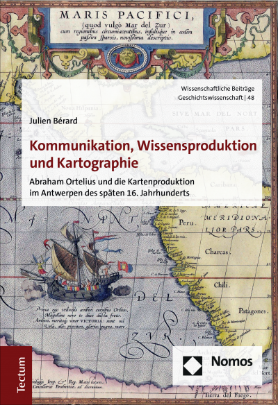
Kommunikation, Wissensproduktion und Kartographie
Abraham Ortelius und die Kartenproduktion im Antwerpen des späten 16. Jahrhunderts- Autor:innen:
- Verlag:
- 2020
Zusammenfassung
Die Produktion von kommerziellen Karten in der Renaissance kann nur unter Betrachtung eines komplexen Zusammenspiels unterschiedlicher Faktoren erklärt werden. Anhand der Karten von Abraham Ortelius (*1527 †1598) lässt sich dies exemplarisch verdeutlichen. Die Struktur von Handelsnetzwerken beeinflusste maßgeblich den Fluss der Informationen, die er benötigte. Technische und ökonomische Möglichkeiten setzten den Rahmen für den Erfolg seiner Kartierungsprojekte. Methodologische und kognitive Prozesse bestimmten den Inhalt und die Gestaltung seines Werkes. Seine Karten waren demzufolge sowohl Produkte von Gelehrsamkeit als auch von Kunsthandwerk – und zugleich Ausdruck eines verbreiteten humanistischen Weltbilds.
Publikation durchsuchen
Bibliographische Angaben
- Auflage
- 1/2020
- Copyrightjahr
- 2020
- ISBN-Print
- 978-3-8288-4542-8
- ISBN-Online
- 978-3-8288-7591-3
- Verlag
- Nomos, Baden-Baden
- Reihe
- Wissenschaftliche Beiträge aus dem Tectum Verlag: Geschichtswissenschaft
- Band
- 48
- Sprache
- Deutsch
- Seiten
- 412
- Produkttyp
- Monographie
Inhaltsverzeichnis
- Titelei/Inhaltsverzeichnis Kein Zugriff Seiten I - XII
- Einleitung Kein Zugriff Seiten 1 - 26
- Iberische Handelsrouten Kein Zugriff
- Konkurrenz im Atlantik Kein Zugriff
- Die Mittelmeerrouten Kein Zugriff
- Kaufmannsfamilien und europäische Handelswege Kein Zugriff
- Exotische Waren, kuriose Objekte und wundersame Sammlungen Kein Zugriff
- Antwerpen im europäischen Handelssystem Kein Zugriff
- Antwerpen als Kommunikationsraum Kein Zugriff
- Antwerpen als Medienstadt Kein Zugriff
- Antwerpen und der kosmographische Druck Kein Zugriff
- Briefbeförderung im 16. Jahrhundert Kein Zugriff
- Briefzeitungen und kosmographische Informationen Kein Zugriff
- Der Brief als Medium der Berichterstattung Kein Zugriff
- Der Renaissance-Gelehrte Kein Zugriff
- Der Brief als Bindeglied der Gelehrtenrepublik Kein Zugriff
- Kleinschriften Kein Zugriff
- Manuskripte und nicht europäische Schriften Kein Zugriff
- Kosmographische Drucke Kein Zugriff
- Struktur und Organisation des Buchmarktes Kein Zugriff
- Eine Tradition des Mittelmeers Kein Zugriff
- Iberische Seekarten Kein Zugriff
- Nicht europäisches Wissen Kein Zugriff
- Die Dissemination von iberischen Seekarten Kein Zugriff
- Antwerpen als Operationsbasis Kein Zugriff
- In Westeuropa unterwegs Kein Zugriff
- Ein Handels- und Gelehrtennetzwerk Kein Zugriff
- Ortelius und Mercator Kein Zugriff
- Ortelius und die Gelehrtenrepublik Kein Zugriff
- Obrigkeit und Kartographie Kein Zugriff
- Marktanforderungen Kein Zugriff
- Kupferstich und Tiefdruckverfahren Kein Zugriff
- Finanzierung und Vertrieb Kein Zugriff
- Ortelius’ Methoden Kein Zugriff
- Die Auswahl, Bewertung und Bearbeitung der Vorlagen Kein Zugriff
- Das Problem der Sprachen Kein Zugriff
- Wissensordnungen, Ästhetik und intermediale Wissensvermittlung Kein Zugriff
- Die Welt in Raum und Zeit Kein Zugriff
- Gottesschöpfung und menschliche Ausbeutung Kein Zugriff
- Mirabilia, Neugier und Glaubwürdigkeit Kein Zugriff
- Plurale Geographie und harmonia mundi Kein Zugriff
- Politik und Pietät Kein Zugriff
- Europa und „der Andere“ Kein Zugriff
- Ergebnisse Kein Zugriff Seiten 349 - 358
- Appendix I: Die Karten des Ortelius Kein Zugriff Seiten 359 - 362
- Appendix II: Kartenvorlagen Kein Zugriff Seiten 363 - 368
- Appendix III: Textvorlagen Kein Zugriff Seiten 369 - 374
- Appendix IV: Quellenverzeichnis Kein Zugriff Seiten 375 - 380
- Literaturverzeichnis Kein Zugriff Seiten 381 - 412
Literaturverzeichnis (494 Einträge)
Es wurden keine Treffer gefunden. Versuchen Sie einen anderen Begriff.
- Literaturverzeichnis Google Scholar öffnen DOI: 10.5771/9783828875913
- Abulafia, David (2008): The Discovery of Mankind. Atlantic Encounters in the Age of Columbus, New Haven, CT. Google Scholar öffnen DOI: 10.5771/9783828875913
- Abulafia, David (2014): Das Mittelmeer. Eine Biographie, Frankfurt am Main. Google Scholar öffnen DOI: 10.5771/9783828875913
- Adhémar, Jean (1947): Frère André Thevet. Grand voyageur et cosmographe des rois de France au XVIe siècle, Paris. Google Scholar öffnen DOI: 10.5771/9783828875913
- Akerman, James R. (1995): The Structuring of Political Territory in Early Printed Atlases, in: Imago Mundi, 47. Jg., S. 138–154. Google Scholar öffnen DOI: 10.5771/9783828875913
- Alden, John (1980): European Americana. A Chronological Guide to Works Printed in Europe Relating to the Americas, 1493–1776, New York, NY. Google Scholar öffnen DOI: 10.5771/9783828875913
- Alegria, Maria Fernanda u. a. (2007): Portuguese Cartography in the Renaissance, in: Woodward, David/Harley, John B. (Hrsg.): The History of Cartography. Bd. 3. Cartography in the Renaissance, Chicago, IL, S. 975–1068. Google Scholar öffnen DOI: 10.5771/9783828875913
- Allaire, Bernard (1997): La France et les voyages de Martin Frobisher (1576–1578), in: Revue Historique, 121. Jg., Nr. 3, S. 3–22. Google Scholar öffnen DOI: 10.5771/9783828875913
- Allen, L. John (1992): From Cabot to Cartier. The Early Exploration of Eastern North America, in: Annals of the Association of American Geographers, 82. Jg., S. 500–521. Google Scholar öffnen DOI: 10.5771/9783828875913
- Andrea, Bernadette (2003): The Ghost of Leo Africanus from the English to the Irish Renaissance, in: Ingham, Patricia Clare/Warren, Michelle R. (Hrsg.): Postcolonial Moves. Medieval through Modern, New York, S. 195–215. Google Scholar öffnen DOI: 10.5771/9783828875913
- Ankenbauer, Norbert (2010): "Das ich mochte meer newer dyng erfaren". Die Versprachlichung des Neuen in den Paesi novamente retrovati (Vicenza, 1507) und in ihrer deutschen Übersetzung (Nürnberg, 1508), Berlin. Google Scholar öffnen DOI: 10.5771/9783828875913
- Arblaster, Paul (2001): Policy and Publishing in the Habsburg Netherlands,1585–1690, in: Dooley, Brendan Maurice (Hrsg.): The Politics of Information in Early Modern Europe, London, S. 179–198. Google Scholar öffnen DOI: 10.5771/9783828875913
- Arblaster, Paul (2004): 'Totius Mundi Emporium'. Antwerp as a Centre for Vernacular Bible Translation, 1253–1545, in: Gelderblom, Arie-Jan/Long, Jan L. de (Hrsg.): The Low Countries as a Crossroads of Religious Beliefs, Leiden, 9–31. Google Scholar öffnen DOI: 10.5771/9783828875913
- Ash, Eric H. (2007): Navigation Techniques and Practice in the Renassance, in: Woodward, David/Harley, John B. (Hrsg.): The History of Cartography. Bd. 3. Cartography in the Renaissance, Chicago, IL, S. 509–527. Google Scholar öffnen DOI: 10.5771/9783828875913
- Astengo, Corradino (2007): The Renaissance Chart Tradition in the Mediterranean, in: Woodward, David/Harley, John B. (Hrsg.): The History of Cartography. Bd. 3. Cartography in the Renaissance, Chicago, IL, S. 174–262. Google Scholar öffnen DOI: 10.5771/9783828875913
- Barbarics, Zsusza/Pieper, Renate (2007): Handwritten Newsletters as a Mean of Communication in Early Modern Europe, in: Bethencourt, Francisco/Egmond, Florike (Hrsg.): Cultural Exchange in Early Modern Europe. Correspondence andCultural Exchange in Europe, 1400–1700, Cambridge, S. 53–79. Google Scholar öffnen DOI: 10.5771/9783828875913
- Barbarics-Hernanik, Zsuzsa (2011): The Coexistence of Manuscript and Print. Handwritten Newsletters in the Second Century of Print, 1540–1640, in: Walsby, Malcolm/Kemp, Graeme (Hrsg.): The Book Triumphant. Print in Transition in the Sixteenth and Seventeenth Centuries, Leiden, S. 347–368. Google Scholar öffnen DOI: 10.5771/9783828875913
- Barrera-Orosio, Antonio (2008): Empiricism in the Spanish Atlantic World, in: Delbourgo, James/Dew, Nicholas (Hrsg.): Science and Empire in the Atlantic World, New York, NY, S. 177–202. Google Scholar öffnen DOI: 10.5771/9783828875913
- Barthes, Roland (2002): La mort de l'auteur [1968], in: Marty, Éric (Hrsg.): Oeuvres compètes. Bd. 3 1968–1971, Paris, S. 40–45. Google Scholar öffnen DOI: 10.5771/9783828875913
- Bartusch, Mark W. (2003): Understanding Dan. An Exegetical Study of a Biblical City, Tribe and Ancestor, Sheffield. Google Scholar öffnen DOI: 10.5771/9783828875913
- Bassin, Mark (1991): Russia Between Europe and Asia. The Ideological Construction of Geographical Space, in: Slavic Review, 50. Jg., Nr. 1, S. 1–17. Google Scholar öffnen DOI: 10.5771/9783828875913
- Baßler, Moritz (1995): Einleitung, in: Baßler, Moritz (Hrsg.): New Historicism. Literaturgeschichte als Poetik der Kultur, Frankfurt am Main, S. 7–28. Google Scholar öffnen DOI: 10.5771/9783828875913
- Bateman, Victoria N. (2012): Markets and Growth in Early Modern Europe, London. Google Scholar öffnen DOI: 10.5771/9783828875913
- Bauer, Oswald (2011): Zeitungen vor der Zeitung. Die Fuggerzeitungen (1568–1605) und das frühmoderne Nachrichtensystem, Berlin. Google Scholar öffnen DOI: 10.5771/9783828875913
- Baumgärtner, Ingrid (1998): Kartographie, Reisebericht und Humanismus. Die Erfahrung in der Weltkarte des venezianischen Kamaldulensermönchs Fra Mauro, 1459, in: Das Mittelalter, 3. Jg., Nr. 2, S. 161–197. Google Scholar öffnen DOI: 10.5771/9783828875913
- Baumgärtner, Ingrid (2017): Der Portulan-Atlas des Battista Agnese. Das Kasseler Prachtexemplaar von 1542, Darmstadt. Google Scholar öffnen DOI: 10.5771/9783828875913
- Bécares Botas, Vicente (1999): Arias Montano y Plantino. El libro flamenco de la España de Felipe II, León. Google Scholar öffnen DOI: 10.5771/9783828875913
- Beeck, Bart op de/Coster, Annie de (2006): Books and Bindings from the Library of Abraham Ortelius, 1527–1598, in: Coster, Annie de/Sorgeloos, Claude (Hrsg.): Bibliophilies et Reliures, Bruxelles, S. 374–409. Google Scholar öffnen DOI: 10.5771/9783828875913
- Behringer, Wolfgang (2003): Im Zeichen des Merkur. Reichspost und Kommunikationsrevolution in der Frühen Neuzeit, Göttingen. Google Scholar öffnen DOI: 10.5771/9783828875913
- Behringer, Wolfgang (2005): "Von der Gutenberg-Galaxis zur Taxis-Galaxis". Die Kommunikationsrevolution – ein Konzept zum besseren Verständnis der Frühen Neuzeit., in: Burkhardt, Johannes/Werkstetter, Christine (Hrsg.): Kommunikation und Medien in der Frühen Neuzeit, München, S. 39–54. Google Scholar öffnen DOI: 10.5771/9783828875913
- Behringer, Wolfgang (2006): Communications Revolutions. A Historiographical Concept, in: German History, 24. Jg., Nr. 3, S. 333–374. Google Scholar öffnen DOI: 10.5771/9783828875913
- Behrisch, Lars (2008): Zu viele Informationen! Die Aggregierung des Wissens in der Frühen Neuzeit, in: Brendecke, Arndt (Hrsg.): Information in der Frühen Neuzeit. Status, Bestände, Strategien, Berlin/Münster, S. 455–474. Google Scholar öffnen DOI: 10.5771/9783828875913
- Bérard, Julien (2014a): Abraham Ortelius and the Mapping of the Atlantic World in Late Sixteenth Century Antwerp, in: Lachenicht, Susanne (Hrsg.): Europeans Engaging the Atlantic. Knowledge and Trade, 1500–1800, Frankfurt am Main/New York, S. 23–45. Google Scholar öffnen DOI: 10.5771/9783828875913
- Bérard, Julien (2014b): Die Habsburger und die Kartographie der Niederlande im 16. Jahrhundert. Repräsentation, Außenpolitik und kommerzielle Interessen, in: Baumgärtner, Ingrid/Thiel, Lena (Hrsg.): Fürstliche Koordinaten. Landesvermessung und Herrschaftsvisualisierung um 1600, Leipzig, S. 299–320. Google Scholar öffnen DOI: 10.5771/9783828875913
- Bérard, Julien (2016): Het middeleeuws wereldbeeld en de cartographie van de renaissance. Het Theatrum Orbis Terrarum van Abraham Ortelius, in: HistoriAnt, 4. Jg., S. 137–157. Google Scholar öffnen DOI: 10.5771/9783828875913
- Besse, Jean-Marc (2000): Le rôle de la carte dans la consruction du concept de terre aux XVe et XVIe siècles. Réflexions épistémologiques, in: Bulletin du Comité français de cartographie, Nr. 163, S. 6–15. Google Scholar öffnen DOI: 10.5771/9783828875913
- Bevers, Holm (1985): Das Rathaus von Antwerpen. (1561–1565): Architektur und Figurenprogramm, Hildesheim/Marburg. Google Scholar öffnen DOI: 10.5771/9783828875913
- Bierdermann, Zoltán (2008): Ormuz et sa région dans les cartes protugaises du XVIe sciècle, in: Couto, Dejanirah/Loureiro, Rui (Hrsg.): Revisiting Hormuz. Portuguese Interactions in the Persian Gulf Region in the Early Modern Period, Wiesbaden, S. 121–133. Google Scholar öffnen DOI: 10.5771/9783828875913
- Biggs, Michael (1999): Putting the State on the Map. Cartography, Territory and European State Formation, in: Comparative Studies in Society and History, 41. Jg., Nr. 2, S. 374–405. Google Scholar öffnen DOI: 10.5771/9783828875913
- Bitterli, Urs (1989): Die exotische Insel, in: König, Hans-Joachim/Reinhard, Wolfgang/Wendt, Reinhard (Hrsg.): Der europäische Beobachter außereuropäischer Kulturen. Zur Problematik der Wirklichkeitswahrnehmung, Berlin, S. 65–81. Google Scholar öffnen DOI: 10.5771/9783828875913
- Bitterli, Urs (1991): Der Eintritt des amerikanischen Überseebewohners in die europäische Geschichte (15.–18. Jahrhundert), in: Bitterli, Urs (Hrsg.): Die Kenntnis beider "Indien" im frühneuzeitlichen Europa, München, S. 63–92. Google Scholar öffnen DOI: 10.5771/9783828875913
- Black, Crofton (2002): Leo Africanus "Descrittione dell‘ Africa“ and its Sixteenth-Century Translations, in: Journal of the Warburg and Courtauld Institutes, 65. Jg., S. 262–272. Google Scholar öffnen DOI: 10.5771/9783828875913
- Blakely, Allison (2000): Blacks in the Dutch World. The Evolution of Racial Imagery in a Modern Society, Bloomington, ID. Google Scholar öffnen DOI: 10.5771/9783828875913
- Blakemore, Michael J./Harley, John B./Dahl, Edward H. (1980): Concepts in the History of Cartography. A Review and Perspective, Toronto. Google Scholar öffnen DOI: 10.5771/9783828875913
- Blanco, Mercedes (2015): Les langues vernaculaires à l'âge d'or de l'imprimerie anversoise. L'officine espagnole de Martin Nutius, 1542–1558, in: Kammerer, Elsa/Müller, Jan-Dirk (Hrsg.): Imprimeurs et libraires de la Renaissance. Le travail de la langue, Genf, S. 145–175. Google Scholar öffnen DOI: 10.5771/9783828875913
- Blondé, Bruno/Gelgerblom Oscar/Stabel, Peter (2012): Foreign Merchant Communities in Bruges, Antwerpt, and Amsterdam, c. 1350–1650, in: Calabi, Donatella/Christensen, Stephen T. (Hrsg.): Cities and Cultural Exchange in Europe, 1400–1700, Cambridge, S. 154–174. Google Scholar öffnen DOI: 10.5771/9783828875913
- Bodenstein, Wulf (1998): Ortelius' Maps of Africa, in: Broecke, Marcel van den/Voet, Léon (Hrsg.): Abraham Ortelius and the First Atlas. Essays Commemorating the Quadricentennial of his Death, 1598–1998, Utrecht, S. 185–207. Google Scholar öffnen DOI: 10.5771/9783828875913
- Böhme, Max (1904): Die großen Reisesammlungen des 16. Jahrhunderts und ihre Bedeutung, Straßburg. Google Scholar öffnen DOI: 10.5771/9783828875913
- Bollmann, Ulrike (2001): Wandlungen neuzeitlichen Wissens. Historisch-systematische Analysen aus pädagogischer Sicht, Würzburg. Google Scholar öffnen DOI: 10.5771/9783828875913
- Boone, Rebecca Ard (2007): War, Domination, and the Monarchy of France. Claude de Seyssel and the Language of Politics in the Renaissance, Leiden. Google Scholar öffnen DOI: 10.5771/9783828875913
- Borreguero Beltrán, Christina (2010): Philip of Spain. The Spider Web of News and Informations, in: Dooley, Brendan Maurice (Hrsg.): The Dissemination of News and the Emergence of Contemporaneity in Early Modern Europe, Farnham, S. 23–49. Google Scholar öffnen DOI: 10.5771/9783828875913
- Bowen, Karen Lee/Imhof, Dirk (2003): Reputation and Wage. The Case of Engravers Who Worked for the Plantin-Moretus Press, in: Simiolus: Netherlands Quarterly for the History of Art, 30. Jg., 3/4, S. 161–195. Google Scholar öffnen DOI: 10.5771/9783828875913
- Bowen, Karen Lee/Imhof, Dirk (2008): Christopher Plantin and Engraved Book Illustrations in Sixteenth-Century Europe, New York, NY. Google Scholar öffnen DOI: 10.5771/9783828875913
- Boyer, Christoph (2008): Netzwerke und Geschichte. Netzwerktheorien und Geschichtswissenschaft, in: Unfried, Berthold (Hrsg.): Transnationale Netzwerke im 20. Jahrhundert, Leipzig, S. 45–58. Google Scholar öffnen DOI: 10.5771/9783828875913
- Branch, Jordan (2014): The Cartographic State. Maps, Territory, and the Origin of Sovereignty, Cambridge. Google Scholar öffnen DOI: 10.5771/9783828875913
- Brandmair, Eduard (1914): Bibliographische Untersuchungen über Entstehung und Entwicklung des Ortelianischen Kartenwerkes, München. Google Scholar öffnen DOI: 10.5771/9783828875913
- Brandt, Reinhard (1994): Das Sammeln der Erkenntnis, in: Grote, Andreas (Hrsg.): Macrocosmos in Microcosmo. Die Welt in der Stube, Opladen, S. 21–33. Google Scholar öffnen DOI: 10.5771/9783828875913
- Braudel, Fernand (1980): Civilisation matérielle, économie et capitalisme. XVe-XVIIIe siècle, Paris. Google Scholar öffnen DOI: 10.5771/9783828875913
- Braudel, Fernand (1990): Das Mittelmeer und die mediterrane Welt in der Epoche Philipps II, Frankfurt am Main. Google Scholar öffnen DOI: 10.5771/9783828875913
- Bredekamp, Horst (1993): Antikensehnsucht und Maschinenglauben. Die Geschichte der Kunstkammer und die Zukunft der Kunstgeschichte, Berlin. Google Scholar öffnen DOI: 10.5771/9783828875913
- Breidbach, Olaf (2012): Representationen des Wissens. Ein Vergleich der Darstellungsformen der barocken Universalwissenschaft (Athanasius Kirchner) und der Modernen, in: Herbst, Klaus-Dieter/Walter, Helmut G. (Hrsg.): Idea matheseos universae. Ordnungssysteme und Welterklarung an den deutschen Universitäten in der zweiten Hälfte des 17. Jahrhunderts, Stuttgart, S. 13–28. Google Scholar öffnen DOI: 10.5771/9783828875913
- Brendecke, Arndt (2009): Imperium und Empirie. Funktionen des Wissens in der spanischen Kolonialherrschaft, Köln. Google Scholar öffnen DOI: 10.5771/9783828875913
- Brentjes, Sonja (2010): Travellers from Europe in the Ottoman and Safavid Empires, 16th–17th centuries. Seeking, Transforming, Discarding Knowledge, Farnham. Google Scholar öffnen DOI: 10.5771/9783828875913
- Brincken, Anna-Dorothee von den (1992): Fines terrae. Die Enden der Erde und der vierte Kontinent auf mittelalterlichen Weltkarten, Hannover. Google Scholar öffnen DOI: 10.5771/9783828875913
- Brincken, Anna-Dorothee von den (2008): Mappamundi und Chronographia. Studien zur imago mundi des abendländischen Mittelalters (1968), in: Studien zur Universalkartographie des Mittelalters, Göttingen, S. 17–81. Google Scholar öffnen DOI: 10.5771/9783828875913
- Broecke, Marcel van den (1998): Introduction to the Life and Work of Abraham Ortelius (1527–1598), in: Broecke, Marcel van den/Voet, Léon (Hrsg.): Abraham Ortelius and the First Atlas. Essays Commemorating the Quadricentennial of his Death, 1598–1998, Utrecht, S. 29–54. Google Scholar öffnen DOI: 10.5771/9783828875913
- Broecke, Marcel van den (2008): The Significance of Language. The Texts on the Verso of the Maps in Abraham Ortelius, Theatrum Orbis Terrarum, in: Imago Mundi, 60. Jg., Nr. 2, S. 202–210. Google Scholar öffnen DOI: 10.5771/9783828875913
- Broecke, Marcel van den (2009): Ortelius' Theatrum Orbis Terrarum (1570–1641). Characteristics and Development of a Sample of "on Verso" Map Texts, Utrecht. Google Scholar öffnen DOI: 10.5771/9783828875913
- Broecke, Marcel van den (2011): Ortelius Atlas Maps. An Illustrated Guide, 2. Aufl., Houten. Google Scholar öffnen DOI: 10.5771/9783828875913
- Broecke, Marcel van den (2014): Abraham Ortelius's Library Reconstructed, in: Imago Mundi, 66. Jg., Nr. 1, S. 25–50. Google Scholar öffnen DOI: 10.5771/9783828875913
- Broecke, Marcel van den (2015): Abraham Ortelius, 1527–1598. Life, Work Sources and Friends, Bilthoven. Google Scholar öffnen DOI: 10.5771/9783828875913
- Broecke, Marcel van den/Voet, Léon (Hrsg.) (1998): Abraham Ortelius and the First Atlas. Essays Commemorating the Quadricentennial of his Death, 1598–1998, Utrecht. Google Scholar öffnen DOI: 10.5771/9783828875913
- Brotton, Jerry (1997): Trading Territories. Mapping the Early Modern World, London. Google Scholar öffnen DOI: 10.5771/9783828875913
- Brübach, Niels (1994): Die Reichsmessen von Frankfurt am Main, Leipzig und Braunschweig. (14.–18. Jahrhundert), Stuttgart. Google Scholar öffnen DOI: 10.5771/9783828875913
- Buisseret, David (1998): Meso-American and Spanish Cartography. An Unusual Example of Sycretic Development, in: Reinhartz, Dennis (Hrsg.): The Mapping of the Entradas into the Greater Southwest, Norman, S. 30–55. Google Scholar öffnen DOI: 10.5771/9783828875913
- Buisseret, David (2003): The Mapmakers' Quest. Depicting New Worlds in Renaissance Europe, Oxford. Google Scholar öffnen DOI: 10.5771/9783828875913
- Buisseret, David (2007): Spanish Colonial Cartography, 1540–1700, in: Woodward, David/Harley, John B. (Hrsg.): The History of Cartography. Bd. 3. Cartography in the Renaissance, Chicago, IL, S. 1143–1171. Google Scholar öffnen DOI: 10.5771/9783828875913
- Bujanda, J. M. de (1971): Literary Censorship in Sixteenth-Century Spain, in: Canadian Catholic Historical Association Study, 38. Jg., S. 51–63. Google Scholar öffnen DOI: 10.5771/9783828875913
- Buker, George E. (1992): The Search for the Seven Cities and Early American Exploration, in: The Florida Historical Quarterly, 72. Jg., Nr. 2, S. 155–168. Google Scholar öffnen DOI: 10.5771/9783828875913
- Burke, Peter (1995): America and the Rewriting of World History, in: Ordahl Kupperman, Karen (Hrsg.): America in European Consciousness, 1493–1750, Chapel Hill, NC, S. 33–51. Google Scholar öffnen DOI: 10.5771/9783828875913
- Burke, Peter (1996): Urbanisierung und Kommunikation. Die vorindustrielle Stadt als Informationszentrale, in: Freibeuter, 68. Jg., S. 1–18. Google Scholar öffnen DOI: 10.5771/9783828875913
- Burke, Peter (1998): Die europäische Renaissance. Zentren und Peripherien, München. Google Scholar öffnen DOI: 10.5771/9783828875913
- Burke, Peter (2000a): A Social History of Knowledge. From Gutenberg to Diderot, Cambridge. Google Scholar öffnen DOI: 10.5771/9783828875913
- Burke, Peter (2000b): Early Modern Venice as a Center of Information and Communication, in: Martin, John/Romano, Dennis (Hrsg.): Venice Reconsidered. The History and Civilization of an Italian City-State, 1297–1797, Baltimore, S. 389–419. Google Scholar öffnen DOI: 10.5771/9783828875913
- Burke, Peter (2004): Languages and Communities in Early Modern Europe, Cambridge. Google Scholar öffnen DOI: 10.5771/9783828875913
- Burschel, Peter (2013): Yuhanna al-Assad, or the Language of Exile, in: Jobs, Sebastian/Mackenthun, Gesa (Hrsg.): Agents of Transculturation. Border-crossers, Mediators, Go-betweens, Münster, S. 39–49. Google Scholar öffnen DOI: 10.5771/9783828875913
- Büttner, Nils (1998): Abraham Ortelius comme collectionneur, in: Karrow, Robert W. (Hrsg.): Abraham Ortelius (1527–1598). Cartographe et humaniste, Turnhout, S. 168–180. Google Scholar öffnen DOI: 10.5771/9783828875913
- Büttner, Nils (2000): Die Erfindung der Landschaft. Kosmographie und Landschaftskunst im Zeitalter Bruegels, Göttingen. Google Scholar öffnen DOI: 10.5771/9783828875913
- Cambel, Tony (2002): Portolan Charts from the Late Thirteenth Century to 1500, in: Harley, John B./Woodward, David (Hrsg.): The History of Cartography. Cartography in Prehistoric, Ancient, and Medieval Europe and the Mediterranean, Chicago, IL, S. 371–463. Google Scholar öffnen DOI: 10.5771/9783828875913
- Camino, Mercedes Maroto (2008): Exploring the Explorers. Spaniards in Oceania, 1519–1794, Manchester. Google Scholar öffnen DOI: 10.5771/9783828875913
- Cañizares-Esguerra, Jorge (2001): How to Write the History of the New World. Histories, Epistemologies, and Identities in the Eighteenth-Century Atlantix World, Stanford, CA. Google Scholar öffnen DOI: 10.5771/9783828875913
- Cañizares-Esguerra, Jorge (2006): Nature, Empire, and Nation. Explorations of the History of Science in the Iberian World, Stanford, CA. Google Scholar öffnen DOI: 10.5771/9783828875913
- Carhart, John S. (2004): How Long Did It Take to Engrave an Early Modern Map? A Consideration of Craft Parctices, in: Imago Mundi, 56. Jg., Nr. 2, S. 194–197. Google Scholar öffnen DOI: 10.5771/9783828875913
- Carter, Paul (1999): Dark with Excess of Bright. Mapping the Coastlines of Knoledge, in: Cosgrove, Denis E. (Hrsg.): Mappings, London, S. 125–147. Google Scholar öffnen DOI: 10.5771/9783828875913
- Cassidy, Donna M. (2001): Art History and Cartography. Picture Making and Art Making in the Seventeenth-Century Netherlands, in: Edney, Matthew H./Novak, Irwin D. (Hrsg.): Reading the World Map, Portland, MA, S. 26–30. Google Scholar öffnen DOI: 10.5771/9783828875913
- Castro, Xavier de u. a. (2007): Le voyage de Magellan (1519–1522). La relation d'Antonio Pigafetta & autres témoignages, Paris. Google Scholar öffnen DOI: 10.5771/9783828875913
- Cavelti, Annina (2010): Was Karten über die Vergangenheit erzählen. Herberstein und Jenkinson kartographieren Russland, in: Happel, Jörn/Werdt, Christophe von (Hrsg.): Osteuropa kartiert. Mapping Eastern Europe, Berlin, S. 133–153. Google Scholar öffnen DOI: 10.5771/9783828875913
- Chaunu, Pierre (1951): Le galion de Manille. Grandeur et décadence d'une route de la soie, in: Annales. Histoire, Sciences Sociales, 6. Jg., Nr. 4, S. 447–462. Google Scholar öffnen DOI: 10.5771/9783828875913
- Christman, Victoria (2015): Pragmatic Toleration. The Politics of Religious Heterodoxy in Early Reformation Antwerp, 1515–1555, Rochester. Google Scholar öffnen DOI: 10.5771/9783828875913
- Cipolla, Carlo M./Hausmann, Friederike (1999): Segel und Kanonen. Die europäische Expansion zur See, Berlin. Google Scholar öffnen DOI: 10.5771/9783828875913
- Claes, Frans (2000): Vocabulaires et livres de conversation pour apprendre de français aux Pays-Bas espagnols entre 1550 et 1700, in: Lioce, Nico/Clercq, Jan de/Swiggers, Pierre (Hrsg.): Grammaire et enseignement du français, 1500–1700, Leuven, S. 217–235. Google Scholar öffnen DOI: 10.5771/9783828875913
- Clair, Colin (1976): A History of European Printing, London. Google Scholar öffnen DOI: 10.5771/9783828875913
- Cline, Howard F. (1962): The Ortelius Maps of New Spain, 1579, and Related Contemporary Materials, 1560–1610, in: Imago Mundi, 16. Jg., S. 98–115. Google Scholar öffnen DOI: 10.5771/9783828875913
- Collet, Dominik (2007): Die Welt in der Stube. Begegnungen mit Außereuropa in Kunstkammern der Frühen Neuzeit, Göttingen. Google Scholar öffnen DOI: 10.5771/9783828875913
- Conley, Tom (2007): Early Modern Literature and Cartography. An Overview, in: Woodward, David/Harley, John B. (Hrsg.): The History of Cartography. Bd. 3. Cartography in the Renaissance, Chicago, IL, S. 401–441. Google Scholar öffnen DOI: 10.5771/9783828875913
- Cook, Bernard A. (2004): Belgium. An History, New York, NY. Google Scholar öffnen DOI: 10.5771/9783828875913
- Cook, Harold John (2007): Matters of Exchange. Commerce, Medicine, and Science in the Dutch Golden Age, New Haven, CT. Google Scholar öffnen DOI: 10.5771/9783828875913
- Cordier, Stéphane (1972): Christophe Plantin architypographe du roy, Ardenne. Google Scholar öffnen DOI: 10.5771/9783828875913
- Cormach, Lessley B. (2007): Maps as Educational Tools in the Renaissance, in: Woodward, David/Harley, John B. (Hrsg.): The History of Cartography. Bd. 3. Cartography in the Renaissance, Chicago, IL, S. 622–636. Google Scholar öffnen DOI: 10.5771/9783828875913
- Cortés, Hernán (2001): Letters from Mexico, New Haven, CT. Google Scholar öffnen DOI: 10.5771/9783828875913
- Cortesão, Armando/Texeira da Mota, Avelino (1960–1987): Portugaliae monumenta cartographica. Comemorações do V centenário da morte do infante D. Henrique, Lisabon. Google Scholar öffnen DOI: 10.5771/9783828875913
- Cosgrove, Denis E. (1992): Mapping New Worlds. Culture and Cartography in Sixteenth-Century Venice, in: Imago Mundi, 44. Jg., S. 64–89. Google Scholar öffnen DOI: 10.5771/9783828875913
- Cosgrove, Denis E. (Hrsg.) (1999): Mappings, London. Google Scholar öffnen DOI: 10.5771/9783828875913
- Cosgrove, Denis E. (2003): Globalism and Tolerance in Early Modern Geography, in: Annals of the Association of American Geographers, 93. Jg., Nr. 4, S. 852–870. Google Scholar öffnen DOI: 10.5771/9783828875913
- Cosgrove, Denis E. (2007a): Images of Renaissance Cosmography, 1450–1650, in: Woodward, David/Harley, John B. (Hrsg.): The History of Cartography. Bd. 3. Cartography in the Renaissance, Chicago, IL, S. 55–98. Google Scholar öffnen DOI: 10.5771/9783828875913
- Cosgrove, Denis E. (2007b): Mapping the World, in: Akerman, James R./Karrow, Robert W. (Hrsg.): Maps. Finding our Place in the World, Chicago, IL, S. 65–116. Google Scholar öffnen DOI: 10.5771/9783828875913
- Cosgrove, Denis E. (2008): Geography and Vision. Seeing, Imagining and Representing the World, London. Google Scholar öffnen DOI: 10.5771/9783828875913
- Costa, Palmira Fontes Da/Leitão, Henrique (2009): Portuguese Imperial Science, 1450–1800, in: Bleichmar, Daniela u. a. (Hrsg.): Science in the Spanish and Portuguese Empires, 1500–1800, Stanford, CA, S. 35–54. Google Scholar öffnen DOI: 10.5771/9783828875913
- Dalton, Heather (2016): Merchants and Explorers. Roger Barlow, Sebastian Cabot, and Networks of Atlantic Exchange, 1500–1560, Oxford. Google Scholar öffnen DOI: 10.5771/9783828875913
- Darnton, Robert (1982): What is the History of Books?, in: Daedalus, 111. Jg., Nr. 3, S. 65–83. Google Scholar öffnen DOI: 10.5771/9783828875913
- Daston, Lorraine (1994): Neugierde als Empfindung und Epistemologie in der frühmodernen Wissenschaft, in: Grote, Andreas (Hrsg.): Macrocosmos in Microcosmo. Die Welt in der Stube, Opladen, S. 35–59. Google Scholar öffnen DOI: 10.5771/9783828875913
- Daston, Lorraine/Park, Katharine (2001): Wonders and the Order of Nature, 1150–1750, New York, NY. Google Scholar öffnen DOI: 10.5771/9783828875913
- Degeorge, Léon (1878): La maison de Plantin à Anvers. Monographie complète de cette imprimerie célèbre aux XVIe et XVIIe siècles ouvrage orné d'un portrait de Plantin, d'après Wierix, d'un Tableau généalogique de la famille, d'un plan-coup du rez-de-chaussée, d'une gravure de la cour interieure et de la marque typographique du grand imprimeur, 2. Aufl., Brussel. Google Scholar öffnen DOI: 10.5771/9783828875913
- Dekesel, Christian E. (1998): Abraham Ortelius. Numismate, in: Karrow, Robert W. (Hrsg.): Abraham Ortelius (1527–1598). Cartographe et humaniste, Turnhout, S. 181–192. Google Scholar öffnen DOI: 10.5771/9783828875913
- Delbourgo, James/Dew, Nicholas (Hrsg.) (2008): Science and Empire in the Atlantic World, New York, NY. Google Scholar öffnen DOI: 10.5771/9783828875913
- Deluz, Christiane (1988): Le livre de Jehan de Mandeville. Une geographie au XVIe siècle, Louvain-La-Neuve. Google Scholar öffnen DOI: 10.5771/9783828875913
- Denucé, Jean (1914): Jean & Jacques Suhron. Cartographe Montois, Mons. Google Scholar öffnen DOI: 10.5771/9783828875913
- Denucé, Jean (1931): De beurs van Antwerpen. Oorsprong en eerste ontwikkeling 15e en 16e eeuwen, in: Antwerpsche Archievenblad, 6. Jg., S. 81–145. Google Scholar öffnen DOI: 10.5771/9783828875913
- Denucé, Jean (1937): L'Afrique au XVIe sciècle et le commerce anversois, Anvers. Google Scholar öffnen DOI: 10.5771/9783828875913
- Denucé, Jean (1964): Oud-nederlandsche Kaartmakers in betrekking met Plantijn, 2. Aufl., Amsterdam. Google Scholar öffnen DOI: 10.5771/9783828875913
- Denzer, Jörg (2002): Die Welser in Venezuela. Das Scheitern ihrer wirtschaftlichen Ziele, in: Häberlein, Mark/Burkhardt, Johannes/Holuba, Judith (Hrsg.): Die Welser. Neue Forschungen zur Geschichte und Kultur des oberdeutschen Handelshauses, Berlin, S. 286–319. Google Scholar öffnen DOI: 10.5771/9783828875913
- Depuydt, Franz/Depuydt, Josst (2009): "America Meridionalis" en los primeros planisferios realizados en los Países Bajos del sur, in: Thomas, Werner/Stols, Eddy (Hrsg.): Un mondo sobre papel. Libros y grabados flamencos en el imperio hispanoportugués, Siglos XVI–XVIII, Leuven, S. 363–382. Google Scholar öffnen DOI: 10.5771/9783828875913
- Depuydt, Joost (2016): New Letters for a Biography of Abraham Ortelius, in: Imago Mundi, 68. Jg., Nr. 1, S. 67–78. Google Scholar öffnen DOI: 10.5771/9783828875913
- Dietrich, Craig (2001): "Until Something More Certain Emerges". Van den Keere's Asia, in: Edney, Matthew H./Novak, Irwin D. (Hrsg.): Reading the World Map, Portland, MA, S. 20–25. Google Scholar öffnen DOI: 10.5771/9783828875913
- Dietrich, Ronald (2003): Der Gelehrte in der Literatur. Literarische Perspektiven zur Ausdifferenzierung des Wissenschaftssystems, Würzburg. Google Scholar öffnen DOI: 10.5771/9783828875913
- Dietz, Alexander (1972): Frankfurter Handelsgeschichte, Glasshütten im Taunus. Google Scholar öffnen DOI: 10.5771/9783828875913
- Dreyer-Eimbcke, Oswald (1994): Durchs Eis ins Reich der Mitte. Einfluß und Bedeutung der Kartograpfie bei der Suche nach den Nordpassagen, in: Löffler, Ruth/Tromnau, Gernot (Hrsg.): Gerhard Mercator, Europa und die Welt, Duisburg, S. 131–172. Google Scholar öffnen DOI: 10.5771/9783828875913
- Dreyer-Eimbcke, Oswald (1996): Auf den Spuren der Entdecker am südlichsten Ende der Welt. Meilensteine der Entdeckungs- und Kartographiegeschichte vom 16. bis 20. Jahrhundert, Gotha. Google Scholar öffnen DOI: 10.5771/9783828875913
- Driessen, Henk (2013): Mediterranean Divides and Connections. The Role of Dragomans as Cultural Brokers, in: Jobs, Sebastian/Mackenthun, Gesa (Hrsg.): Agents of Transculturation. Border-crossers, Mediators, Go-betweens, Münster, S. 25–38. Google Scholar öffnen DOI: 10.5771/9783828875913
- Ducène, Jean-Charles (2013): Le portulan arabe décrit par Al-'Umarī, in: Comité français de cartographie, 216. Jg., S. 81–90. Google Scholar öffnen DOI: 10.5771/9783828875913
- Duke, Alastair/Pollmann, Judith/Spicer, Andrew (2009): Dissident Identities in the Early Modern Low Countries, Farnham. Google Scholar öffnen DOI: 10.5771/9783828875913
- Duntze, Oliver (2002): Die Frankfurter und Leipziger Meßkataloge als buchgeschichtliche Quellen, in: Börsenblatt für den Deutschen Buchhandel, 21. Jg., Nr. 1, S. B10–B18. Google Scholar öffnen DOI: 10.5771/9783828875913
- Duntze, Oliver (2010): Verlagsbuchhandel und verbreitender Buchhandel von der Erfindung des Buchdrucks bis 1700, in: Rautenberg, Ursula (Hrsg.): Buchwissenschaft in Deutschland. 1. Theorie und Forschung, Berlin, S. 203–256. Google Scholar öffnen DOI: 10.5771/9783828875913
- Duzer, Chet A. van (2015): The World for a King. Pierre Desceliers' map of 1550, London. Google Scholar öffnen DOI: 10.5771/9783828875913
- Eamon, William (2006): Markets, Piazzas, and Villages, in: Park, Katharine/Daston, Lorraine (Hrsg.): The Cambridge History of Science. Bd. 3. Early Modern Science, Cambridge, S. 206–223. Google Scholar öffnen DOI: 10.5771/9783828875913
- Edney, Matthew H. (1996): Theory and the History of Cartography, in: Imago Mundi, 48. Jg., S. 185–191. Google Scholar öffnen DOI: 10.5771/9783828875913
- Edney, Matthew H. (1997): Mapping an Empire. The Geographical Construction of British India, 1765–1843, Chicago, IL. Google Scholar öffnen DOI: 10.5771/9783828875913
- Edney, Matthew H. (2011): Knowledge and Cartography in the Early Atlantic, in: Canny, Nicholas P./Morgan, Philip D. (Hrsg.): The Oxford Handbook of the Atlantic World, c. 1450–c. 1850, Oxford, S. 87–112. Google Scholar öffnen DOI: 10.5771/9783828875913
- Eibach, Johachim (2008): Das Haus. Zwischen öffentlicher Zugänglichkeit und geschützer Privatheit (16.–18. Jahrhundert), in: Rau, Susanne/Schwerhoff, Gerd (Hrsg.): Zwischen Gotteshaus und Taverne. Öffentliche Räume in Spätmittelalter und Früher Neuzeit, 2. Aufl., Köln, S. 183–205. Google Scholar öffnen DOI: 10.5771/9783828875913
- Eisenstein, Elizabeth L. (1979): The Printing Press as an Agent of Change. Communications and Cultural Transformations in Early-Modern Europe, Cambridge. Google Scholar öffnen DOI: 10.5771/9783828875913
- Elbl, Ivana (1992): Cross-Cultural Trade and Diplomacy. Portuguese Relations with West Africa, 1441–1521, in: Journal of World History, 3. Jg., Nr. 2, S. 165–204. Google Scholar öffnen DOI: 10.5771/9783828875913
- Elmquvist Söderlund, Inga (2014): The Early Modern Library as a Site for Collecting and Display of Scientific Instrument, in: Gáldy, Andrea/Heudecker, Sylvia (Hrsg.): Collecting Nature, Newcastle upon Tyne, S. 151–168. Google Scholar öffnen DOI: 10.5771/9783828875913
- Emiralioğlu, Pınar (2014): Geographical Knowledge and Imperial Culture in the Early Modern Ottoman Empire, Farnham. Google Scholar öffnen DOI: 10.5771/9783828875913
- Estienne, Henri (1969): The Frankfort Book Fair. Henricus Stephanus II. Francofordiense Emporium, 1574, Amsterdam. Google Scholar öffnen DOI: 10.5771/9783828875913
- Ewing, Dan (1990): Marketing Art in Antwerp, 1460–1560. Our Lady's Pand, in: The Art Bulletin, 72. Jg., Nr. 4, S. 558–584. Google Scholar öffnen DOI: 10.5771/9783828875913
- Externbrink, Sven (2010): Humanismus, Gelehrtenrepublik und Diplomatie. Überlegung zu ihren Beziehungen in der Frühen Neuzeit, in: Thiessen, Hillard von/Windler, Christian (Hrsg.): Akteure der Außenbeziehungen. Netzwerke und Interkulturalität im historischen Wandel, Köln, S. 133–149. Google Scholar öffnen DOI: 10.5771/9783828875913
- Faidutti, Bruno (1996): Images et connaissance de la licorne. Fin du Moyen-Age–IXeme sciècle. Université de Paris XII, Paris. Google Scholar öffnen DOI: 10.5771/9783828875913
- Fangerau, Heiner (2009): Der Austausch von Wissen und die rekonstruktive Visualisierung formeller und informeller Denkkollektive, in: Fangerau, Heiner/Halling, Thorsten (Hrsg.): Netzwerke. Allgemeine Theorie oder Universalmetapher in den Wissenschaften?, Bielefeld, S. 215–246. Google Scholar öffnen DOI: 10.5771/9783828875913
- Febvre, Lucien/Martin, Henri-Jean (1971): L'Apparition du livre, 2. Aufl., Paris. Google Scholar öffnen DOI: 10.5771/9783828875913
- Feest, Christian F. (1995): The Collecting of American Indian Artifacts in Europe, 1493–1750, in: Ordahl Kupperman, Karen (Hrsg.): America in European Consciousness, 1493–1750, Chapel Hill, NC. Google Scholar öffnen DOI: 10.5771/9783828875913
- Feist Hirsch, Elisabeth (1967): Damião de Gois. The Life and Thought of a Portuguese Humanist, 1502–1574, Dordrecht. Google Scholar öffnen DOI: 10.5771/9783828875913
- Feldbauer, Peter (2005): Die Portugiesen in Asien, 1498–1620, Essen. Google Scholar öffnen DOI: 10.5771/9783828875913
- Fernández-Armesto, Felipe (2007): Maps and Exploration in the Sixteenth and Early Seventeenth Centuries, in: Woodward, David/Harley, John B. (Hrsg.): The History of Cartography. Bd. 3. Cartography in the Renaissance, Chicago, IL, S. 738–770. Google Scholar öffnen DOI: 10.5771/9783828875913
- Fernández-Armesto, Felipe (2008): Amerigo. The Man who Gave his Name to America, New York, NY. Google Scholar öffnen DOI: 10.5771/9783828875913
- Findlay, Ronald/O'Rourke, Kevin H. (2007): Power and Plenty. Trade, War, and the World Economy in the Second Millennium, Princeton, NJ. Google Scholar öffnen DOI: 10.5771/9783828875913
- Findlen, Paula (2002): Commerce, Art, and Science in Early Modern Cabinet of Curiosities, in: Smith, Pamela/Findlen, Paula (Hrsg.): Merchants and Marvels. Commerce, Science, and Art in Early Modern Europe, New York, NY, S. 297–323. Google Scholar öffnen DOI: 10.5771/9783828875913
- Fiorani, Francesca (2005): The Marvel of Maps. Art, Cartography and Politics in Renaissance Italy, New Haven, CT. Google Scholar öffnen DOI: 10.5771/9783828875913
- Fisch, Jörg (1984): Die europäische Expansion und das Völkerrecht. Die Auseinandersetzungen um den Status der überseeischen Gebiete vom 15. Jahrhundert bis zur Gegenwart, Stuttgart. Google Scholar öffnen DOI: 10.5771/9783828875913
- Flood, John L. (2007): "Omnium totius orbis emporiorum compendium". The Frankfurt Fair in the Early Modern Period, in: Myers, Robin/Harris, Michael/Mandelbrote, Giles (Hrsg.): Fairs, Markets and the Itinerant Book Trade, New Castle DE, S. 1–42. Google Scholar öffnen DOI: 10.5771/9783828875913
- Foucault, Michel (1966): Les mots et les choses. Une achéologie des sciences humaines, Paris. Google Scholar öffnen DOI: 10.5771/9783828875913
- Francois, Etienne (1987): Geographie du livre et réseau urbain dans l'Allemagne moderne, in: Lepetit, Bernard (Hrsg.): La ville et l'innovation. Relais et réseaux de diffusion en Europe, 14e–19e siècles, Paris, S. 59–74. Google Scholar öffnen DOI: 10.5771/9783828875913
- French, Peter J. (2013): John Dee. The World of an Elizabethan Magus, Hoboken. Google Scholar öffnen DOI: 10.5771/9783828875913
- Friedrichs, Christopher R. (2005): Das städtische Rathaus als kommunikativer Raum in europäischer Perspektive, in: Burkhardt, Johannes/Werkstetter, Christine (Hrsg.): Kommunikation und Medien in der Frühen Neuzeit, München, S. 159–174. Google Scholar öffnen DOI: 10.5771/9783828875913
- García Oro, José (1995): Los reyes y los libros. La política libraria de la Corona en el siglo de oro, 1475–1598, Madrid. Google Scholar öffnen DOI: 10.5771/9783828875913
- Gautier Dalché, Patrick (2007): The Reception of Ptolemy's Geography. End of the Fourteenth to Beginning of the Sixteenth Century, in: Woodward, David/Harley, John B. (Hrsg.): The History of Cartography. Bd. 3. Cartography in the Renaissance, Chicago, IL, S. 285–364. Google Scholar öffnen DOI: 10.5771/9783828875913
- Gerbi, Antonello/Moyle, Jeremy (2010): Nature in the New World. From Christopher Columbus to Gonzalo Fernández de Oviedo, Pittsburgh, PA. Google Scholar öffnen DOI: 10.5771/9783828875913
- Giesecke, Michael (1991): Der Buchdruck in der Frühen Neuzeit. Eine historische Fallstudie über die Durchsetzung neuer Informations- und Kommunikationstechnologien, Frankfurt am Main. Google Scholar öffnen DOI: 10.5771/9783828875913
- Giesecke, Michael (1994): Die typographische Konstruktion der ‚Neuen Welt‘, in: Wenzel, Horst/Kittler, Friedrich A./Schneider, Manfred (Hrsg.): Gutenberg und die neue Welt, München, S. 15–31. Google Scholar öffnen DOI: 10.5771/9783828875913
- Gilly, Carlos (1985): Spanien und der Basler Buchdruck bis 1600. Ein Querschnitt durch die spanische Geistesgeschichte aus der Sicht einer europaischen Buchdruckerstadt, Basel/Frankfurt am Main. Google Scholar öffnen DOI: 10.5771/9783828875913
- Glauser, Jürg/Kiening, Christian (Hrsg.) (2007): Text – Bild – Karte. Kartographien der Vormoderne, Freiburg. Google Scholar öffnen DOI: 10.5771/9783828875913
- Godinho, Vitorino Magalhães (1963–1965): Os descobrimentos e a economia mundial, Lisboa. Google Scholar öffnen DOI: 10.5771/9783828875913
- Goes, Damião de (1994): Damian de Góis' Schrift über Glaube und Sitten der Äthiopier, Wiesbaden. Google Scholar öffnen DOI: 10.5771/9783828875913
- Goldenberg, L. A. (2007): Russian Cartography to ca. 1700, in: Woodward, David/Harley, John B. (Hrsg.): The History of Cartography. Bd. 3. Cartography in the Renaissance, Chicago, IL, S. 1852–1903. Google Scholar öffnen DOI: 10.5771/9783828875913
- Golvers, Noel (2009): La circulación de impressos procedentes de los Países Bajos Meridionales en China en los siglos XVII y XVIII, in: Thomas, Werner/Stols, Eddy (Hrsg.): Un mondo sobre papel. Libros y grabados flamencos en el imperio hispanoportugués, Siglos XVI–XVIII, Leuven, S. 283–302. Google Scholar öffnen DOI: 10.5771/9783828875913
- González González, Enrique (2009): Libros de Flanders en la Nueva España, in: Thomas, Werner/Stols, Eddy (Hrsg.): Un mondo sobre papel. Libros y grabados flamencos en el imperio hispanoportugués, Siglos XVI–XVIII, Leuven, S. 183–198. Google Scholar öffnen DOI: 10.5771/9783828875913
- Grafton, Anthon/Shelford, April (1992): New Worlds, Ancient Texts. The Power of Tradition and the Shock of Discovery, Cambridge, MA. Google Scholar öffnen DOI: 10.5771/9783828875913
- Grafton, Anthony (2006): Libraries and Lecture Halls, in: Park, Katharine/Daston, Lorraine (Hrsg.): The Cambridge History of Science. Bd. 3. Early Modern Science, Cambridge, S. 238–250. Google Scholar öffnen DOI: 10.5771/9783828875913
- Grafton, Anthony (2009): Worlds Made by Words. Scholarship and Community in the Modern West, Cambridge, MA. Google Scholar öffnen DOI: 10.5771/9783828875913
- Granzow, Uwe (1986): Quadrant, Kompass und Chronometer. Technische Implikationen des euro-asiatischen Seehandels von 1500 bis 1800, Stuttgart. Google Scholar öffnen DOI: 10.5771/9783828875913
- Greenblatt, Stephen J. (1994): Wunderbarer Besitztümer. Die Erfindung des Fremden, Darmstadt. Google Scholar öffnen DOI: 10.5771/9783828875913
- Grewe, Wilhelm G. (2000): The Epochs of International Law, Berlin. Google Scholar öffnen DOI: 10.5771/9783828875913
- Griffin, Clive (2007): Itinerant Booksellers, Printers, and Pedlars in Sixteeneh-Century Spain and Portugal, in: Myers, Robin/Harris, Michael/Mandelbrote, Giles (Hrsg.): Fairs, Markets and the Itinerant Book Trade, New Castle DE, S. 43–59. Google Scholar öffnen DOI: 10.5771/9783828875913
- Groesen, Michiel van (2008): The Representations of Overseas World in De Bry Collection of Voyage, 1590–1634, Leiden. Google Scholar öffnen DOI: 10.5771/9783828875913
- Grote, Andreas (Hrsg.) (1994): Macrocosmos in Microcosmo. Die Welt in der Stube, Opladen. Google Scholar öffnen DOI: 10.5771/9783828875913
- Haase, Wolfgang/Mayer, Reinhold (Hrsg.) (1994): The Classical Tradition and the Americas. European Images of the Americas and the Classical Tradition, Berlin, Google Scholar öffnen DOI: 10.5771/9783828875913
- Haberland, Detlef (2005): Die Kosmographie. Typologie und Medienstrategien, in: Enenkel, Karl A. E./Neuber, Wolfgang (Hrsg.): Cognition and the Book. Typologies of Formal Organisation of Knowledge in the Printed Book of the Early Modern Period, Leiden, S. 125–159. Google Scholar öffnen DOI: 10.5771/9783828875913
- Häberlein, Mark (2016): Aufbruch ins globale Zeitalter. Die Handelswelt der Fugger und Welser, Darmstadt. Google Scholar öffnen DOI: 10.5771/9783828875913
- Hale, John (2007): Warefare and Cartography, ca. 1450 to ca. 1640, in: Woodward, David/Harley, John B. (Hrsg.): The History of Cartography. Bd. 3. Cartography in the Renaissance, Chicago, IL, S. 719–737. Google Scholar öffnen DOI: 10.5771/9783828875913
- Hamilton, Alastair (1981): The Family of Love, Cambridge. Google Scholar öffnen DOI: 10.5771/9783828875913
- Harley, John B. (1988): Silences and Secrecy. The Hidden Agenda of Cartography in Early Modern Europe, in: Imago Mundi, 40. Jg., S. 57–76. Google Scholar öffnen DOI: 10.5771/9783828875913
- Harley, John B. (1989): Deconstructing the Map, in: Cartographica, 26. Jg., Nr. 2, S. 1–20. Google Scholar öffnen DOI: 10.5771/9783828875913
- Harreld, Donald J. (2003): Trading Places. The Public and Private Spaces of Merchants in Sixteenth-Century Antwerp, in: Journal of Urban History, 29. Jg., S. 657–669. Google Scholar öffnen DOI: 10.5771/9783828875913
- Harreld, Donald J. (2004): High Germans in the Low Countries. German Merchants and Commerce in Golden Age Antwerp, Boston. Google Scholar öffnen DOI: 10.5771/9783828875913
- Harreld, Donald J. (2006): Merchants and International Trade Networks in the Sixteenth Century, URL: http://www.helsinki.fi/iehc2006/papers3/Harreld.pdf, Stand: 3. April 2014. Google Scholar öffnen DOI: 10.5771/9783828875913
- Harris, Jason (2004): The Religious Position of Abraham Ortelius, in: Gelderblom, Arie-Jan/Long, Jan L. de (Hrsg.): The Low Countries as a Crossroads of Religious Beliefs, Leiden, S. 89–139. Google Scholar öffnen DOI: 10.5771/9783828875913
- Harris, Steven J. (2006): Network of Travel, Correspondence, and Exchange, in: Park, Katharine/Daston, Lorraine (Hrsg.): The Cambridge History of Science. Bd. 3. Early Modern Science, Cambridge, S. 341–362. Google Scholar öffnen DOI: 10.5771/9783828875913
- Harrison, Charles (2007): The Printed Picture in the Renaissance, in: Woods, Kim W. (Hrsg.): Making Renaissance Art, New Heaven, CT, S. 211–250. Google Scholar öffnen DOI: 10.5771/9783828875913
- Hausberger, Bernd (2002): Lateinamerika – der eroberte Kontinent., in: Edelmayer, Friedrich/Feldbauer, Peter/Wakounig, Marija (Hrsg.): Globalgeschichte, 1450–1620. Anfänge und Perspektiven, Wien, S. 53–74. Google Scholar öffnen DOI: 10.5771/9783828875913
- Hausberger, Bernd (2015): Die Verknüpfung der Welt. Geschichte der frühen Globalisierung vom 16. bis zum 18. Jahrhundert, Wien. Google Scholar öffnen DOI: 10.5771/9783828875913
- Hébert, John R./Pflederer, Richard (2000): Like No Other. The 1562 Gutiérrez Map of America, in: Mercator's world, 5. Jg., Nr. 6, S. 46–51. Google Scholar öffnen DOI: 10.5771/9783828875913
- Heijden, Henk van der (1998): Ortelius and the Netherlands, in: Broecke, Marcel van den/Voet, Léon (Hrsg.): Abraham Ortelius and the First Atlas. Essays Commemorating the Quadricentennial of his Death, 1598–1998, Utrecht, S. 271–290. Google Scholar öffnen DOI: 10.5771/9783828875913
- Heinz, Markus/Reiter, Cornelia (1998): Asiae Descriptio and the Judgment Day Painting, in: Broecke, Marcel van den/Voet, Léon (Hrsg.): Abraham Ortelius and the First Atlas. Essays Commemorating the Quadricentennial of his Death, 1598–1998, Utrecht, S. 125–131. Google Scholar öffnen DOI: 10.5771/9783828875913
- Hellmann, G. (1909): Magnetische Kartographie in historisch-kritischer Darstellung, Berlin, Heidelberg. Google Scholar öffnen DOI: 10.5771/9783828875913
- Herzig, Edmund (1992): The Volume of Iranian Raw Silk Exports in the Safavid Period, in: Iranian Studies, 25. Jg., 1/2, S. 61–79. Google Scholar öffnen DOI: 10.5771/9783828875913
- Herzig, Edmund (1996): The Rise of the Julfa Merchants in the Late Sixteenth Century, in: Melville, Charles (Hrsg.): Safavid Persia. The History and Politics of an Islamic Society, London, S. 305–322. Google Scholar öffnen DOI: 10.5771/9783828875913
- Hiatt, Alfred (2008): Terra Incognita. Mapping the Antipodes before 1600, Chicago, IL. Google Scholar öffnen DOI: 10.5771/9783828875913
- Hirsch, Rudolf (1974): Printing, Selling and Reading, 1540–1550, Wiesbaden. Google Scholar öffnen DOI: 10.5771/9783828875913
- Hirsch, Rudolf (1976): Printed Reports on the Early Discoveries and their Reception, in: Chiappelli, Fredi (Hrsg.): First Images of America. The Impact of the New World on the Old, Berkeley, CA, S. 537–558. Google Scholar öffnen DOI: 10.5771/9783828875913
- Hodgett, Gerald Augustus John (2006): A Social and Economic History of Medieval Europe, London. Google Scholar öffnen DOI: 10.5771/9783828875913
- Hofmann, Catherine (2007): Publishing and the Map Trade in France, 1470–1670, in: Woodward, David/Harley, John B. (Hrsg.): The History of Cartography. Bd. 3. Cartography in the Renaissance, Chicago, IL, S. 1569–1588. Google Scholar öffnen DOI: 10.5771/9783828875913
- Hogenberg, Frans/Hogenberg, Abraham (1983): Geschichtsblätter, Nördlingen. Google Scholar öffnen DOI: 10.5771/9783828875913
- Holthuis, Susanne (1993): Intertextualität. Aspekte einer rezeptionsorientierten Konzeption, Tübingen. Google Scholar öffnen DOI: 10.5771/9783828875913
- Holtus, Günter (2000): Gérard du Vivier. Grammaire Françoise (1566), in: Lioce, Nico/Clercq, Jan de/Swiggers, Pierre (Hrsg.): Grammaire et enseignement du français, 1500–1700, Leuven, S. 401–424. Google Scholar öffnen DOI: 10.5771/9783828875913
- Hoonaard, Will C. van den (2013): Map Worlds. A History of Women in Cartography, Waterloo, Ontario. Google Scholar öffnen DOI: 10.5771/9783828875913
- Hoppe, Brigitte (1994): Kunstkammer der Spätrenaissance zwischen Kuriosität und Wissenschaft, in: Grote, Andreas (Hrsg.): Macrocosmos in Microcosmo. Die Welt in der Stube, Opladen, S. 243–263. Google Scholar öffnen DOI: 10.5771/9783828875913
- Horodowich, Elizabeth (2018): The Venetian Discovery of America. Geographic Imagination and Print Culture in the Age of Encounters, Cambridge. Google Scholar öffnen DOI: 10.5771/9783828875913
- Horodowich, Liz (2005): Armchair Travelers and the Venetian Discovery of the New World, in: Sixteenth Century Journal, 36. Jg., Nr. 4, S. 1039–1062. Google Scholar öffnen DOI: 10.5771/9783828875913
- Huizinga, Johan (1975): Herbst des Mittelalters. Studien über Lebens- und Geistesformen des 14. und 15. Jahrhunderts in Frankreich und in den Niederlanden, 11. Aufl., Stuttgart. Google Scholar öffnen DOI: 10.5771/9783828875913
- Hüllen, Werner (1994): Die Darstellung der Welt in Kirchen, Wunderkammern und naturkundlichen Museen, in: Wenzel, Horst/Kittler, Friedrich A./Schneider, Manfred (Hrsg.): Gutenberg und die neue Welt, München, S. 121–134. Google Scholar öffnen DOI: 10.5771/9783828875913
- Imhof, Dirk (1998a): Abraham Ortelius et Jean Moretus. La production et la vente des oeuvres d'Ortelius par l'Officine Plantinienne de 1589 à 1610, in: Karrow, Robert W. (Hrsg.): Abraham Ortelius (1527–1598). Cartographe et humaniste, Turnhout, S. 193–206. Google Scholar öffnen DOI: 10.5771/9783828875913
- Imhof, Dirk (1998b): The Production of Ortelius Atlases by Christopher Plantin, in: Broecke, Marcel van den/Voet, Léon (Hrsg.): Abraham Ortelius and the First Atlas. Essays Commemorating the Quadricentennial of his Death, 1598–1998, Utrecht, S. 79–92. Google Scholar öffnen DOI: 10.5771/9783828875913
- Imhof, Dirk (2014): Jan Moretus and the Continuation of the Plantin Press. A Bibliography of the Works Published and Printed by Jan Moretus I in Antwerp, 1589–1610, Leiden. Google Scholar öffnen DOI: 10.5771/9783828875913
- Israel, Jonathan I. (2002): Diasporas within a Diaspora. Jews, Crypto-Jews, and the World of Maritime Empires, 1540–1740, Boston, MA. Google Scholar öffnen DOI: 10.5771/9783828875913
- Israel, Jonathan I. (2009): Jews and Crypto-Jews int he Atlantic World Systems, 1500–1800, in: Kagan, Richard L./Morgan, Philip D. (Hrsg.): Atlantic Diasporas. Jews, Conversos, and Crypto-Jews in the Age of Mercantilism, Baltimore, S. 3–17. Google Scholar öffnen DOI: 10.5771/9783828875913
- Jacob, Christian (1996): Toward a Cultural History of Cartography, in: Imago Mundi, 48. Jg., S. 191–198. Google Scholar öffnen DOI: 10.5771/9783828875913
- Jacob, Christian (1999): Mapping the Mind. The Earth from Acient Alexandria, in: Cosgrove, Denis E. (Hrsg.): Mappings, London, S. 24–49. Google Scholar öffnen DOI: 10.5771/9783828875913
- Jacob, Christian (2006): The Sovereign Map. Theoretical Approaches in Cartography throughout History, Chicago, IL. Google Scholar öffnen DOI: 10.5771/9783828875913
- Jäger, Eckhard (1980): Löhne für Zeichner und Stecher von Landkarten. Beispiele aus der europäischen Landkartenrpoduktion des 15. bis 19. Jahrhunderts, in: Schmidtchen, Volder/Jäger, Eckhard/Timm, Albrecht (Hrsg.): Wirtschaft, Technik und Geschichte. Beiträge zur Erforschung der Kulturbeziehungen in Deutschland und Osteuropa, Berlin, S. 109–128. Google Scholar öffnen DOI: 10.5771/9783828875913
- Jäger, Georg (2005): Keine Kulturtheorie ohne Geldtheorie. Grundlegung einer Theorie des Buchverlags, in: Wittmann, Reinhard u. a. (Hrsg.): Buchkulturen. Beiträge zur Geschichte der Literaturvermittlung, Wiesbaden, S. 59–78. Google Scholar öffnen DOI: 10.5771/9783828875913
- Jahn, Bernhard (1993): Raumkonzepte in der frühen Neuzeit. Zur Konstruktion von Wirklichkeit in Pilgerberichten, Amerikareisebeschreibungen und Prosaerzählungen, Frankfurt am Main u.a. Google Scholar öffnen DOI: 10.5771/9783828875913
- Jancke, Gabriele (2013): Gastfreundschaft in der frühneuzeitlichen Gesellschaft. Praktiken, Normen und Perspektiven von Gelehrten, Göttingen. Google Scholar öffnen DOI: 10.5771/9783828875913
- Jandesek, Reinhold (1992): Reiseberichte nach China als Quelle für Martin Behaim, in: Pülhorn, Wolfgang (Hrsg.): Focus, Behaim-Globus. Aufsätze, Nürnberg, S. 223–238. Google Scholar öffnen DOI: 10.5771/9783828875913
- Johnson, Donald S. (1999): Fata Morgana der Meere. Die verschwundenen Inseln des Atlantiks, München. Google Scholar öffnen DOI: 10.5771/9783828875913
- Kagan, Richard L./Schmidt, Benjamin (2007): Maps and the Early Modern State. Official Cartography, in: Woodward, David/Harley, John B. (Hrsg.): The History of Cartography. Bd. 3. Cartography in the Renaissance, Chicago, IL, S. 661–679. Google Scholar öffnen DOI: 10.5771/9783828875913
- Kantor, Iris (2009): Impressos flamengos nas academias coloniais. Os leitores brasileiros de Ortelius e Justus Lipsius, in: Thomas, Werner/Stols, Eddy (Hrsg.): Un mondo sobre papel. Libros y grabados flamencos en el imperio hispanoportugués, Siglos XVI–XVIII, Leuven, S. 253–259. Google Scholar öffnen DOI: 10.5771/9783828875913
- Karrow, Robert W. (1993): Mapmakers of the Sixteenth Century and Their Maps. Bio-bibliographies of the Cartographers of Abraham Ortelius, 1570, Chicago, IL. Google Scholar öffnen DOI: 10.5771/9783828875913
- Karrow, Robert W. (Hrsg.) (1998): Abraham Ortelius (1527–1598). Cartographe et humaniste, Turnhout. Google Scholar öffnen DOI: 10.5771/9783828875913
- Kellenbenz, Hermann (1973): The Economic Significance of the Archangel Route (From the Late 16th to the Late 18th Century), in: Journal of European Economic History, 2. Jg., Nr. 3, S. 541–581. Google Scholar öffnen DOI: 10.5771/9783828875913
- Kellenbenz, Hermann (1990): Die Fugger in Spanien und Portugal bis 1560. Ein Großunternehmen des 16. Jahrhunderts, München. Google Scholar öffnen DOI: 10.5771/9783828875913
- Kellenbenz, Hermann/Angermann, Norbert (Hrsg.) (1986): Europäische Wirtschafts- und Sozialgeschichte vom ausgehenden Mittelalter bis zur Mitte des 17. Jahrhunderts, Stuttgart. Google Scholar öffnen DOI: 10.5771/9783828875913
- Kellenbenz, Hermann/Walter, Rolf (Hrsg.) (2001): Oberdeutsche Kaufleute in Sevilla und Cadiz (1525–1560). Eine Edition von Notariatsakten aus den dortigen Archiven, Stuttgart. Google Scholar öffnen DOI: 10.5771/9783828875913
- Keller, Katrin/Molino, Paola (2015): Die Fuggerzeitungen im Kontext. Zeitungssammlungen im Alten Reich und in Italien, Vienna. Google Scholar öffnen DOI: 10.5771/9783828875913
- Kempe, Michael (2010): Fluch der Weltmeere. Piraterie, Völkerrecht und internationale Beziehungen, 1500–1900, Frankfurt am Main. Google Scholar öffnen DOI: 10.5771/9783828875913
- Kiening, Christian (2007): >Erfahrung< und >Vermessung< der Welt in der frühen Neuzeit, in: Glauser, Jürg/Kiening, Christian (Hrsg.): Text – Bild – Karte. Kartographien der Vormoderne, Freiburg, S. 221–251. Google Scholar öffnen DOI: 10.5771/9783828875913
- Kirsch, Charles (2013): Die Carrera de Indias. Cádiz und der spanische Atlantik, Hamburg, Germany. Google Scholar öffnen DOI: 10.5771/9783828875913
- Klooster, Wim (2011): The Northern European Atlantic World, in: Canny, Nicholas P./Morgan, Philip D. (Hrsg.): The Oxford Handbook of the Atlantic World, c. 1450–c. 1850, Oxford, S. 165–180. Google Scholar öffnen DOI: 10.5771/9783828875913
- Koeman, Cornelis u. a. (2007): Commercial Cartography and Map Production in the Low Countries, 1500- ca. 1672, in: Woodward, David/Harley, John B. (Hrsg.): The History of Cartography. Bd. 3. Cartography in the Renaissance, Chicago, IL, S. 1296–1375. Google Scholar öffnen DOI: 10.5771/9783828875913
- Kohlndorfer-Fries, Ruth (2009): Diplomatie und Gelehrtenrepublik. Die Kontakte des französischen Gesandten Jacques Bongars (1554–1612), Tübingen. Google Scholar öffnen DOI: 10.5771/9783828875913
- Koller, Ariane (2014): Weltbilder und die Ästhetik der Geographie. Die Offizin Blaeu und die niederländische Kartographie der Frühen Neuzeit, Affalterbach. Google Scholar öffnen DOI: 10.5771/9783828875913
- Konetzke, Richard (1935–1936): Die ersten Berichte über die Eroberung Perus, in: Ibero-amerikanisches Archiv, 9. Jg., Nr. 2, S. 101–108. Google Scholar öffnen DOI: 10.5771/9783828875913
- Krogt, Peter van der (1998): The Elevated Stone of Poitier, in: Broecke, Marcel van den/Voet, Léon (Hrsg.): Abraham Ortelius and the First Atlas. Essays Commemorating the Quadricentennial of his Death, 1598–1998, Utrecht, S. 53–54. Google Scholar öffnen DOI: 10.5771/9783828875913
- Künast, Hans-Jörg (1997): "Getruckt zu Augspurg". Buchdruck und Buchhandel in Augsburg zwischen 1468 und 1555, Tübingen. Google Scholar öffnen DOI: 10.5771/9783828875913
- La Fontaine Verwey, Herman de (1976): Uit de wereld van het boek. Bd. 1. Humanisten, dwepers en rebellen in de zestiende eeuw, 2. Aufl., Amsterdam. Google Scholar öffnen DOI: 10.5771/9783828875913
- La Roncière, Monique de/Mollat du Jourdin,, Michel (1984): Les portulans. Cartes marines du XIIIe au XVIIe siècle, Fribourg. Google Scholar öffnen DOI: 10.5771/9783828875913
- Lach, Donald F. (1965): Asia in the Making of Europe. Bd. 1. The Century of Discovery. Buch 2, Chicago, IL. Google Scholar öffnen DOI: 10.5771/9783828875913
- Lach, Donald F. (1970): Asia in the Making of Europe. Bd. 2. A Century of Wonder. Buch 1. The Visual Arts, Chicago, IL. Google Scholar öffnen DOI: 10.5771/9783828875913
- Lach, Donald F. (1977): Asia in the Making of Europe. Bd. 2. A Century of Wonder. Buch 2. The Literary Arts, Chicago, IL. Google Scholar öffnen DOI: 10.5771/9783828875913
- Lachenicht, Susanne (2019): How the Americas Came to Be Known as "the Americas". A Historical Approach to the Western Hemisphere, in: Depkat, Volker/Paul, Heike/Waldschmidt-Nelson, Britta (Hrsg.): Cultural Mobility and Knowledge Formation in the Americas, Heidelberg, S. 13–30. Google Scholar öffnen DOI: 10.5771/9783828875913
- Landwehr, Achim (2007): Wissensgeschichte, in: Schützeichel, Rainer (Hrsg.): Handbuch Wissenssoziologie und Wissensforschung, Konstanz, S. 801–813. Google Scholar öffnen DOI: 10.5771/9783828875913
- Latour, Bruno (1999): Pandora's Hope. Essays on the Reality of Science Studies, Cambridge, MA. Google Scholar öffnen DOI: 10.5771/9783828875913
- Latour, Bruno (2007): Reassembling the Social. An Introduction to Actor-Network-Theory, Oxford. Google Scholar öffnen DOI: 10.5771/9783828875913
- Lazure, Guy (2011): Building Bridges Between Antwerp and Seville. Friends and Followers of Benito Arias Montano, 1579–1598, in: De Gulden Passer, 89. Jg., Nr. 1, S. 31–43. Google Scholar öffnen DOI: 10.5771/9783828875913
- Lederle, Julia (2009): Mission und Ökonomie der Jesuiten in Indien. Intermediäres Handeln am Beispiel der Malabar-Provinz im 18. Jahrhundert, Wiesbaden. Google Scholar öffnen DOI: 10.5771/9783828875913
- Leitsch, Walter (1982): Westeuropäische Reiseberichte über den Moskauer Staat, in: Maczak, Antoni/Teuteberg, Hans Jürgen (Hrsg.): Reiseberichte als Quellen europäischer Kulturgeschichte. Aufgaben und Möglichkeiten der historischen Reiseforschung, Wolfenbüttel, S. 153–176. Google Scholar öffnen DOI: 10.5771/9783828875913
- Lesger, Clé (2016): The Rise of the Amsterdam Market and Information Exchange. Merchants, Commercial Expansion and Change in the Spatial Economy of the Low Countries, c. 1550–1630, London. Google Scholar öffnen DOI: 10.5771/9783828875913
- Lestringant, Frank (1991a): André Thevet. Cosmographe des derniers Valois, Paris. Google Scholar öffnen DOI: 10.5771/9783828875913
- Lestringant, Frank (1991b): Le déclin d'un savoir. La crise de la cosmographie à la fin de la Renaissance, in: Annales, Économies, Sociétés, Civilisation, 46. Jg., Nr. 2, S. 239–260. Google Scholar öffnen DOI: 10.5771/9783828875913
- Lestringant, Frank (1994): Mapping the Renaissance World. The Geographical Imagination in the Age of Discovery, Berkeley, CA. Google Scholar öffnen DOI: 10.5771/9783828875913
- Lestringant, Frank (2002): Le livre des îles. Atlas et récits insulaires de la genèse à Jules Verne, Genève. Google Scholar öffnen DOI: 10.5771/9783828875913
- Lestringant, Frank (2003): Sous la leçon des vents. Le monde d'André Thevet, cosmographe de la Renaissance, Paris. Google Scholar öffnen DOI: 10.5771/9783828875913
- Lestringant, Frank (2011): Die Erfindung des Raums. Kartographie, Fiktion und Alterität in der Literatur der Renaissance, Bielefeld. Google Scholar öffnen DOI: 10.5771/9783828875913
- Lewis, G. Malcom (1998): Maps, Mapmaking, and Map Use by Native North Americans, in: Woodward, David/Lewis, G. Malcon (Hrsg.): The History of Cartography. Bd. 2.3. Cartography in the Traditional African, American, Arctic, Australian, and Pacific Societies, Chicago, IL, S. 51–182. Google Scholar öffnen DOI: 10.5771/9783828875913
- Limberger, Michael (2001): 'No Town in the World Provides More Advantages'. Economies of Agglomeration and the Golden Age of Antwerp, in: O'Brien, Patrick/Keene, Derek (Hrsg.): Urban Achievement in Early Modern Europe. Golden Ages in Antwerp, Amsterdam and London, Cambridge, S. 39–62. Google Scholar öffnen DOI: 10.5771/9783828875913
- Lombaerde, Piet (2001): Antwerp in its Golden Age. 'One of the Largest Cities in the Low Countries' and ' One of the Best Fortified in Europe', in: O'Brien, Patrick/Keene, Derek (Hrsg.): Urban Achievement in Early Modern Europe. Golden Ages in Antwerp, Amsterdam and London, Cambridge, S. 99–127. Google Scholar öffnen DOI: 10.5771/9783828875913
- Lowood, Henry (1995): The New World and the Europeean Catalog of Nature, in: Ordahl Kupperman, Karen (Hrsg.): America in European Consciousness, 1493–1750, Chapel Hill, NC, S. 295–323. Google Scholar öffnen DOI: 10.5771/9783828875913
- Lupher, David A. (2006): Romans in a New World. Classical Models in Sixteenth-Century Spanish America, Ann Arbor, MI. Google Scholar öffnen DOI: 10.5771/9783828875913
- MacGregor, Arthur (1994): Die besonderen Eigenschaften der "Kunstkammer", in: Grote, Andreas (Hrsg.): Macrocosmos in Microcosmo. Die Welt in der Stube, Opladen, S. 61–106. Google Scholar öffnen DOI: 10.5771/9783828875913
- Maclean, Ian (2007): Murder, Debt and Retribution in the Italico-Franco-Spanish Book Trade. The Beraud-Michel-Ruiz Affair, 1586–1591, in: Myers, Robin/Harris, Michael/Mandelbrote, Giles (Hrsg.): Fairs, Markets and the Itinerant Book Trade, New Castle DE, S. 61–106. Google Scholar öffnen DOI: 10.5771/9783828875913
- Maclean, Ian (2009a): Learning and the Market Place. Essays in the History of the Early Modern Book, Leiden. Google Scholar öffnen DOI: 10.5771/9783828875913
- Maclean, Ian (2009b): The Market for Scholarly Books and Conceptions of Genre in Northern Europe, 1570–1630, in: Learning and the Market Place. Essays in the History of the Early Modern Book, Leiden, S. 9–24. Google Scholar öffnen DOI: 10.5771/9783828875913
- Maclean, Ian (2012): Scholarship, Commerce, Religion. The Learned Book in the Age of Confessions, 1560–1630, Cambridge, MA. Google Scholar öffnen DOI: 10.5771/9783828875913
- Magini, Giovanni Antonio (1886): Carteggio inedito di Ticone Brahe, Giovanni Keplero e di altri celebri astronomi e matematici dei secoli XVI e XVII con Giovanni Antonio Magini, Bologna. Google Scholar öffnen DOI: 10.5771/9783828875913
- Mangani, Giorgio (1998a): Abraham Ortelius and the Hermetic Meaning of the Cordiform Projection, in: Imago Mundi, 50. Jg., Nr. 1, S. 59–83. Google Scholar öffnen DOI: 10.5771/9783828875913
- Mangani, Giorgio (1998b): Il "mondo" di Abramo Ortelio. Misticismo, geografia e collezionismo nel Rinascimento dei Paesi Bassi, Modena. Google Scholar öffnen DOI: 10.5771/9783828875913
- Mangani, Giorgio (1998c): La signification providentielle du Theatrum Orbis Terrarum, in: Karrow, Robert W. (Hrsg.): Abraham Ortelius (1527–1598). Cartographe et humaniste, Turnhout, S. 93–104. Google Scholar öffnen DOI: 10.5771/9783828875913
- Mathew, Kuzhippalli Skaria (1986): Portuguese and the Sultanate of Guajarat 1500–1573, Dehli. Google Scholar öffnen DOI: 10.5771/9783828875913
- Mathew, Kuzhippalli Skaria (1988): History of the Portuguese Navigation in India, 1497–1600, Delhi. Google Scholar öffnen DOI: 10.5771/9783828875913
- Matthee, Rudolph P. (2006): The Politics of Trade in Safavid Iran. Silk for Silver, 1600–1730, Cambridge. Google Scholar öffnen DOI: 10.5771/9783828875913
- Matthee, Rudolph P. (2012): The Safavid Economy as Part of the World Economy, in: Floor, Willem M./Herzig, Edmund (Hrsg.): Iran and the World in the Safavid Age, London, S. 31–47. Google Scholar öffnen DOI: 10.5771/9783828875913
- Mauelshagen, Franz (2003): Networks of Trust. Scholarly Correspondence and Scientific Exchange in Early Modern Europe, in: The Medieval History Journal, 6. Jg., Nr. 1, S. 1–32. Google Scholar öffnen DOI: 10.5771/9783828875913
- Mauelshagen, Franz (2005): Netzwerke des Nachrichtenaustauschs. Für einen Paradigmenwechsel in der Erforschung der "neuen Zeitung", in: Burkhardt, Johannes/Werkstetter, Christine (Hrsg.): Kommunikation und Medien in der Frühen Neuzeit, München, S. 409–425. Google Scholar öffnen DOI: 10.5771/9783828875913
- McCoy, Roger M. (2012): On the Edge. Mapping North America's Coasts, Oxford. Google Scholar öffnen DOI: 10.5771/9783828875913
- McLean, Matthew (2007): The Cosmographia of Sebastian Münster. Describing the World in the Reformation, Aldershot. Google Scholar öffnen DOI: 10.5771/9783828875913
- Meadow, Mark A. (2002): Merchants and Marvels. Hans Jacob Fugger and the Origins of the Wunderkammer, in: Smith, Pamela/Findlen, Paula (Hrsg.): Merchants and Marvels. Commerce, Science, and Art in Early Modern Europe, New York, NY, S. 182–200. Google Scholar öffnen DOI: 10.5771/9783828875913
- Meganck, Tine Luk (2017): Erudite Eyes. Friendship, Art and Erudition in the Network of Abraham Ortelius (1527–1598), Leiden. Google Scholar öffnen DOI: 10.5771/9783828875913
- Messerli, Alfred (2010): Leser, Leserschichten und -gruppen, Lesestoffe in der Neuzeit (1450–1850). Konsum, Rezeptionsgeschichte, Materialität, in: Rautenberg, Ursula (Hrsg.): Buchwissenschaft in Deutschland. 1. Theorie und Forschung, Berlin, S. 443–502. Google Scholar öffnen DOI: 10.5771/9783828875913
- Meurer, Peter H. (1991): Fontes Cartographici Orteliani. Das "Theatrum orbis terrarum" von Abraham Ortelius und seine Kartenquellen, Weinheim. Google Scholar öffnen DOI: 10.5771/9783828875913
- Meurer, Peter H. (1994): De verboden eerste uitgave van de Henegouwenkaart door Jacques de Surhon uit het jaar 1572, in: Caert-Thresoor, 13. Jg., S. 81–86. Google Scholar öffnen DOI: 10.5771/9783828875913
- Meurer, Peter H. (1998a): Abraham Ortelius comme cartographe, in: Karrow, Robert W. (Hrsg.): Abraham Ortelius (1527–1598). Cartographe et humaniste, Turnhout, S. 43–60. Google Scholar öffnen DOI: 10.5771/9783828875913
- Meurer, Peter H. (1998b): Ortelius as the Father of Historical Cartography, in: Broecke, Marcel van den/Voet, Léon (Hrsg.): Abraham Ortelius and the First Atlas. Essays Commemorating the Quadricentennial of his Death, 1598–1998, Utrecht, S. 133–159. Google Scholar öffnen DOI: 10.5771/9783828875913
- Meurer, Peter H. (2007): Cartography in the German Lands, 1450–1650, in: Woodward, David/Harley, John B. (Hrsg.): The History of Cartography. Bd. 3. Cartography in the Renaissance, Chicago, IL, S. 1172–1245. Google Scholar öffnen DOI: 10.5771/9783828875913
- Mielants, Eric (2017): Early Modern Antwerp. The First "World City"?, in: Journal of Historical Sociology, 30. Jg., Nr. 2, S. 262–283. Google Scholar öffnen DOI: 10.5771/9783828875913
- Milanesi, Marica (1982): Giovanni Battista Ramusios Sammlung von Reiseberichten des Endeckungszeitalters. Delle Navigazioni e Viaggi (1550–1559) neu betrachtet, in: Maczak, Antoni/Teuteberg, Hans Jürgen (Hrsg.): Reiseberichte als Quellen europäischer Kulturgeschichte. Aufgaben und Möglichkeiten der historischen Reiseforschung, Wolfenbüttel, S. 33–44. Google Scholar öffnen DOI: 10.5771/9783828875913
- Milanesi, Marica (1993): Arsarot oder Anian? Identität und Unterscheidung zwischen Asien und der Neuen Welt in der Kartographie der 16. Jahrhunderts (1500–1570), in: Prosperi, Adriano/Reinhard, Wolfgang (Hrsg.): Die Neue Welt im Bewustsein der Italiener und Deutschen des 16. Jahrhunderts, Berlin, S. 15–68. Google Scholar öffnen DOI: 10.5771/9783828875913
- Milano, Ernesto (1991): La carta del Cantino e la rappresentazione della terra nei codici e nei libri a stampa della Biblioteca estense e universitaria, Modena. Google Scholar öffnen DOI: 10.5771/9783828875913
- Moffitt Watts, Pauline (2007): The European Religious Worldview and its Influence on Mapping, in: Woodward, David/Harley, John B. (Hrsg.): The History of Cartography. Bd. 3. Cartography in the Renaissance, Chicago, IL, S. 382–400. Google Scholar öffnen DOI: 10.5771/9783828875913
- Moring, Beatrice/Wall, Richard (2017): Widows in European Economy and Society, 1600–1920, Suffolk. Google Scholar öffnen DOI: 10.5771/9783828875913
- Moss, Ann (2005): Locating Knowledge, in: Enenkel, Karl A. E./Neuber, Wolfgang (Hrsg.): Cognition and the Book. Typologies of Formal Organisation of Knowledge in the Printed Book of the Early Modern Period, Leiden, S. 35–49. Google Scholar öffnen DOI: 10.5771/9783828875913
- Moureau, François (1999): Répertoire des nouvelles à la main. Dictionnaire de la presse manuscrite clandestine, XVIe -XVIIIe siècle, Oxford. Google Scholar öffnen DOI: 10.5771/9783828875913
- Müller, Karl Otto (1962): Welthandelsbräuche, 1480–1540, 1934. Aufl., Wiesbaden. Google Scholar öffnen DOI: 10.5771/9783828875913
- Mundy, Barbara E. (1996): The Mapping of New Spain. Indigenous Cartography and the Maps of the Relaciones Geográficas, Chicago, IL. Google Scholar öffnen DOI: 10.5771/9783828875913
- Mundy, Barbara E. (1998): Mapping the Aztec Capital. 1524 Nuremberg Map of Tenochtitlan, Its Sources and Meanings, in: Imago Mundi, 50. Jg., S. 11–33. Google Scholar öffnen DOI: 10.5771/9783828875913
- Nave, Francine de (2009): Amberes como centro tipográfico del mundo ibérico, siglos XVI–XVIII, in: Thomas, Werner/Stols, Eddy (Hrsg.): Un mondo sobre papel. Libros y grabados flamencos en el imperio hispanoportugués, Siglos XVI–XVIII, Leuven, S. 39–62. Google Scholar öffnen DOI: 10.5771/9783828875913
- Noguez, Xavier (2007): Códices Mendoza, in: Arqueología Mexicana, Sonderheft, Nr. 31, S. 64–67. Google Scholar öffnen DOI: 10.5771/9783828875913
- Nordenskiöld, Adolf Erik von (1899): The Influence of the "Travels of Marco Polo" on Jacobo Gastaldi's Maps of Asia, in: The Geographical Journal, 13. Jg., Nr. 4, S. 396–406. Google Scholar öffnen DOI: 10.5771/9783828875913
- Nordenskiöld, Adolf Erik von (1973): Facsimile-Atlas to the Early History of Cartography, 2. Aufl., New York, NY. Google Scholar öffnen DOI: 10.5771/9783828875913
- North, Michael (2011): Geschichte der Ostsee. Handel und Kulturen, München. Google Scholar öffnen DOI: 10.5771/9783828875913
- Northrup, David (2002): Africa's Discovery of Europe, 1450–1850, Oxford. Google Scholar öffnen DOI: 10.5771/9783828875913
- Northrup, David (2011): Africans, Early European Contacts and the Emergent Diaspora, in: Canny, Nicholas P./Morgan, Philip D. (Hrsg.): The Oxford Handbook of the Atlantic World, c. 1450–c. 1850, Oxford, S. 38–54. Google Scholar öffnen DOI: 10.5771/9783828875913
- Nuovo, Angela (2013): The Book Trade in the Italian Renaissance, Leiden. Google Scholar öffnen DOI: 10.5771/9783828875913
- Offer, Avner (1997): Between the Gift and the Market. The Economy of Regard, in: The Economic History Review, New Series, 50. Jg., Nr. 3, S. 450–476. Google Scholar öffnen DOI: 10.5771/9783828875913
- O'Gorman, Edmundo (1958): La invención de América. El universalismo de la cultura de occidente, México/Buenos Aires. Google Scholar öffnen DOI: 10.5771/9783828875913
- O'Gorman, Edmundo (1989): Cuatro historiadores de indias, siglo XVI. Pedro Mártir de Anglería, Gonzalo Fernández de Oviedo y Valdés, Fray Bartolomé de las Casas, Joseph de Acosta, 2. Aufl., México. Google Scholar öffnen DOI: 10.5771/9783828875913
- Olmi, Giuseppe (1994): Die Sammlung. Nutzbarmachung und Funktion, in: Grote, Andreas (Hrsg.): Macrocosmos in Microcosmo. Die Welt in der Stube, Opladen, S. 169–189. Google Scholar öffnen DOI: 10.5771/9783828875913
- Ordahl Kupperman, Karen (ed.) (1995): America in European Consciousness, 1493–1750, Chapel Hill, NC. Google Scholar öffnen DOI: 10.5771/9783828875913
- Osterhammel, Jürgen (2010): Die Entzauberung Asiens. Europa und die asiatischen Reiche im 18. Jahrhundert, München. Google Scholar öffnen DOI: 10.5771/9783828875913
- Otroy, Fernand van (1963): L'oeuvre cartographique de Gérard et de Corneille de Jode, 2. Aufl., Amsterdam. Google Scholar öffnen DOI: 10.5771/9783828875913
- Padrón, Ricardo (2004): The Spacious Word. Cartography Literature and Empire in Early Modern Spain, Chicago, IL. Google Scholar öffnen DOI: 10.5771/9783828875913
- Pagden, Anthony Robin (1993): European Encounters with the New World. From Renaissance to Romanticism, New Haven, CT. Google Scholar öffnen DOI: 10.5771/9783828875913
- Pagden, Anthony Robin (Hrsg.) (2000): Facing Each Other. The World's Perception of Europe and Europe's Perception of the World, Aldershot. Google Scholar öffnen DOI: 10.5771/9783828875913
- Parker, Geoffrey (1992): Maps and Ministers. The Spanish Habsburgs, in: Buisseret, David (Hrsg.): Monarchs, Ministers and Maps. The Emergence of Cartography as a Tool of Goverment in Early Modern Europe, Chicago, IL, S. 124–152. Google Scholar öffnen DOI: 10.5771/9783828875913
- Parker, Geoffrey (2002): Success is Never Final. Empire, War, and Faith in Early Modern Europe, New York, NY. Google Scholar öffnen DOI: 10.5771/9783828875913
- Parker, Geoffrey (2004): The Army of Flanders and the Spanish Road, 1567–1659. The Logistics of Spanish Victory and Defeat in the Low Countries' Wars, 2. Aufl., Cambridge. Google Scholar öffnen DOI: 10.5771/9783828875913
- Parks, George B. (1955): Ramusio's Literary History, in: Studies in Philology, 52. Jg., Nr. 2, S. 127–148. Google Scholar öffnen DOI: 10.5771/9783828875913
- Parry, John Horace (1966): The Spanish Seaborne Empire, New York, NY. Google Scholar öffnen DOI: 10.5771/9783828875913
- Peeters-Fontainas, Jean (1956): L'officine espagnole de Martin Nutius à Anvers, Anvers. Google Scholar öffnen DOI: 10.5771/9783828875913
- Peeters-Fontainas, Jean (1965): Bibliographie des impressions espagnoles des Pays-Bas méridionaux, Nieuwkoop. Google Scholar öffnen DOI: 10.5771/9783828875913
- Pettegree, Andrew (2008): Centre and Periphery in the European Book World, in: Transactions of the Royal Historical Society, 18. Jg., S. 101–128. Google Scholar öffnen DOI: 10.5771/9783828875913
- Pettegree, Andrew (2011): Printing in the Low Countries in the Early Sixteenth Century, in: Walsby, Malcolm/Kemp, Graeme (Hrsg.): The Book Triumphant. Print in Transition in the Sixteenth and Seventeenth Centuries, Leiden, S. 3–28. Google Scholar öffnen DOI: 10.5771/9783828875913
- Pettegree, Andrew (2014): The Invention of News. How the World Came to Know about Itself, New Haven, CT. Google Scholar öffnen DOI: 10.5771/9783828875913
- Pettegree, Andrew (2017): Broadsheets. Single-Sheet Publishing in the First Age of Print, in: Pettegree, Andrew (Hrsg.): Broadsheets. Single-Sheet Publishing in the First Age of Print, Leiden, S. 3–32. Google Scholar öffnen DOI: 10.5771/9783828875913
- Pfeiffer, Rudolf (1982): Die klassische Philologie von Petrarca bis Mommsen, München. Google Scholar öffnen DOI: 10.5771/9783828875913
- Philip, Ian Gilbert (1985): The Bodleian Library in the Seventeenth and Eighteenth Centuries, Oxford. Google Scholar öffnen DOI: 10.5771/9783828875913
- Pieper, Renate (1993): Die Berichtersattung aus der Neuen Welt im ausgehenden 16. Jahrhundert am Beispiel der Fuggerzeitung, in: Prosperi, Adriano/Reinhard, Wolfgang (Hrsg.): Die Neue Welt im Bewustsein der Italiener und Deutschen des 16. Jahrhunderts, Berlin, S. 157–173. Google Scholar öffnen DOI: 10.5771/9783828875913
- Pieper, Renate (2000): Die Vermittlung einer neuen Welt. Amerika im Nachrichtennetz des Habsburgischen Imperiums, 1493–1598, Mainz. Google Scholar öffnen DOI: 10.5771/9783828875913
- Pieper, Renate (2001): Infomationszentren im Vergleich. Die Stellung Venedigs und Antwerpens im 16. Jahrhunderts, in: North, Michael (Hrsg.): Kommunikationsrevolutionen. Die neuen Medien des 16. und 19. Jahrhunderts, 2. Aufl., Köln, S. 45–60. Google Scholar öffnen DOI: 10.5771/9783828875913
- Pieper, Renate (2009): El nuevo mundo en los impressos flamencos del siglo XVI, in: Thomas, Werner/Stols, Eddy (Hrsg.): Un mondo sobre papel. Libros y grabados flamencos en el imperio hispanoportugués, Siglos XVI–XVIII, Leuven, S. 305–315. Google Scholar öffnen DOI: 10.5771/9783828875913
- Pieper, Renate (2016): News from the New World. Spain's Monopoly in the European Network of Handwritten Newsletters during the Sixteenth Century, in: Raymond, Joad/Moxham, Noah (Hrsg.): News Networks in Early Modern Europe, Leiden, S. 495–511. Google Scholar öffnen DOI: 10.5771/9783828875913
- Pohl, Frederick Julius (1967): Amerigo Vespucci Pilot Major, London. Google Scholar öffnen DOI: 10.5771/9783828875913
- Pollard, Graham/Ehrman, Albert (1965): The Distribution of Books by Catalogue. From the Inverntion of Printing to A.D. 1800, Cambridge. Google Scholar öffnen DOI: 10.5771/9783828875913
- Pope, Peter Edward (2004): Fish into Wine. The Newfoundland Plantation in the Seventeenth Century, Chapel Hill, NC. Google Scholar öffnen DOI: 10.5771/9783828875913
- Portuondo, María M. (2009a): Cosmography at the Casa, Consejo, and Corte During the Century of Discovery, in: Bleichmar, Daniela u. a. (Hrsg.): Science in the Spanish and Portuguese Empires, 1500–1800, Stanford, CA, S. 57–77. Google Scholar öffnen DOI: 10.5771/9783828875913
- Portuondo, María M. (2009b): Secret Science. Spanish Cosmography and the New World, Chicago, IL. Google Scholar öffnen DOI: 10.5771/9783828875913
- Puttevils, Jeroen (2016): Merchants and Trading in the Sixteenth Century. The Golden Age of Antwerp, London. Google Scholar öffnen DOI: 10.5771/9783828875913
- Raemdonk, J. van (1891): Relations commerciales entre Gerard Mercator et Christophe Plantin à Anvers, in: Acta cartographica, 27. Jg., S. 327–366. Google Scholar öffnen DOI: 10.5771/9783828875913
- Randles, William G. L. (1988): From the Mediterranean Portulan Chart to the Marine World Chart of the Great Discoveries. The Crisis in Cartography in the Sixteenth Century, in: Imago Mundi, 40. Jg., S. 115–118. Google Scholar öffnen DOI: 10.5771/9783828875913
- Rau, Susanne (2013): Räume. Konzepte, Wahrnehmungen, Nutzungen, Frankfurt am Main. Google Scholar öffnen DOI: 10.5771/9783828875913
- Rau, Susanne/Schwerhoff, Gerd (2008): Öffentliche Räume in der Frühen Neuzeit. Überlegungen zu Leitbegriffen und Themen eines Forschungsfeldes, in: Rau, Susanne/Schwerhoff, Gerd (Hrsg.): Zwischen Gotteshaus und Taverne. Öffentliche Räume in Spätmittelalter und Früher Neuzeit, 2. Aufl., Köln, S. 11–52. Google Scholar öffnen DOI: 10.5771/9783828875913
- Rautenberg, Ursula (1999): Buchhändlerische Organisationsformen in der Inkunabel- und Frühdruckzeit, in: Tiemann, Barbara (Hrsg.): Die Buchkultur im 15. und 16. Jahrhundert, Hamburg, S. 339–376. Google Scholar öffnen DOI: 10.5771/9783828875913
- Raven, James (1993): Selling Books across Europe c. 1450–1800. An Overview, in: Publishing History, 34. Jg., S. 5–19. Google Scholar öffnen DOI: 10.5771/9783828875913
- Reichert, Folker (2014): Asien und Europa im Mittelalter. Studien zur Geschichte des Reisens, Göttingen. Google Scholar öffnen DOI: 10.5771/9783828875913
- Reinhard, Wolfgang (1983): Geschichte der europäischen Expansion. Bd 1. Die Alte Welt, Stuttgart. Google Scholar öffnen DOI: 10.5771/9783828875913
- Reinhard, Wolfgang (1985): Geschichte der europäischen Expansion. Bd 2. Die Neue Welt, Stuttgart. Google Scholar öffnen DOI: 10.5771/9783828875913
- Reinhartz, Dennis (1998): The Americas Revealed in the Theatrum, in: Broecke, Marcel van den/Voet, Léon (Hrsg.): Abraham Ortelius and the First Atlas. Essays Commemorating the Quadricentennial of his Death, 1598–1998, Utrecht, S. 209–220. Google Scholar öffnen DOI: 10.5771/9783828875913
- Rocart, E. (1929): Un cartographe du XVIe siècle. Jacques de Surhon, in: Revue belge de philologie et d'histoire, 8. Jg., Nr. 2, S. 513–522. Google Scholar öffnen DOI: 10.5771/9783828875913
- Rodger, N. A. M. (2011): Atlantic Seafaring, in: Canny, Nicholas P./Morgan, Philip D. (Hrsg.): The Oxford Handbook of the Atlantic World, c. 1450–c. 1850, Oxford, S. 71–86. Google Scholar öffnen DOI: 10.5771/9783828875913
- Roeck, Bernd (2013): Gelehrte Künstler. Maler, Bildhauer und Architekten der Renaissance über Kunst, Berlin. Google Scholar öffnen DOI: 10.5771/9783828875913
- Romm, James (1994): New World and "Novos Orbes". Seneca in the Renaissance Debate over Ancient Knowledge of the America, in: Haase, Wolfgang/Mayer, Reinhold (Hrsg.): The Classical Tradition and the Americas. European Images of the Americas and the Classical Tradition, Berlin,, S. 77–116. Google Scholar öffnen DOI: 10.5771/9783828875913
- Roos, Anton G. (1914): De geschienis van de bibliotheek der Reijsuniversiteit te Groningen, Groningen. Google Scholar öffnen DOI: 10.5771/9783828875913
- Roover, R. de (1956): The Business Organisation of the Plantin Press in the Setting of Sixteenth Century Antwerp, in: De Gulden Passer, 34. Jg., S. 104–120. Google Scholar öffnen DOI: 10.5771/9783828875913
- Rossen, Stijn van (2013): The Verdussens and the International Trade in Catholic Books. Antwerp, Seventeenth Century, in: Álvarez, Natalia Maillard (Hrsg.): Books in the Catholic World during the Early Modern Period, Leiden, S. 1–50. Google Scholar öffnen DOI: 10.5771/9783828875913
- Rouzet, Anne/Colin-Boon, Micheline (1975): Dictionnaire des imprimeurs. Libraires et éditeurs des XVe et XVIe siècles dans les limites géographiques de la Belgique actuelle, Nieuwkoop. Google Scholar öffnen DOI: 10.5771/9783828875913
- Rubiés, Joan-Pau (2000): New Worlds and Renaissance Ethnology, in: Pagden, Anthony Robin (Hrsg.): Facing Each Other. The World's Perception of Europe and Europe's Perception of the World, Aldershot, S. 81–121. Google Scholar öffnen DOI: 10.5771/9783828875913
- Rubiés, Joan-Pau (2008): Imagen mental e imagen artística en la representación de los pueblos no europeos, in: Palos, Joan Lluís/Carrió-Invernizzi, Diana (Hrsg.): La historia imaginada. Construcciones visuales del pasado en la Edad Moderna, Madrid, S. 327–357. Google Scholar öffnen DOI: 10.5771/9783828875913
- Rubiés, Joan-Pau (2011): The Worlds of Europeans, Africans and Americans, c. 1490, in: Canny, Nicholas P./Morgan, Philip D. (Hrsg.): The Oxford Handbook of the Atlantic World, c. 1450–c. 1850, Oxford, S. 22–37. Google Scholar öffnen DOI: 10.5771/9783828875913
- Safier, Neil (2008): Measuring the New World. Enlightenment Science and South America, Chicago, IL. Google Scholar öffnen DOI: 10.5771/9783828875913
- Said, Edward W. (1978): Orientalism, New York, NY. Google Scholar öffnen DOI: 10.5771/9783828875913
- Salazar-Soler, Carmen (2009): El libro de los Países Bajos Meridionales en el Perú, in: Thomas, Werner/Stols, Eddy (Hrsg.): Un mondo sobre papel. Libros y grabados flamencos en el imperio hispanoportugués, Siglos XVI–XVIII, Leuven, S. 219–233. Google Scholar öffnen DOI: 10.5771/9783828875913
- Sánchez, Jean-Pierre (1994): Myths and Legends in the Old Worlds and European Expansionism on the American Continent, in: Haase, Wolfgang/Mayer, Reinhold (Hrsg.): The Classical Tradition and the Americas. European Images of the Americas and the Classical Tradition, Berlin,, S. 189–240. Google Scholar öffnen DOI: 10.5771/9783828875913
- Sánchez Martínez, Antonio/Pardo Thomás, José (2014): Between Imperial Design and Colonial Appropriation. The Relaciones Geográficas de Indias and their Pinturas as Cartographic Practices in New Spain, in: Bulletin for Spanish and Portugese Historical Studies, 39. Jg., Nr. 1, S. 1–20. Google Scholar öffnen DOI: 10.5771/9783828875913
- Sandman, Alison (2007): Spanish Nautical Cartography in the Renaissance, in: Woodward, David/Harley, John B. (Hrsg.): The History of Cartography. Bd. 3. Cartography in the Renaissance, Chicago, IL, S. 1095–1142. Google Scholar öffnen DOI: 10.5771/9783828875913
- Sandman, Alison (2008): Controlling Knowledge. Navigation, Cartography, and Secrecy in the Early Modern Spanish Atlantic, in: Delbourgo, James/Dew, Nicholas (Hrsg.): Science and Empire in the Atlantic World, New York, NY, S. 31–51. Google Scholar öffnen DOI: 10.5771/9783828875913
- Sarasin, Philipp (2011): Was ist Wissensgeschichte?, in: Internationales Archiv für Sozialgeschichte der deutschen Literatur, 36. Jg., Nr. 1, S. 159–172. Google Scholar öffnen DOI: 10.5771/9783828875913
- Scheiding, Oliver (2009): Mapping America and the Colonial Imagination, in: Engler, Bernd/Scheiding, Oliver (Hrsg.): A Companion to American Cultural History. From the Colonial Period to the End of the 19th Century, Trier, S. 1–26. Google Scholar öffnen DOI: 10.5771/9783828875913
- Schenk, Frithjof Benjamin (2002): Mental Maps. Die Konstruktion von geographischen Räumen in Europa seit der Aufklärung, in: Geschichte und Gesellschaft, 28. Jg., Nr. 3, S. 493–514. Google Scholar öffnen DOI: 10.5771/9783828875913
- Schilder, Günter (1981): The Cartographical Relationships between Italy and the Low Countries in the Sixteenth Century, in: The Map Collector, 17. Jg., S. 2–8. Google Scholar öffnen DOI: 10.5771/9783828875913
- Schilder, Günter (1998): The Wall Maps by Abraham Ortelius, in: Broecke, Marcel van den/Voet, Léon (Hrsg.): Abraham Ortelius and the First Atlas. Essays Commemorating the Quadricentennial of his Death, 1598–1998, Utrecht, S. 93–123. Google Scholar öffnen DOI: 10.5771/9783828875913
- Schilling, Michael (1990): Bildpublizistik der frühen Neuzeit. Aufgaben und Leistungen des illustrierten Flugblatts in Deutschland bis um 1700, Tübingen. Google Scholar öffnen DOI: 10.5771/9783828875913
- Schmauks, Dagmar (1998): Landkarte als synoptisches Medium, in: Schmauks, Dagmar/Nöht, Winfried (Hrsg.): Landkarten als synoptisches Medium, S. 7–24. Google Scholar öffnen DOI: 10.5771/9783828875913
- Schmitt, Eberhard (1992): Atlantische Epansion und maritime Indienfahrt im 16. Jahrhundert, in: Füssel, Stephan (Hrsg.): Die Folgen der Entdeckungsreisen für Europa, Nürnberg, S. 127–144. Google Scholar öffnen DOI: 10.5771/9783828875913
- Schmitz, Wolfgang (1999): Reformation und Gegenreformation in der Entwicklung von Buchdruck und Buchhandel, in: Tiemann, Barbara (Hrsg.): Die Buchkultur im 15. und 16. Jahrhundert, Hamburg, S. 253–338. Google Scholar öffnen DOI: 10.5771/9783828875913
- Schneider, Ute (2004): Die Macht der Karten. Eine Geschichte der Kartographie vom Mitealalter bis heute, Darmstadt. Google Scholar öffnen DOI: 10.5771/9783828875913
- Schneider, Ute (2005): Das Buch als Wissensvermittler in der Frühen Neuzeit, in: Burkhardt, Johannes/Werkstetter, Christine (Hrsg.): Kommunikation und Medien in der Frühen Neuzeit, München, S. 63–78. Google Scholar öffnen DOI: 10.5771/9783828875913
- Schneider, Ute (2015): Der Verlag Mercator. Strategien des Vertriebs, in: Schneider, Ute/Brakensiek, Stefan (Hrsg.): Gerhard Mercator. Wissenschaft und Wissenstransfer, Darmstadt, S. 41–53. Google Scholar öffnen DOI: 10.5771/9783828875913
- Schneider, Ute/Bennemann, Niels (2015): Gerhard Mercator. Lebensform und Habitus, in: Schneider, Ute/Brakensiek, Stefan (Hrsg.): Gerhard Mercator. Wissenschaft und Wissenstransfer, Darmstadt, S. 54–66. Google Scholar öffnen DOI: 10.5771/9783828875913
- Schnurmann, Claudia (1991): Kommerz und Klüngel. Der Englandhandel Kölner Kaufleute im 16. Jahrhundert, Göttingen. Google Scholar öffnen DOI: 10.5771/9783828875913
- Schobesberger, Nikolaus (2013): Räume und Einzugsgebiet der Wiener Fuggerzeitungen. Die Geographie eines frühneuzeitlichen Nachrichtenmediums, in: Frühe Neuzeit Info, 24. Jg., S. 68–80. Google Scholar öffnen DOI: 10.5771/9783828875913
- Schobesberger, Nikolaus u. a. (2016): European Postal Networks, in: Raymond, Joad/Moxham, Noah (Hrsg.): News Networks in Early Modern Europe, Leiden, S. 19–63. Google Scholar öffnen DOI: 10.5771/9783828875913
- Schreiber, Wilhelm L. (1932): Die Briefmaler und ihre Mitarbeiter, in: Gutenberg-Jahrbuch, 7. Jg., S. 53–54. Google Scholar öffnen DOI: 10.5771/9783828875913
- Schreiner, Klaus (2007): „Abwuerdigung der Feyertage“. Neuordnung der Zeit im Widerstreit zwischen religiöser Heilssorge und wirtschaftlichem Fortschritt, in: Brendecke, Arndt/Fuchs, Ralf-Peter/Koller, Edith (Hrsg.): Die Autorität der Zeit in der Frühen Neuzeit, Berlin, S. 257–304. Google Scholar öffnen DOI: 10.5771/9783828875913
- Schüler, C. J. (2010): Die Geschichte der Kartographie, Paris. Google Scholar öffnen DOI: 10.5771/9783828875913
- Schwartz, Stuart B. (2011): The Iberian Atlantic to 1650, in: Canny, Nicholas P./Morgan, Philip D. (Hrsg.): The Oxford Handbook of the Atlantic World, c. 1450–c. 1850, Oxford, S. 147–164. Google Scholar öffnen DOI: 10.5771/9783828875913
- Scott, Hamish (2015): Travel and Communications, in: Scott, Hamish (Hrsg.): The Oxford Handbook of Early Modern European History, 1350–1750, Oxford, S. 165–191. Google Scholar öffnen DOI: 10.5771/9783828875913
- Seaver, Kisten A. (1998): Norumbega and "Harmonia Mundi" in Sixteenth-Century Cartography, in: Imago Mundi, 50. Jg., S. 34–58. Google Scholar öffnen DOI: 10.5771/9783828875913
- Shafer, Boyd C./Diffie, Bailey/Winius, George (1977): Europe and the World in the Age of Expansion. Bd. 1. Foundations of the Portuguese Empire 1415–1580, Minneapolis. Google Scholar öffnen DOI: 10.5771/9783828875913
- Shalev, Zur (2003): Sacred Geography, Antiquarianism and Visual Erudition. Benito Arias Montano and the Maps in the Antwerp Polyglot Bible, in: Imago Mundi, 55. Jg., S. 56–80. Google Scholar öffnen DOI: 10.5771/9783828875913
- Shapin, Steven (2006): The Man of Science, in: Park, Katharine/Daston, Lorraine (Hrsg.): The Cambridge History of Science. Bd. 3. Early Modern Science, Cambridge, S. 179–191. Google Scholar öffnen DOI: 10.5771/9783828875913
- Shirley, Rodney W. (1983): The Mapping of the World. Early Printed World Maps, 1472–1700, London. Google Scholar öffnen DOI: 10.5771/9783828875913
- Siegert, Bernhard (1994): Die Verortung Amerikas im Nachrichtendispositiv um 1500 oder: Die Neue Welt der Casa de Contratación, in: Wenzel, Horst/Kittler, Friedrich A./Schneider, Manfred (Hrsg.): Gutenberg und die neue Welt, München, S. 307–325. Google Scholar öffnen DOI: 10.5771/9783828875913
- Simpson, Julianne (2009): Selling the Biblia Regia. The Marketing and Distribution Methods for Christopher Plantin's Polyglot Bible, in: Myers, Robin/Harris, Michael/Mandelbrote, Giles (Hrsg.): Books for Sale. The Advertising and Promotion of Print since the Fifteenth Century, New Castle, DE, S. 27–55. Google Scholar öffnen DOI: 10.5771/9783828875913
- Soucek, Svat (1998): Islamic Charting in the Mediterranean, in: Woodward, David/Lewis, G. Malcon (Hrsg.): The History of Cartography. Bd. 2.1. Cartography in the Traditional Islamic and South Asian Societies, Chicago, IL, S. 263–292. Google Scholar öffnen DOI: 10.5771/9783828875913
- Spenlé, Virginie (2014): Wenzel Jamnitzer's Mortar. Life Casting and Court Experimentation in the 16th Century, in: Gáldy, Andrea/Heudecker, Sylvia (Hrsg.): Collecting Nature, Newcastle upon Tyne, S. 37–56. Google Scholar öffnen DOI: 10.5771/9783828875913
- Spies, Marijke (1998): Humanist Conceptions of the Far North in the Works of Mercator and Ortelius, in: Broecke, Marcel van den/Voet, Léon (Hrsg.): Abraham Ortelius and the First Atlas. Essays Commemorating the Quadricentennial of his Death, 1598–1998, Utrecht, S. 303–317. Google Scholar öffnen DOI: 10.5771/9783828875913
- Stagl, Justin (1992): Ars Apodemica. Bildungsreise und Reisenmethodik von 1560 bis 1600, in: Ertzdorff, Xenja von (Hrsg.): Reisen und Reiseliteratur im Mittelalter und in der Frühen Neuzeit, Amsterdam, S. 141–189. Google Scholar öffnen DOI: 10.5771/9783828875913
- Stalljohann-Schemme, Marina (2017): Stadt und Stadtbild in der Frühen Neuzeit. Frankfurt am Main als kulturelles Zentrum im publizistischen Diskurs, Berlin. Google Scholar öffnen DOI: 10.5771/9783828875913
- Stock, Jan van der/Jackson, Beverly (1998): Printing Images in Antwerp. The Introduction of Printmaking in a City, Rotterdam. Google Scholar öffnen DOI: 10.5771/9783828875913
- Stols, Eddy (2009): Livros, gravuras e mapas Flamengos nas rotas portugueses da primereira mundialização, in: Thomas, Werner/Stols, Eddy (Hrsg.): Un mondo sobre papel. Libros y grabados flamencos en el imperio hispanoportugués, Siglos XVI–XVIII, Leuven, S. 101–145. Google Scholar öffnen DOI: 10.5771/9783828875913
- Straub, Eberhard (1976): Das Bellum iustum des Hernán Cortés in Mexico, Köln. Google Scholar öffnen DOI: 10.5771/9783828875913
- Studnicki-Gizbert, Daviken (2007): A Nation upon the Ocean Sea. Portugal's Atlantic Diaspora and the Crisis of the Spanish Empire, 1492–1640, Oxford. Google Scholar öffnen DOI: 10.5771/9783828875913
- Tanzella-Nitti, Giuseppe (2005): The Two Books prior to the Scientific Revolution, in: Perspectives on Science and Christian Faith, 57. Jg., Nr. 3. Google Scholar öffnen DOI: 10.5771/9783828875913
- Thomas, Werner (2009): Los impressores de los Países Bajos Meridionales en España e Hispanoamérica, in: Thomas, Werner/Stols, Eddy (Hrsg.): Un mondo sobre papel. Libros y grabados flamencos en el imperio hispanoportugués, Siglos XVI–XVIII, Leuven, S. 147–166. Google Scholar öffnen DOI: 10.5771/9783828875913
- Thornton, John (1992): Africa and the Africans in the Making of the Atlantic World, 1400–1680, New York, NY. Google Scholar öffnen DOI: 10.5771/9783828875913
- Tibbetts, Gerald R. (1998): The Role of Charts in Islamic Navigation in the Indian Ocean, in: Woodward, David/Lewis, G. Malcon (Hrsg.): The History of Cartography. Bd. 2.1. Cartography in the Traditional Islamic and South Asian Societies, Chicago, IL, S. 256–262. Google Scholar öffnen DOI: 10.5771/9783828875913
- Toulouse, Sarah (2007): Marine Cartography and Navigation in Renaissance France, in: Woodward, David/Harley, John B. (Hrsg.): The History of Cartography. Bd. 3. Cartography in the Renaissance, Chicago, IL, S. 1550–1568. Google Scholar öffnen DOI: 10.5771/9783828875913
- Trentmann, Frank (2017): Herrschaft der Dinge. Die Geschichte des Konsums vom 15. Jahrhundert bis heute, München. Google Scholar öffnen DOI: 10.5771/9783828875913
- Tromnau, Gernot (1994): Götzen, Mythen, Kannibalen. "Ethnographische" Darstellung im Kartenwerk Gerhard Mercators, in: Löffler, Ruth/Tromnau, Gernot (Hrsg.): Gerhard Mercator, Europa und die Welt, Duisburg, S. 173–182. Google Scholar öffnen DOI: 10.5771/9783828875913
- Turnbull, David (1966): Cartography and Science in Early Modern Europe. Mapping the Construction of Knowledge Spaces, in: Imago Mundi, 48. Jg., S. 5–24. Google Scholar öffnen DOI: 10.5771/9783828875913
- Tyacke, Sarah (2007): Chartmaking in England and Its Context, 1500–1660, in: Woodward, David/Harley, John B. (Hrsg.): The History of Cartography. Bd. 3. Cartography in the Renaissance, Chicago, IL, S. 1722–1753. Google Scholar öffnen DOI: 10.5771/9783828875913
- Unverfehrt, Gerd (2007): Da sah ich viel köstliche Dinge. Albrecht Dürers Reise in die Niederlande, Göttingen. Google Scholar öffnen DOI: 10.5771/9783828875913
- Vaganay, Hugues (1918): Bibliographie hispanique extra-péninsulaire. Seizième et dix-septième siècle, in: Revue Hispanique, 42. Jg., S. 1–304. Google Scholar öffnen DOI: 10.5771/9783828875913
- Valkema Blouw, Paul (2013): Plantin Clandestine Activities, 1555 to 1583, in: van Croiset Uchelen, Anthony R. A. (Hrsg.): Dutch Typography in the Sixteenth Century. The Collected Works of Paul Valema Blouw, Leiden, S. 729–752. Google Scholar öffnen DOI: 10.5771/9783828875913
- Varry, Dominique (2002): Lyon's Printers and Booksellers from the Fifteenth to the Nineteenth Centuy, in: Gee, Malcolm/Kirk, Tim (Hrsg.): Printed Matters. Printing, Publishing and Urban Culture in Europe in the Early Modern Period, Aldershot, S. 30–47. Google Scholar öffnen DOI: 10.5771/9783828875913
- Vigneras, L. A. (1962): The Cartographer Diogo Ribeiro, in: Imago Mundi, 16. Jg., Nr. 1, S. 76–83. Google Scholar öffnen DOI: 10.5771/9783828875913
- Vivanti, Corrado (1993): Die Humanisten und die geographischen Entdeckungen, in: Prosperi, Adriano/Reinhard, Wolfgang (Hrsg.): Die Neue Welt im Bewustsein der Italiener und Deutschen des 16. Jahrhunderts, Berlin, S. 273–290. Google Scholar öffnen DOI: 10.5771/9783828875913
- Voet, Léon (1969–1972): The Golden Compasses. The History of the House of Plantin-Moretus, 2. Aufl., Amsterdam. Google Scholar öffnen DOI: 10.5771/9783828875913
- Voet, Léon (1998): Abraham Otelius and His World, in: Broecke, Marcel van den/Voet, Léon (Hrsg.): Abraham Ortelius and the First Atlas. Essays Commemorating the Quadricentennial of his Death, 1598–1998, Utrecht, S. 11–28. Google Scholar öffnen DOI: 10.5771/9783828875913
- Vogel, Jakob (2004): Von der Wissenschafts- zur Wissensgeschichte. Für eine Historisierung der "Wissensgesellschaft", in: Geschichte und Gesellschaft, 30. Jg., Nr. 4, S. 639–660. Google Scholar öffnen DOI: 10.5771/9783828875913
- Vogel, Klaus A. (1992): Amerigo Vespucci und die Humanisten in Wien. Die Rezeption der geographischen Entdeckungen und der Streit zwischen Johachim Vadian und Johannes Camers über die Irrtümer der Klassiker, in: Füssel, Stephan (Hrsg.): Die Folgen der Entdeckungsreisen für Europa, Nürnberg, S. 53–104. Google Scholar öffnen DOI: 10.5771/9783828875913
- Vogel, Klaus A. (2006): Cosmography, in: Park, Katharine/Daston, Lorraine (Hrsg.): The Cambridge History of Science. Bd. 3. Early Modern Science, Cambridge, S. 469–496. Google Scholar öffnen DOI: 10.5771/9783828875913
- Wagner, Henry R. (1947): Peter Martyr and His Works, in: American Antiquarian Society, 56. Jg., Nr. 2, S. 239–288. Google Scholar öffnen DOI: 10.5771/9783828875913
- Wagner, Klaus (1996): Les librairies espagnoles au XVIe siècle, in: Barbier, Frédéric (Hrsg.): L' Europe et le livre. Réseaux et pratiques du négoce de librairie, XVIe–XIXe siècles, Paris, S. 31–42. Google Scholar öffnen DOI: 10.5771/9783828875913
- Wagner, Klaus (2002): Flamencos en el comercio del libro en España. Juan Lippeo, mercader de libros y agente de los Bellère de Amberes, in: López-Vidriero, María Luisa/Cátedra, Pedro M./Escapa, Pablo Andrés (Hrsg.): El Libro antiguo español, Salamanca, S. 431–498. Google Scholar öffnen DOI: 10.5771/9783828875913
- Walsby, Malcolm (2016): Plantin and the French Book Market, in: McLean, Matthew/Barker, Sara (Hrsg.): International Exchange in the Early Modern Book World, Leiden, S. 80–101. Google Scholar öffnen DOI: 10.5771/9783828875913
- Waterschoot, Werner (2001): Antwerp. Books, Publishing and Cultural Production before 1585, in: O'Brien, Patrick/Keene, Derek (Hrsg.): Urban Achievement in Early Modern Europe. Golden Ages in Antwerp, Amsterdam and London, Cambridge, S. 233–248. Google Scholar öffnen DOI: 10.5771/9783828875913
- Wee, Herman van der (1963a): The Growth of the Antwerp Market and the European Economy. Fourteenth-Sixteenth Centuries, Louvain. Google Scholar öffnen DOI: 10.5771/9783828875913
- Wee, Herman van der (1963b): The Growth of the Antwerp Market and the European Economy. Fourteenth-Sixteenth Centuries, Louvain. Google Scholar öffnen DOI: 10.5771/9783828875913
- Wee, Herman van der (1990): Structural Changes in European Long-Distance Trade, and Particularly in the Re-Export Trade from South to North, 1350–1750, in: Tracy, James D. (Hrsg.): Rise of Merchant Empires. Long-Distance Trade in the Early Modern World, 1350–1750, Cambridge, S. 14–33. Google Scholar öffnen DOI: 10.5771/9783828875913
- Welkinson, Alexander (2011): The Printed Book on the Iberian Peninsula, 1500–1540, in: Walsby, Malcolm/Kemp, Graeme (Hrsg.): The Book Triumphant. Print in Transition in the Sixteenth and Seventeenth Centuries, Leiden, S. 78–96. Google Scholar öffnen DOI: 10.5771/9783828875913
- Welslau, Erich (1976): Imitation und Plagiat in der französischen Literatur von der Renaissance bis zur Revolution, Rheinfelden. Google Scholar öffnen DOI: 10.5771/9783828875913
- Welu, James A. (1987): The Sources and Development of Cartographic Ornamentation in the Netherlands, in: Woodward, David (Hrsg.): Art and Cartography. Six Historical Essays, Chicago, IL, S. 147–173. Google Scholar öffnen DOI: 10.5771/9783828875913
- Westrem, Scott D. (1998): Against Gog and Magog, in: Tomasch, Sylvia (Hrsg.): Text and Territory. Geographical Imagination in the European Middle Ages, Philadelphia, PA, S. 54–75. Google Scholar öffnen DOI: 10.5771/9783828875913
- Whitehead, Neil L. (1998): Indigenous Cartography in Lowland South America and the Caribbean, in: Woodward, David/Lewis, G. Malcon (Hrsg.): The History of Cartography. Bd. 2.3. Cartography in the Traditional African, American, Arctic, Australian, and Pacific Societies, Chicago, IL, S. 301–326. Google Scholar öffnen DOI: 10.5771/9783828875913
- Whitehead, Neil L. (2011): Native Americans and Europeans. Early Encounters in the Caribbean and Along the Atlantic Coast, in: Canny, Nicholas P./Morgan, Philip D. (Hrsg.): The Oxford Handbook of the Atlantic World, c. 1450–c. 1850, Oxford, S. 55–70. Google Scholar öffnen DOI: 10.5771/9783828875913
- Wilke, Jürgen (2000): Grundzüge der Medien- und Kommunikationsgeschichte. Von den Anfängen bis ins 20. Jahrhundert, Köln. Google Scholar öffnen DOI: 10.5771/9783828875913
- Wilkinson, Robert John (2007): The Kabbalistic Scholars of the Antwerp Polyglot Bible, Leiden. Google Scholar öffnen DOI: 10.5771/9783828875913
- Winnerling, Tobias (2014): Vernunft und Imperium. Die Societas Jesu in Indien und Japan, 1542–1574, Göttingen. Google Scholar öffnen DOI: 10.5771/9783828875913
- Winter, Heinrich (1562): The Fra Mauro Portolan Chart in the Vatican, in: Imago Mundi, 16. Jg., S. 17–28. Google Scholar öffnen DOI: 10.5771/9783828875913
- Winterer, Caroline (2016): American Enlightenments. Pursuing Happiness in the Age of Reason, New Haven, CT. Google Scholar öffnen DOI: 10.5771/9783828875913
- Wittkower, Rudolf (1942): Marvels of the East. A Study in the History of Monsters, in: Journal of the Warburg and Courtauld Institutes, 5. Jg., S. 159–197. Google Scholar öffnen DOI: 10.5771/9783828875913
- Wojciehowski, Hannah Chapelle (2011): Group Identity in the Renaissance World, Cambridge. Google Scholar öffnen DOI: 10.5771/9783828875913
- Wölfle, Sylvia (2009): Die Kunstpatronage der Fugger, 1560–1618, Augsburg. Google Scholar öffnen DOI: 10.5771/9783828875913
- Wood, Denis (1992): The Power of Maps, New York, NY. Google Scholar öffnen DOI: 10.5771/9783828875913
- Woodward, David (1974): The Study of the History of Cartography. A Suggested Framework, in: The American Cartographer, 1. Jg., S. 101–115. Google Scholar öffnen DOI: 10.5771/9783828875913
- Woodward, David (Hrsg.) (1987): Art and Cartography. Six Historical Essays, Chicago, IL. Google Scholar öffnen DOI: 10.5771/9783828875913
- Woodward, David (1990): The Maps and Prints of Paolo Forlani. A Descriptive Bibliography, Chicago, IL. Google Scholar öffnen DOI: 10.5771/9783828875913
- Woodward, David (1991): Maps and the Rationalization of Geographical Space, in: Levenson, Jay Alan (Hrsg.): Circa 1492. Art in the Age of Exploration, New Haven, CT, S. 83–88. Google Scholar öffnen DOI: 10.5771/9783828875913
- Woodward, David (1998): The Renaissance Geographic and Cartographic Background to the First Century of Greater Southwest Discovery and Cartography, in: Reinhartz, Dennis (Hrsg.): The Mapping of the Entradas into the Greater Southwest, Norman, S. 3–29. Google Scholar öffnen DOI: 10.5771/9783828875913
- Woodward, David (2002): Medieval Mappaemundi, in: Harley, John B./Woodward, David (Hrsg.): The History of Cartography. Cartography in Prehistoric, Ancient, and Medieval Europe and the Mediterranean, Chicago, IL, S. 286–370. Google Scholar öffnen DOI: 10.5771/9783828875913
- Woodward, David (2007a): Cartography and the Renaisance. Continuity and Change, in: Woodward, David/Harley, John B. (Hrsg.): The History of Cartography. Bd. 3. Cartography in the Renaissance, Chicago, IL, S. 3–24. Google Scholar öffnen DOI: 10.5771/9783828875913
- Woodward, David (2007b): Techniques of Map Engraving, Printing, and Coloring in the European Renaissance, in: Woodward, David/Harley, John B. (Hrsg.): The History of Cartography. Bd. 3. Cartography in the Renaissance, Chicago, IL, S. 591–610. Google Scholar öffnen DOI: 10.5771/9783828875913
- Woodward, David (2007c): The Italian Map Trade, 1480–1560, in: Woodward, David/Harley, John B. (Hrsg.): The History of Cartography. Bd. 3. Cartography in the Renaissance, Chicago, IL, S. 773–803. Google Scholar öffnen DOI: 10.5771/9783828875913
- Woodward, David/Harley, John B. (Hrsg.) (2007): The History of Cartography. Bd. 3. Cartography in the Renaissance, Chicago, IL. Google Scholar öffnen DOI: 10.5771/9783828875913
- Worms, Laurence (2007): The London Map Trade to 1640, in: Woodward, David/Harley, John B. (Hrsg.): The History of Cartography. Bd. 3. Cartography in the Renaissance, Chicago, IL, S. 1693–1721. Google Scholar öffnen DOI: 10.5771/9783828875913
- Würgler, Andreas (2012): Nationale und transnationale Nachrichtenkommunikation, 1400–1500, URL: http://www.ieg-ego.eu/wuerglera-2012-deurn:nbn:de:0159–2012102210, Stand: 15. Oktober 2018. Google Scholar öffnen DOI: 10.5771/9783828875913
- Yun-Casalilla, Bartolomé (2018): Iberian World Empires and the Globalization of Europe 1415–1668, Singapore. Google Scholar öffnen DOI: 10.5771/9783828875913
- Zandvliet, Kees (1998): Mapping for Money. Maps, Plans, and Topographic Paintings and their Role in Dutch Overseas Expansion during the 16th and 17th Centuries, Amsterdam. Google Scholar öffnen DOI: 10.5771/9783828875913
- Zedelmaier, Helmut (2015): Werkstätten des Wissens zwischen Renaissance und Aufklärung, Tübingen. Google Scholar öffnen DOI: 10.5771/9783828875913
- Zemon Davis, Natalie (1982): Le monde de l'imprimerie humaniste: Lyon, in: Chartier, Roger/Martin, Henri-Jean (Hrsg.): Histoire de l'édition française. Bd. 1. Le Livre conquérant, du Moyen Âge au milieu du dix-septième siècle, Paris, S. 423–444. Google Scholar öffnen DOI: 10.5771/9783828875913
- Zemon Davis, Natalie (1983): Beyond the Market. Books as Gifts in Sixteenth-Century France, in: Transactions of the Royal Historical Society, Nr. 33, S. 69–88. Google Scholar öffnen DOI: 10.5771/9783828875913
- Ziegler, Georgianna (1996): En-Gendering the World. The Politics and Theatricality of Orteliuss' Titel Page, in: Szőnyi, György Endre (Hrsg.): European Iconography East and West, Leiden, S. 128–145. Google Scholar öffnen DOI: 10.5771/9783828875913
- Zilsel, Edgar (2000): The Sociological Roots of Science, in: Social Studies of Science, 30. Jg., Nr. 6, S. 935–949. Google Scholar öffnen DOI: 10.5771/9783828875913
- Zimmermann, Clemens (2017): Europäische Medienstädte (1500–2000). Historische Kontinuitäten und urbane Kontexte der Medienproduktion, St. Ingbert. Google Scholar öffnen DOI: 10.5771/9783828875913
- Zisermann, Falk (2017): Fifty Thousand Veronicas. Print Runs of Broadsheets in the Fifteenth and Early Sixteenth Century, in: Pettegree, Andrew (Hrsg.): Broadsheets. Single-Sheet Publishing in the First Age of Print, Leiden, S. 76–113. Google Scholar öffnen DOI: 10.5771/9783828875913
- Zumthor, Paul (1993): La mesure du monde. Représentation de l'espace au moyen âge, Paris. Google Scholar öffnen DOI: 10.5771/9783828875913